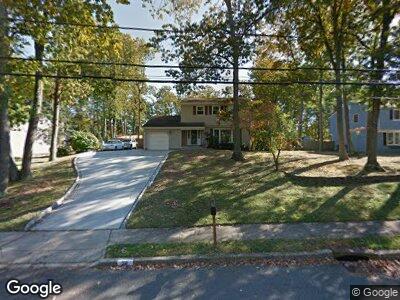
28 Sandspring Dr Eatontown, NJ 07724
Estimated Value: $732,268 - $763,000
4
Beds
2
Baths
1,888
Sq Ft
$396/Sq Ft
Est. Value
About This Home
This home is located at 28 Sandspring Dr, Eatontown, NJ 07724 and is currently estimated at $747,817, approximately $396 per square foot. 28 Sandspring Dr is a home located in Monmouth County with nearby schools including Woodmere Elementary School, Memorial Middle School, and Monmouth Regional High School.
Ownership History
Date
Name
Owned For
Owner Type
Purchase Details
Closed on
Aug 15, 2012
Sold by
Pereira Lynette
Bought by
Pereira Luis F
Current Estimated Value
Purchase Details
Closed on
Jul 5, 2005
Sold by
Swartz Gilfred Boyd
Bought by
Pereira Luis F
Home Financials for this Owner
Home Financials are based on the most recent Mortgage that was taken out on this home.
Original Mortgage
$355,000
Interest Rate
5.25%
Mortgage Type
Adjustable Rate Mortgage/ARM
Create a Home Valuation Report for This Property
The Home Valuation Report is an in-depth analysis detailing your home's value as well as a comparison with similar homes in the area
Home Values in the Area
Average Home Value in this Area
Purchase History
| Date | Buyer | Sale Price | Title Company |
|---|---|---|---|
| Pereira Luis F | -- | First American Title Insuran | |
| Pereira Luis F | $445,000 | -- |
Source: Public Records
Mortgage History
| Date | Status | Borrower | Loan Amount |
|---|---|---|---|
| Open | Pereira Luis | $335,000 | |
| Closed | Pereira Luis F | $355,000 | |
| Previous Owner | Swartz Gilfred Boyd | $100,000 |
Source: Public Records
Tax History Compared to Growth
Tax History
| Year | Tax Paid | Tax Assessment Tax Assessment Total Assessment is a certain percentage of the fair market value that is determined by local assessors to be the total taxable value of land and additions on the property. | Land | Improvement |
|---|---|---|---|---|
| 2024 | $11,623 | $684,400 | $347,500 | $336,900 |
| 2023 | $11,623 | $589,700 | $282,500 | $307,200 |
| 2022 | $10,366 | $491,400 | $235,400 | $256,000 |
| 2021 | $10,366 | $450,700 | $222,500 | $228,200 |
| 2020 | $9,895 | $434,000 | $212,500 | $221,500 |
| 2019 | $9,274 | $407,300 | $192,500 | $214,800 |
| 2018 | $8,671 | $375,200 | $172,500 | $202,700 |
| 2017 | $8,349 | $373,900 | $172,500 | $201,400 |
| 2016 | $8,627 | $395,200 | $192,500 | $202,700 |
| 2015 | $8,041 | $361,700 | $162,500 | $199,200 |
| 2014 | $7,652 | $339,200 | $162,500 | $176,700 |
Source: Public Records
Map
Nearby Homes
- 119 Sandspring Dr
- 270 Grant Ave
- 217 Wyckoff Rd
- 104 Waypoint Dr
- 31 Wesley Ct
- 96 Hilbert Pkwy
- 150 Waypoint Dr
- 25 Wesley Ct
- 239 Grant Ave
- 310 Wyckoff Rd
- 20 Juniper Ln
- 27 Ginger Ct
- 165 Wyckoff Rd Unit B
- 31 Juniper Ln Unit A
- 25 Laurel Place Unit B
- 133 Grant Ave
- 49B Victor Ave
- 8 Sarah Ln
- 283 Daniele Dr Unit F
- 110 Barberry Dr
- 28 Sandspring Dr
- 20 Sandspring Dr
- 36 Sandspring Dr
- 10 Sandspring Dr
- 31 Sandspring Dr
- 23 Sandspring Dr
- 1 Barnsdale Way
- 44 Sandspring Dr
- 55 Raleigh Ct
- 47 Sandspring Dr
- 15 Sandspring Dr
- 57 Raleigh Ct
- 2 Brentwood Rd
- 55 Sandspring Dr
- 51 Raleigh Ct
- 47 Raleigh Ct
- 7 Sandspring Dr
- 88 Windsor Dr
- 12 Brentwood Rd
- 63 Sandspring Dr