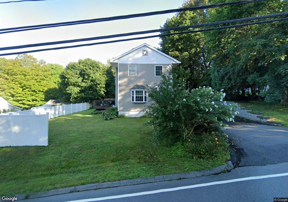
28 Sharp Hill Rd Uncasville, CT 06382
Oxoboxo River NeighborhoodEstimated Value: $366,000 - $399,000
3
Beds
3
Baths
2,048
Sq Ft
$189/Sq Ft
Est. Value
About This Home
This home is located at 28 Sharp Hill Rd, Uncasville, CT 06382 and is currently estimated at $386,387, approximately $188 per square foot. 28 Sharp Hill Rd is a home located in New London County with nearby schools including Leonard J. Tyl Middle School, Montville High School, and Bradley School-New London Regional.
Ownership History
Date
Name
Owned For
Owner Type
Purchase Details
Closed on
May 7, 2009
Sold by
Hsbc Bank Usa
Bought by
Rubs Craig A
Current Estimated Value
Purchase Details
Closed on
Jan 8, 2009
Sold by
Coulombe Ann M
Bought by
Hsbc Bank Usa
Purchase Details
Closed on
Oct 27, 2003
Sold by
Macgregor Richard and Macgregor Viola
Bought by
Coulombe Ann
Create a Home Valuation Report for This Property
The Home Valuation Report is an in-depth analysis detailing your home's value as well as a comparison with similar homes in the area
Home Values in the Area
Average Home Value in this Area
Purchase History
| Date | Buyer | Sale Price | Title Company |
|---|---|---|---|
| Rubs Craig A | $79,000 | -- | |
| Rubs Craig A | $79,000 | -- | |
| Hsbc Bank Usa | -- | -- | |
| Hsbc Bank Usa | -- | -- | |
| Coulombe Ann | $126,000 | -- | |
| Coulombe Ann | $126,000 | -- |
Source: Public Records
Mortgage History
| Date | Status | Borrower | Loan Amount |
|---|---|---|---|
| Previous Owner | Coulombe Ann | $144,000 | |
| Previous Owner | Coulombe Ann | $36,000 |
Source: Public Records
Tax History Compared to Growth
Tax History
| Year | Tax Paid | Tax Assessment Tax Assessment Total Assessment is a certain percentage of the fair market value that is determined by local assessors to be the total taxable value of land and additions on the property. | Land | Improvement |
|---|---|---|---|---|
| 2025 | $4,812 | $166,670 | $30,240 | $136,430 |
| 2024 | $4,628 | $166,670 | $30,240 | $136,430 |
| 2023 | $4,628 | $166,670 | $30,240 | $136,430 |
| 2022 | $4,452 | $166,670 | $30,240 | $136,430 |
| 2021 | $4,453 | $140,260 | $31,470 | $108,790 |
| 2020 | $4,542 | $140,260 | $31,470 | $108,790 |
| 2019 | $1,752 | $140,260 | $31,470 | $108,790 |
| 2018 | $5,226 | $140,260 | $31,470 | $108,790 |
| 2017 | $4,446 | $140,260 | $31,470 | $108,790 |
| 2016 | $4,382 | $143,160 | $39,380 | $103,780 |
| 2015 | $4,382 | $143,160 | $39,380 | $103,780 |
| 2014 | $4,205 | $143,160 | $39,380 | $103,780 |
Source: Public Records
Map
Nearby Homes
- 320 Maple Ave
- 45 Lynch Hill Rd
- 0 Monahan Dr
- 270 Gay Hill Rd
- 523 Route 163
- 57 Roselund Hill Rd
- 49 Cottonwood Ln
- 727 Old Colchester Rd
- 79 Cottonwood Ln
- 1 High Ridge Cir
- 5 Mountain Laurel Ridge
- 2 Mountain Laurel Ridge
- 19 Wyndwood Rd
- 22 Heather Brook Rd
- 82C Pires Dr
- 10 Gutterman Rd
- 170 Raymond Hill Rd
- 10 Marcia Dr
- 104 Woodland Dr Unit A
- 995 Old Colchester Rd
- 24 Sharp Hill Rd
- 32 Sharp Hill Rd
- 27 Sharp Hill Rd
- 39 Sharp Hill Rd
- 21 Sharp Hill Rd
- 14 Sharp Hill Rd
- 19 Sharp Hill Rd
- 45 Sharp Hill Rd
- 42 Sharp Hill Rd
- 15 Sharp Hill Rd
- 10 Sharp Hill Rd
- 376 Maple Ave
- 364 Maple Ave
- 48 Sharp Hill Rd
- 390 Maple Ave
- 348 Maple Ave
- 55 Sharp Hill Rd
- 354 Maple Ave
- 392 Maple Ave
- 375 Maple Ave