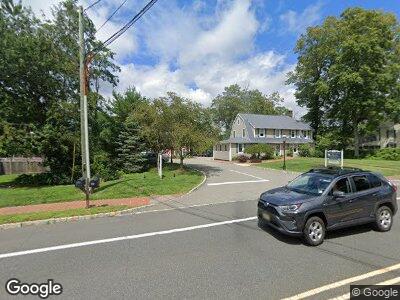
28 State Route 24 Chester, NJ 07930
Chester-Flanders NeighborhoodEstimated Value: $559,000 - $698,000
--
Bed
--
Bath
1,950
Sq Ft
$329/Sq Ft
Est. Value
About This Home
This home is located at 28 State Route 24, Chester, NJ 07930 and is currently estimated at $642,426, approximately $329 per square foot. 28 State Route 24 is a home located in Morris County with nearby schools including Dickerson School, Bragg School, and Black River Middle School.
Ownership History
Date
Name
Owned For
Owner Type
Purchase Details
Closed on
Dec 30, 2013
Sold by
Community Restoration Llc
Bought by
Deluca Remo and Deluca Ida Ann
Current Estimated Value
Purchase Details
Closed on
Jul 29, 2013
Sold by
Moran Allatta Margaret A and Allatta Paul
Bought by
Community Restoration Llc
Purchase Details
Closed on
Oct 14, 2002
Sold by
Allatta Paul
Bought by
Allatta Margaret and Allatta Paul
Purchase Details
Closed on
Jun 25, 1998
Sold by
Anthony George R and Anthony Rose Marie
Bought by
Moran Allatta Margaret A
Home Financials for this Owner
Home Financials are based on the most recent Mortgage that was taken out on this home.
Original Mortgage
$156,000
Interest Rate
7.02%
Create a Home Valuation Report for This Property
The Home Valuation Report is an in-depth analysis detailing your home's value as well as a comparison with similar homes in the area
Home Values in the Area
Average Home Value in this Area
Purchase History
| Date | Buyer | Sale Price | Title Company |
|---|---|---|---|
| Deluca Remo | $273,000 | Associated Title | |
| Community Restoration Llc | $225,000 | None Available | |
| Allatta Margaret | -- | -- | |
| Moran Allatta Margaret A | $240,000 | -- |
Source: Public Records
Mortgage History
| Date | Status | Borrower | Loan Amount |
|---|---|---|---|
| Previous Owner | Allatta Paul B | $422,400 | |
| Previous Owner | Moran Allatta Margaret A | $156,000 |
Source: Public Records
Tax History Compared to Growth
Tax History
| Year | Tax Paid | Tax Assessment Tax Assessment Total Assessment is a certain percentage of the fair market value that is determined by local assessors to be the total taxable value of land and additions on the property. | Land | Improvement |
|---|---|---|---|---|
| 2024 | $10,660 | $420,500 | $234,000 | $186,500 |
| 2023 | $10,660 | $420,500 | $234,000 | $186,500 |
| 2022 | $10,113 | $420,500 | $234,000 | $186,500 |
| 2021 | $10,113 | $420,500 | $234,000 | $186,500 |
| 2020 | $9,978 | $420,500 | $234,000 | $186,500 |
| 2019 | $9,932 | $420,500 | $234,000 | $186,500 |
| 2018 | $9,844 | $420,500 | $234,000 | $186,500 |
| 2017 | $9,806 | $420,500 | $234,000 | $186,500 |
| 2016 | $9,756 | $420,500 | $234,000 | $186,500 |
| 2015 | $9,634 | $420,500 | $234,000 | $186,500 |
| 2014 | $9,650 | $406,800 | $234,000 | $172,800 |
Source: Public Records
Map
Nearby Homes
- 27 Parker Rd
- 197 E Mill Rd
- 60 Sherwood Park
- 45 Furnace Rd
- 8 Highland Dr
- 6 Trout Brook Ct
- 7 Trout Brook Ct
- 21 Overlook Dr
- 43 Long Hill Rd
- 11 Forest View Dr
- 109 Fairmount Ave
- 2 Elm St
- 116 Old Farmers Rd
- 80 U S Highway 206
- 30 N Four Bridges Rd Unit 32
- 4 Emmons Path
- 73 Fairmount Ave
- 21 Barkman Way
- 281 Fairview Ave
- 1 Rolling Meadow Ct
- 28 State Route 24
- 28 Route 24
- 26 State Route 24
- 18 State Route 24
- 33 State Route 24
- 72 Furnace Rd
- 35 State Route 24
- 35 Route 24
- 16 State Route 24
- 81 Furnace Rd
- 37 State Route 24
- 14 State Route 24
- 79 Furnace Rd
- 4 Parker Rd
- 68 Furnace Rd
- 6 Parker Rd
- 70 Furnace Rd
- 12 State Route 24
- 12 Route 24
- 66 Furnace Rd
