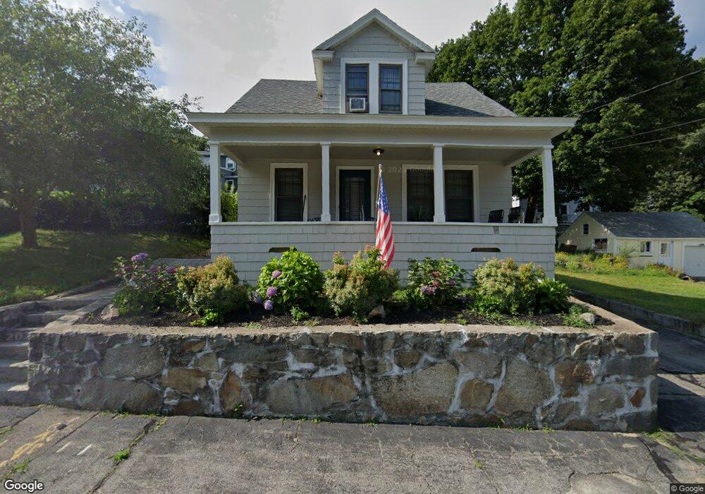
28 Topping Rd Andover, MA 01810
Shawsheen Heights NeighborhoodEstimated Value: $578,000 - $638,596
3
Beds
3
Baths
1,584
Sq Ft
$386/Sq Ft
Est. Value
About This Home
This home is located at 28 Topping Rd, Andover, MA 01810 and is currently estimated at $612,149, approximately $386 per square foot. 28 Topping Rd is a home located in Essex County with nearby schools including West Elementary School, Andover West Middle School, and Andover High School.
Ownership History
Date
Name
Owned For
Owner Type
Purchase Details
Closed on
Jun 16, 2010
Sold by
Feeney Brian J and Feeney Sandi L
Bought by
Russell Maureen
Current Estimated Value
Home Financials for this Owner
Home Financials are based on the most recent Mortgage that was taken out on this home.
Original Mortgage
$291,080
Outstanding Balance
$194,157
Interest Rate
5.03%
Mortgage Type
Purchase Money Mortgage
Estimated Equity
$417,992
Purchase Details
Closed on
Sep 29, 1988
Sold by
Mercier Gertrude M
Bought by
Feeney Brian J
Create a Home Valuation Report for This Property
The Home Valuation Report is an in-depth analysis detailing your home's value as well as a comparison with similar homes in the area
Home Values in the Area
Average Home Value in this Area
Purchase History
| Date | Buyer | Sale Price | Title Company |
|---|---|---|---|
| Russell Maureen | $295,000 | -- | |
| Russell Maureen | $295,000 | -- | |
| Feeney Brian J | $150,000 | -- |
Source: Public Records
Mortgage History
| Date | Status | Borrower | Loan Amount |
|---|---|---|---|
| Open | Russell Maureen | $291,080 | |
| Closed | Feeney Brian J | $291,080 | |
| Previous Owner | Feeney Brian J | $83,000 | |
| Previous Owner | Feeney Brian J | $30,000 |
Source: Public Records
Tax History Compared to Growth
Tax History
| Year | Tax Paid | Tax Assessment Tax Assessment Total Assessment is a certain percentage of the fair market value that is determined by local assessors to be the total taxable value of land and additions on the property. | Land | Improvement |
|---|---|---|---|---|
| 2024 | $6,310 | $489,900 | $237,500 | $252,400 |
| 2023 | $6,040 | $442,200 | $213,800 | $228,400 |
| 2022 | $5,761 | $394,600 | $185,800 | $208,800 |
| 2021 | $5,526 | $361,400 | $169,100 | $192,300 |
| 2020 | $5,299 | $353,000 | $164,800 | $188,200 |
| 2019 | $5,244 | $343,400 | $159,900 | $183,500 |
| 2018 | $5,050 | $322,900 | $153,600 | $169,300 |
| 2017 | $4,835 | $318,500 | $150,600 | $167,900 |
| 2016 | $4,720 | $318,500 | $150,600 | $167,900 |
| 2015 | $4,542 | $303,400 | $144,700 | $158,700 |
Source: Public Records
Map
Nearby Homes
- 102 Weare St
- 437 N Main St Unit C
- 34 Leeds Terrace
- 10 Martingale Ln Unit 10
- 6 Windsor St
- 21 Clubview Dr Unit 21
- 5 Marc Ln
- 5 W Kenneth St
- 5 Lafayette Ave
- 33 Jefferson St
- 11 W Hawley St
- 42 Beresford St
- 24 Inman St Unit 32
- 24 York St
- 96 Beacon St
- 15 Beaconsfield St
- 25 Clubview Dr Unit 25
- 13 Clubview Dr Unit 13
- 54 Amherst St
- 11 Devonshire St
- 23 Juliette St
- 32 Topping Rd
- 29 Juliette St
- 17 Juliette St
- 22 Topping Rd
- 26 Juliette St
- 23 Topping Rd
- 35 Juliette St
- 24 Juliette St
- 20 Topping Rd
- 29 Topping Rd
- 30 Juliette St
- 27 Topping Rd
- 31 Topping Rd
- 21 Topping Rd
- 21 Topping Rd Unit a
- 21 Topping Rd Unit 21
- 16 Juliette St
- 33 Topping Rd
- 33 Topping Rd Unit 1