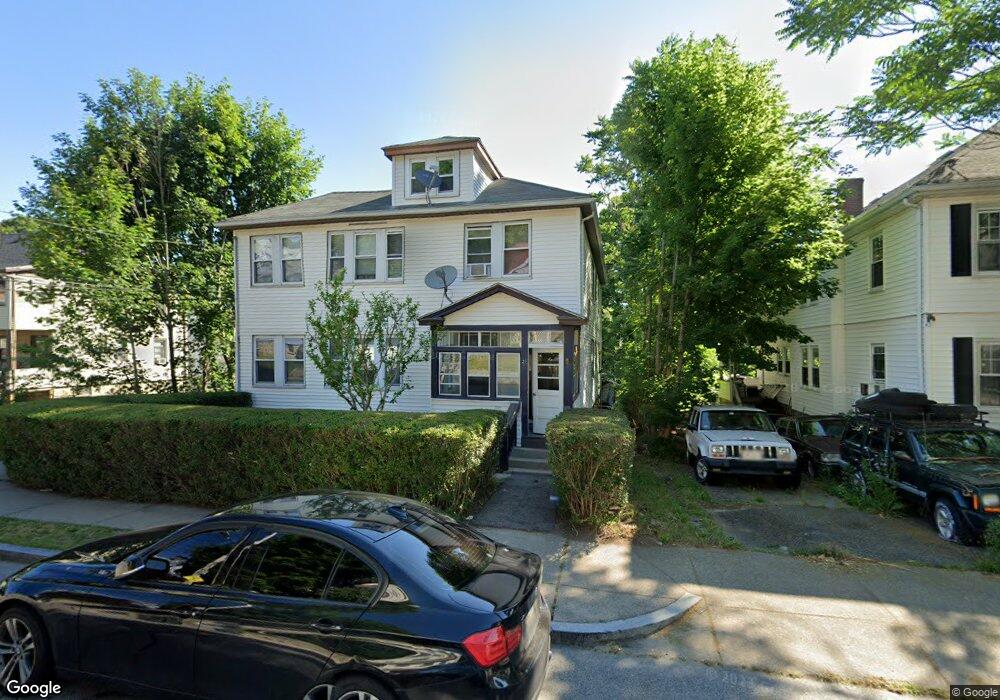
28 Whitford St Unit 30 Roslindale, MA 02131
Roslindale NeighborhoodEstimated Value: $858,000 - $1,054,163
2
Beds
1
Bath
1,000
Sq Ft
$935/Sq Ft
Est. Value
About This Home
This home is located at 28 Whitford St Unit 30, Roslindale, MA 02131 and is currently estimated at $935,041, approximately $935 per square foot. 28 Whitford St Unit 30 is a home located in Suffolk County with nearby schools including Brooke Charter School Roslindale, Sacred Heart STEM School, and St. Clare High School.
Ownership History
Date
Name
Owned For
Owner Type
Purchase Details
Closed on
Jun 22, 2016
Sold by
Cadet Anne and Cadet Beaudelaire F
Bought by
Exilhomme Francois and Exilhomme Jenny
Current Estimated Value
Home Financials for this Owner
Home Financials are based on the most recent Mortgage that was taken out on this home.
Original Mortgage
$330,687
Outstanding Balance
$263,190
Interest Rate
3.57%
Mortgage Type
New Conventional
Estimated Equity
$671,851
Purchase Details
Closed on
Aug 31, 1999
Sold by
Lambert Denis B and Odell James R
Bought by
Cadet Ferdaine and Cadet Anne
Purchase Details
Closed on
May 1, 1990
Sold by
Swide Mathilda Est
Bought by
Lambert Denis M
Create a Home Valuation Report for This Property
The Home Valuation Report is an in-depth analysis detailing your home's value as well as a comparison with similar homes in the area
Home Values in the Area
Average Home Value in this Area
Purchase History
| Date | Buyer | Sale Price | Title Company |
|---|---|---|---|
| Exilhomme Francois | $350,000 | -- | |
| Cadet Ferdaine | $254,000 | -- | |
| Lambert Denis M | $194,900 | -- |
Source: Public Records
Mortgage History
| Date | Status | Borrower | Loan Amount |
|---|---|---|---|
| Open | Exilhomme Francois | $330,687 | |
| Previous Owner | Lambert Denis M | $327,051 | |
| Previous Owner | Lambert Denis M | $350,000 | |
| Previous Owner | Lambert Denis M | $300,000 |
Source: Public Records
Tax History Compared to Growth
Tax History
| Year | Tax Paid | Tax Assessment Tax Assessment Total Assessment is a certain percentage of the fair market value that is determined by local assessors to be the total taxable value of land and additions on the property. | Land | Improvement |
|---|---|---|---|---|
| 2025 | $9,989 | $862,600 | $293,400 | $569,200 |
| 2024 | $8,416 | $772,100 | $264,000 | $508,100 |
| 2023 | $7,972 | $742,300 | $253,800 | $488,500 |
| 2022 | $7,342 | $674,800 | $230,700 | $444,100 |
| 2021 | $7,059 | $661,600 | $226,200 | $435,400 |
| 2020 | $6,301 | $596,700 | $204,300 | $392,400 |
| 2019 | $5,935 | $563,100 | $165,100 | $398,000 |
| 2018 | $5,568 | $531,300 | $165,100 | $366,200 |
| 2017 | $5,514 | $520,700 | $165,100 | $355,600 |
| 2016 | $5,303 | $482,100 | $165,100 | $317,000 |
| 2015 | $4,685 | $386,900 | $142,800 | $244,100 |
| 2014 | $4,345 | $345,400 | $142,800 | $202,600 |
Source: Public Records
Map
Nearby Homes
- 25 Crandall St
- 250 Poplar St Unit 1
- 142 Metropolitan Ave Unit A
- 16 Hilburn Place
- 69 Metropolitan Ave
- 55 Metropolitan Ave
- 415 Poplar St
- 5 7 Hemman St
- 67 Cummins Hwy Unit 101
- 417 Poplar St
- 273 Metropolitan Ave Unit 2
- 295 Kittredge St
- 142 Birch St
- 142 Birch St Unit 1
- 142 Birch St Unit 2
- 89 Glendower Rd
- 25 Pinedale Rd Unit 1
- 75 Glendower Rd
- 65 Birch St Unit 3
- 80 Roslindale Ave Unit 3
- 30 Whitford St Unit 30
- 32 Whitford St Unit 34
- 42 Augustus Ave
- 38 Augustus Ave
- 34 Augustus Ave
- 36 Whitford St Unit 38
- 36 Whitford St Unit 1
- 40 Whitford St Unit 1
- 40 Whitford St Unit 42
- 25 Whitford St
- 44 Augustus Ave
- 44 Augustus Ave Unit 44 Augustus Ave Apt.
- 44 Augustus Ave Unit 1
- 44 Augustus Ave Unit 2
- 32 Augustus Ave
- 32 Augustus Ave Unit 2
- 31 Whitford St
- 48 Augustus Ave
- 35 Whitford St
- 35 Whitford St Unit 2