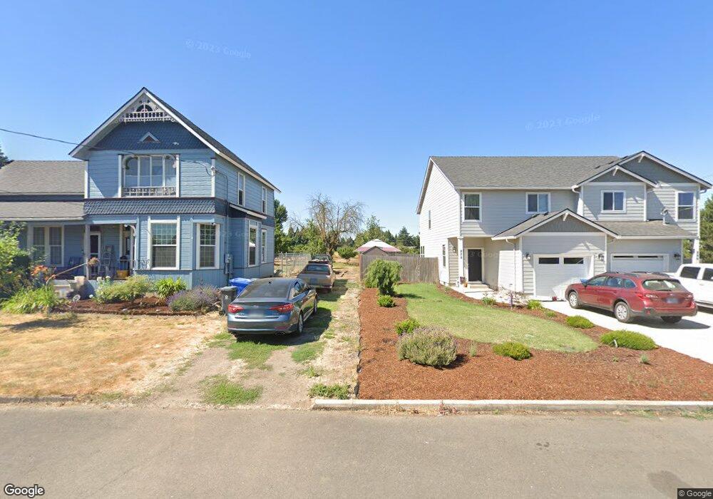
280 Alder Ave Gervais, OR 97026
Estimated Value: $542,000 - $727,607
--
Bed
4
Baths
2,974
Sq Ft
$213/Sq Ft
Est. Value
About This Home
This home is located at 280 Alder Ave, Gervais, OR 97026 and is currently estimated at $634,804, approximately $213 per square foot. 280 Alder Ave is a home with nearby schools including Gervais Middle School, Gervais High School, and Sacred Heart Catholic School.
Ownership History
Date
Name
Owned For
Owner Type
Purchase Details
Closed on
Jul 15, 2019
Sold by
Sly Toran
Bought by
Toran Sylvester
Current Estimated Value
Home Financials for this Owner
Home Financials are based on the most recent Mortgage that was taken out on this home.
Original Mortgage
$250,000
Outstanding Balance
$131,286
Interest Rate
3.82%
Mortgage Type
Commercial
Estimated Equity
$503,518
Purchase Details
Closed on
May 9, 2018
Sold by
Oneil Patricia A and Rayburn Patricia A
Bought by
Toran Sly
Purchase Details
Closed on
Apr 30, 2018
Sold by
Oneil Patricia A and Rayburn Patricia A
Bought by
Toran Sly
Create a Home Valuation Report for This Property
The Home Valuation Report is an in-depth analysis detailing your home's value as well as a comparison with similar homes in the area
Home Values in the Area
Average Home Value in this Area
Purchase History
| Date | Buyer | Sale Price | Title Company |
|---|---|---|---|
| Toran Sylvester | -- | First American | |
| Toran Sly | $89,000 | First American Title | |
| Toran Sly | $89,000 | First American Title |
Source: Public Records
Mortgage History
| Date | Status | Borrower | Loan Amount |
|---|---|---|---|
| Open | Toran Sylvester | $250,000 |
Source: Public Records
Tax History Compared to Growth
Tax History
| Year | Tax Paid | Tax Assessment Tax Assessment Total Assessment is a certain percentage of the fair market value that is determined by local assessors to be the total taxable value of land and additions on the property. | Land | Improvement |
|---|---|---|---|---|
| 2025 | $8,077 | $395,610 | -- | -- |
| 2024 | $8,077 | $384,090 | -- | -- |
| 2023 | $7,151 | $372,910 | $0 | $0 |
| 2022 | $6,753 | $362,050 | $0 | $0 |
| 2021 | $6,561 | $351,510 | $0 | $0 |
| 2020 | $6,570 | $341,280 | $0 | $0 |
| 2019 | $4,678 | $243,050 | $0 | $0 |
| 2018 | $855 | $0 | $0 | $0 |
| 2017 | $814 | $0 | $0 | $0 |
| 2016 | $798 | $0 | $0 | $0 |
| 2015 | $740 | $0 | $0 | $0 |
| 2014 | $730 | $0 | $0 | $0 |
Source: Public Records
Map
Nearby Homes
- Lot 301 & 303 Checkerboard Rd NE
- 600 4th St
- 220 222 Juniper St
- 222 Juniper Ave
- 985 5th St
- 0 Checkerboard Rd NE Unit 585951546
- 9008 NE Parr (Near) Rd
- 1004 Drake Ln
- 3249 Quail Ave
- 3225 Quail Ave
- 3175 Quail Ave
- Azalea Plan at Brighton Pointe - The Evergreen Collection
- Ashland Plan at Brighton Pointe - The Willow Collection
- Thatcher Plan at Brighton Pointe - The Willow Collection
- Burton Plan at Brighton Pointe - The Evergreen Collection
- William Plan at Brighton Pointe - The Willow Collection
- Cypress Plan at Brighton Pointe - The Willow Collection
- Dalton Plan at Brighton Pointe - The Willow Collection
- Mckay Plan at Brighton Pointe - The Evergreen Collection
- Everett Plan at Brighton Pointe - The Willow Collection