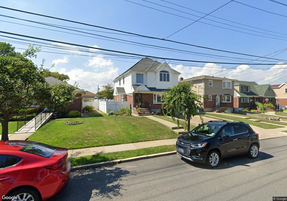
280 Collfield Ave Staten Island, NY 10314
Westerleigh NeighborhoodEstimated Value: $923,000 - $1,005,000
3
Beds
2
Baths
1,150
Sq Ft
$852/Sq Ft
Est. Value
About This Home
This home is located at 280 Collfield Ave, Staten Island, NY 10314 and is currently estimated at $979,522, approximately $851 per square foot. 280 Collfield Ave is a home located in Richmond County with nearby schools including P.S. 30 Westerleigh, I.S. 51 Edwin Markham, and Port Richmond High School.
Ownership History
Date
Name
Owned For
Owner Type
Purchase Details
Closed on
Oct 11, 2021
Sold by
Castaldo Debra and Castaldo Daniel
Bought by
Castaldo Debra
Current Estimated Value
Purchase Details
Closed on
Oct 12, 2001
Sold by
Brown Ann T
Bought by
Castaldo Paul and Castaldo Debra
Home Financials for this Owner
Home Financials are based on the most recent Mortgage that was taken out on this home.
Original Mortgage
$200,000
Interest Rate
7.15%
Create a Home Valuation Report for This Property
The Home Valuation Report is an in-depth analysis detailing your home's value as well as a comparison with similar homes in the area
Home Values in the Area
Average Home Value in this Area
Purchase History
| Date | Buyer | Sale Price | Title Company |
|---|---|---|---|
| Castaldo Debra | -- | None Available | |
| Castaldo Paul | $320,000 | First American Title Ins Co |
Source: Public Records
Mortgage History
| Date | Status | Borrower | Loan Amount |
|---|---|---|---|
| Previous Owner | Castaldo Paul | $200,000 |
Source: Public Records
Tax History Compared to Growth
Tax History
| Year | Tax Paid | Tax Assessment Tax Assessment Total Assessment is a certain percentage of the fair market value that is determined by local assessors to be the total taxable value of land and additions on the property. | Land | Improvement |
|---|---|---|---|---|
| 2025 | $9,349 | $72,180 | $13,660 | $58,520 |
| 2024 | $9,361 | $70,080 | $13,424 | $56,656 |
| 2023 | $9,049 | $45,959 | $11,351 | $34,608 |
| 2022 | $8,769 | $65,100 | $19,620 | $45,480 |
| 2021 | $9,039 | $64,560 | $19,620 | $44,940 |
| 2020 | $6,669 | $55,680 | $19,620 | $36,060 |
| 2019 | $1,987 | $55,740 | $19,620 | $36,120 |
| 2018 | $7,510 | $38,299 | $16,201 | $22,098 |
| 2017 | $7,406 | $37,802 | $15,394 | $22,408 |
| 2016 | $7,085 | $36,991 | $15,608 | $21,383 |
| 2015 | $6,085 | $34,898 | $18,045 | $16,853 |
| 2014 | $6,085 | $33,298 | $20,662 | $12,636 |
Source: Public Records
Map
Nearby Homes
- 279 Collfield Ave
- 422 Crystal Ave
- 101 Delmore St
- 181 Collfield Ave
- 13 Hawthorne Ave
- 360 Caswell Ave
- 182 Woodbine Ave
- 144 Bryson Ave
- 292 Woolley Ave
- 124 Woodbine Ave
- 290 Woolley Ave
- 523 Woolley Ave
- 127 Glascoe Ave
- 777-805 Willowbrook Rd
- 199 Willowbrook Rd
- 366 Neal Dow Ave
- 17 B Yafa Ct Unit A
- 284 Bidwell Ave
- 70 Lyon Place
- 251 Cambridge Ave
- 276 Collfield Ave
- 286 Collfield Ave
- 272 Collfield Ave
- 271 Bryson Ave
- 275 Bryson Ave
- 267 Bryson Ave
- 279 Bryson Ave
- 265 Bryson Ave
- 227 Caswell Ave
- 221 Caswell Ave
- 266 Collfield Ave
- 233 Caswell Ave
- 261 Bryson Ave
- 283 Collfield Ave
- 275 Collfield Ave
- 285 Bryson Ave
- 287 Collfield Ave
- 262 Collfield Ave
- 293 Collfield Ave
- 257 Bryson Ave