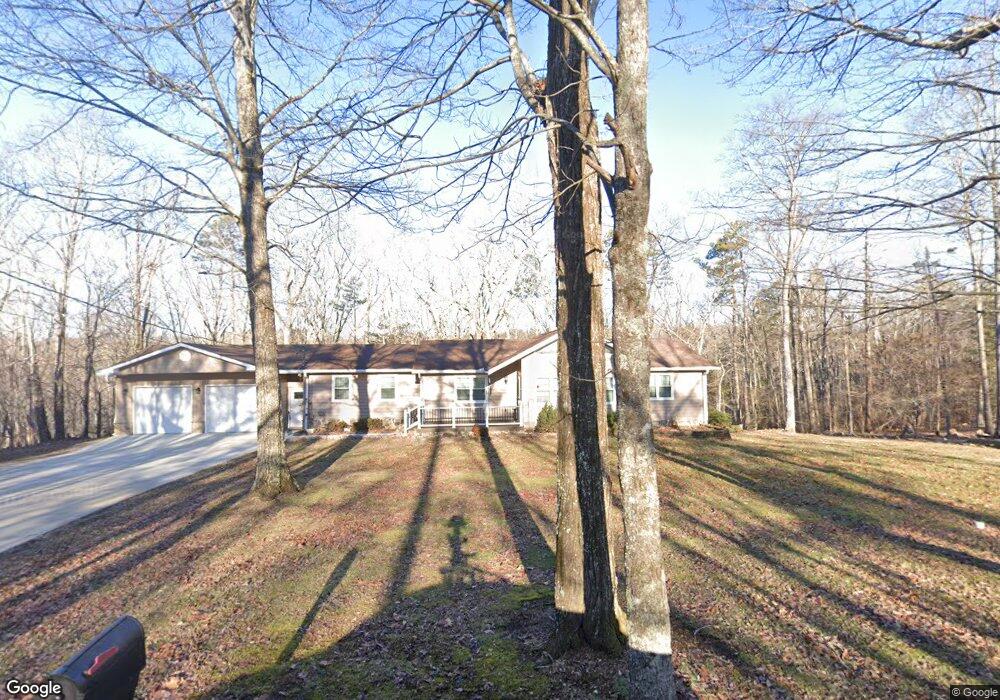
280 Maple Branch Rd Signal Mountain, TN 37377
Estimated Value: $350,000 - $470,000
--
Bed
2
Baths
1,968
Sq Ft
$196/Sq Ft
Est. Value
About This Home
This home is located at 280 Maple Branch Rd, Signal Mountain, TN 37377 and is currently estimated at $385,997, approximately $196 per square foot. 280 Maple Branch Rd is a home located in Sequatchie County with nearby schools including Griffith Elementary School, Sequatchie County Middle School, and Sequatchie County High School.
Ownership History
Date
Name
Owned For
Owner Type
Purchase Details
Closed on
Sep 28, 2017
Sold by
Mcbride Marilyn M
Bought by
Johnson Kari and Johnson Tommy
Current Estimated Value
Purchase Details
Closed on
Aug 21, 1998
Sold by
Hawkins James D and Hawkins Wife
Bought by
Mcbride Gary H and Mcbride Marilyn
Purchase Details
Closed on
May 16, 1991
Bought by
Hawkins James D and Wife Rowena
Create a Home Valuation Report for This Property
The Home Valuation Report is an in-depth analysis detailing your home's value as well as a comparison with similar homes in the area
Home Values in the Area
Average Home Value in this Area
Purchase History
| Date | Buyer | Sale Price | Title Company |
|---|---|---|---|
| Johnson Kari | $165,303 | None Available | |
| Mcbride Gary H | $115,000 | -- | |
| Hawkins James D | $7,300 | -- |
Source: Public Records
Tax History Compared to Growth
Tax History
| Year | Tax Paid | Tax Assessment Tax Assessment Total Assessment is a certain percentage of the fair market value that is determined by local assessors to be the total taxable value of land and additions on the property. | Land | Improvement |
|---|---|---|---|---|
| 2024 | $1,223 | $66,600 | $9,200 | $57,400 |
| 2023 | $1,223 | $66,600 | $9,200 | $57,400 |
| 2022 | $1,042 | $42,675 | $7,200 | $35,475 |
| 2021 | $1,042 | $42,675 | $7,200 | $35,475 |
| 2020 | $1,042 | $42,675 | $7,200 | $35,475 |
| 2019 | $1,042 | $42,675 | $7,200 | $35,475 |
| 2018 | $1,042 | $42,675 | $7,200 | $35,475 |
| 2017 | $1,042 | $42,675 | $7,200 | $35,475 |
| 2016 | $1,061 | $41,300 | $7,125 | $34,175 |
| 2015 | $968 | $37,675 | $7,125 | $30,550 |
| 2014 | $968 | $37,675 | $7,125 | $30,550 |
Source: Public Records
Map
Nearby Homes
- 763 U S 127
- 460 Spring Dr
- 342 Miller Rd
- 71 Miller Cove Cir
- 43 Miller Cove Cir
- 34 Miller Cove Cir
- 720 Miller Rd
- 78 Gray Rd
- 28 Lynn Rd
- 435 County Line Rd
- 0 Clear Brooks Dr Unit RTC2912326
- 0 Clear Brooks Dr Unit 1506809
- 316 Brock Creek Trail
- 3014 Edgewood Dr
- 2803 Us 127
- 2435 Blue Mist Dr
- 361 Pine Ridge Dr
- 0 Dandy Rd Unit 1512628
- 4644 Signal Forest Dr
- 2610 Eagle Creek Way
- 275 Maple Branch Rd
- 193 Maple Branch Rd
- 361 Maple Branch Rd
- 358 Maple Branch Rd
- 943 Us 127
- 97 Maple Branch Rd
- 375 Maple Branch Rd
- 464 Maple Branch Rd
- 34 Maple Branch Rd
- 429 Swanger Rd
- 1045 Us 127
- 1045 Us 127
- 589 Swanger Rd
- 3 Hall Rd
- 939 Us 127
- 2 Hall Rd
- 1118 Us 127
- 14 Hall Rd
- 937 Us 127
- 588 Swanger Rd