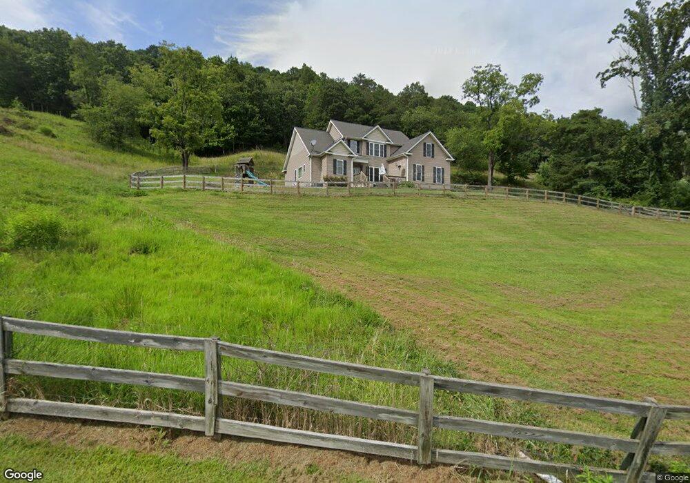
280 River Point Rd Canton, NC 28716
Estimated Value: $524,639 - $754,000
3
Beds
3
Baths
1,462
Sq Ft
$408/Sq Ft
Est. Value
About This Home
This home is located at 280 River Point Rd, Canton, NC 28716 and is currently estimated at $595,910, approximately $407 per square foot. 280 River Point Rd is a home located in Haywood County with nearby schools including Bethel Elementary, Bethel Middle School, and Pisgah High School.
Ownership History
Date
Name
Owned For
Owner Type
Purchase Details
Closed on
Nov 14, 2006
Sold by
Lowe Kenneth Tim and Lowe Terry S
Bought by
Cody Christopher S and Cody Jennifer L
Current Estimated Value
Home Financials for this Owner
Home Financials are based on the most recent Mortgage that was taken out on this home.
Original Mortgage
$196,889
Outstanding Balance
$77,646
Interest Rate
6.33%
Mortgage Type
Seller Take Back
Estimated Equity
$518,264
Create a Home Valuation Report for This Property
The Home Valuation Report is an in-depth analysis detailing your home's value as well as a comparison with similar homes in the area
Home Values in the Area
Average Home Value in this Area
Purchase History
| Date | Buyer | Sale Price | Title Company |
|---|---|---|---|
| Cody Christopher S | $197,000 | None Available |
Source: Public Records
Mortgage History
| Date | Status | Borrower | Loan Amount |
|---|---|---|---|
| Open | Cody Christopher S | $196,889 |
Source: Public Records
Tax History
| Year | Tax Paid | Tax Assessment Tax Assessment Total Assessment is a certain percentage of the fair market value that is determined by local assessors to be the total taxable value of land and additions on the property. | Land | Improvement |
|---|---|---|---|---|
| 2025 | -- | $366,100 | $55,200 | $310,900 |
| 2024 | $25 | $366,100 | $55,200 | $310,900 |
| 2023 | $2,484 | $366,100 | $55,200 | $310,900 |
| 2022 | $2,429 | $366,100 | $55,200 | $310,900 |
| 2021 | $2,429 | $366,100 | $55,200 | $310,900 |
| 2020 | $2,089 | $288,100 | $45,200 | $242,900 |
| 2019 | $2,094 | $288,100 | $45,200 | $242,900 |
| 2018 | $2,094 | $288,100 | $45,200 | $242,900 |
| 2017 | $2,065 | $288,100 | $0 | $0 |
| 2016 | $2,013 | $288,400 | $0 | $0 |
| 2015 | $2,013 | $288,400 | $0 | $0 |
| 2014 | $1,869 | $288,400 | $0 | $0 |
Source: Public Records
Map
Nearby Homes
- 88 Brown Bear Way
- 50 Feather Ln Unit 50
- 50 Feather Ln
- 183 Lunar Trace Rd
- 00 Cove Creek Rd
- 99 Thistle Ridge
- TBD Tracy Ln
- 36 Lambert Ln
- 00 Yellow Locust Dr
- 608 Evans Rd
- 1201 Cathey Cove Rd
- 140 Debbie Loop
- 144 Pinehaven Dr
- 940 Haynes Cove
- 248 Max Thompson Rd
- 57 Eden Brook Dr
- 26 Ashewood Ln
- 57 Bittersweet Trail
- 00 Cobblestone Dr Unit 32
- 175 & 179 River Ln
- 309 River Point Rd
- 273 River Point Rd
- 190 River Point Rd
- 388 River Point Rd
- 405 River Point Rd
- 106 Moorehill Dr
- 138 River Point Rd
- 334 Eastern Sky Dr
- 105 River Point Rd
- 110 Moorehill Dr
- 416 River Point Rd
- 134 River Point Rd
- 3510 Old River Rd
- 149 Moorehill Dr
- 345 Moorehill Dr
- 3628 Old River Rd
- 00 Moorehill Dr
- 619 River Point Rd
- 621 River Point Rd
- 255 Moorehill Dr
Your Personal Tour Guide
Ask me questions while you tour the home.