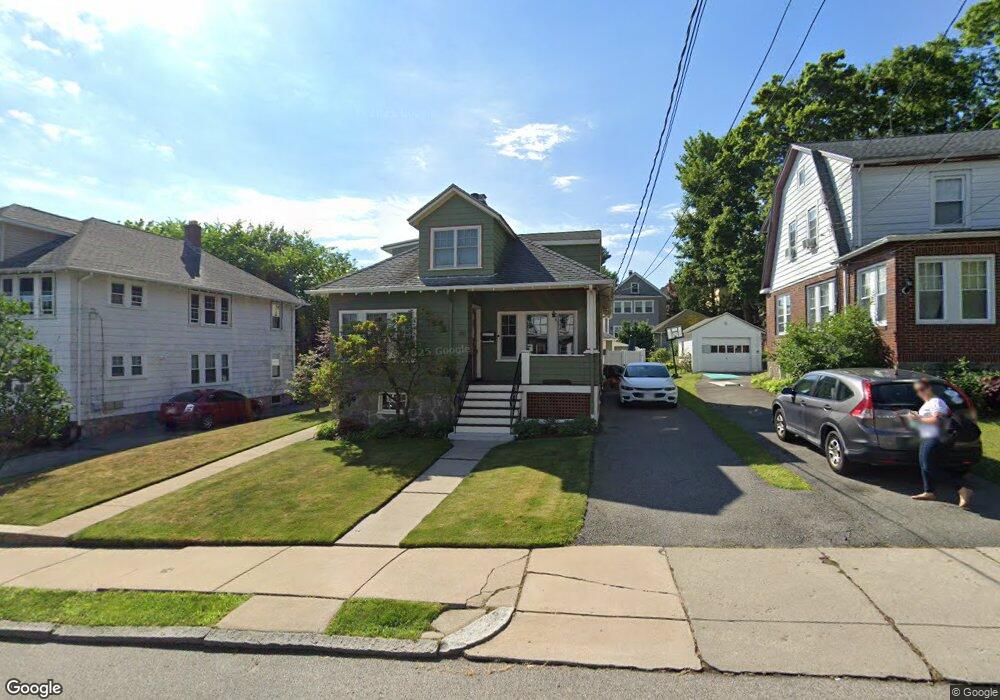
280 Roslindale Ave Roslindale, MA 02131
Roslindale NeighborhoodEstimated Value: $855,000 - $930,000
3
Beds
2
Baths
1,842
Sq Ft
$490/Sq Ft
Est. Value
About This Home
This home is located at 280 Roslindale Ave, Roslindale, MA 02131 and is currently estimated at $902,357, approximately $489 per square foot. 280 Roslindale Ave is a home located in Suffolk County with nearby schools including Holy Name Parish School, Sacred Heart STEM School, and The Roxbury Latin School.
Ownership History
Date
Name
Owned For
Owner Type
Purchase Details
Closed on
Oct 21, 2016
Sold by
Avenue 208 Roslindale
Bought by
Dietzel Ft
Current Estimated Value
Purchase Details
Closed on
Feb 28, 2013
Sold by
Dietzel Steven R and Dietzel Eileen P
Bought by
280 Roslindale Avenue
Purchase Details
Closed on
Aug 27, 1999
Sold by
Newman Bruce D and Newman Ellen M
Bought by
Mason Elizabeth F
Create a Home Valuation Report for This Property
The Home Valuation Report is an in-depth analysis detailing your home's value as well as a comparison with similar homes in the area
Home Values in the Area
Average Home Value in this Area
Purchase History
| Date | Buyer | Sale Price | Title Company |
|---|---|---|---|
| Dietzel Ft | -- | -- | |
| 280 Roslindale Avenue | -- | -- | |
| Mason Elizabeth F | $207,000 | -- |
Source: Public Records
Mortgage History
| Date | Status | Borrower | Loan Amount |
|---|---|---|---|
| Previous Owner | Mason Elizabeth F | $262,000 | |
| Previous Owner | Mason Elizabeth F | $330,000 |
Source: Public Records
Tax History Compared to Growth
Tax History
| Year | Tax Paid | Tax Assessment Tax Assessment Total Assessment is a certain percentage of the fair market value that is determined by local assessors to be the total taxable value of land and additions on the property. | Land | Improvement |
|---|---|---|---|---|
| 2025 | $8,878 | $766,700 | $230,400 | $536,300 |
| 2024 | $8,112 | $744,200 | $233,900 | $510,300 |
| 2023 | $7,610 | $708,600 | $222,700 | $485,900 |
| 2022 | $6,885 | $632,800 | $198,900 | $433,900 |
| 2021 | $6,312 | $591,600 | $189,400 | $402,200 |
| 2020 | $6,149 | $582,300 | $183,400 | $398,900 |
| 2019 | $5,718 | $542,500 | $150,100 | $392,400 |
| 2018 | $5,264 | $502,300 | $150,100 | $352,200 |
| 2017 | $4,972 | $469,500 | $150,100 | $319,400 |
| 2016 | $5,015 | $455,900 | $150,100 | $305,800 |
| 2015 | $5,364 | $442,900 | $149,100 | $293,800 |
| 2014 | $5,061 | $402,300 | $149,100 | $253,200 |
Source: Public Records
Map
Nearby Homes
- 276 Cornell St
- 239 Stratford St
- 150 Aldrich St
- 34 Averton St
- 0 Averton St
- 95 Newburg St
- 59 Aldrich St Unit 2
- 15 White Oak Rd
- 275 Bellevue St
- 43 Aldrich St
- 73 Woodard Rd
- 40 Newburg St Unit 1
- 55 Metropolitan Ave
- 69 Metropolitan Ave
- 52 Metropolitan Ave Unit 3
- 12 Loyola Cir
- 142 Birch St
- 142 Birch St Unit 2
- 142 Birch St Unit 1
- 37 Montvale St Unit 2
- 284 Roslindale Ave
- 276 Roslindale Ave Unit 278
- 276 Roslindale Ave Unit 2
- 278 Roslindale Ave Unit 1
- 278 Roslindale Ave
- 272 Roslindale Ave
- 288 Roslindale Ave
- 37 Nikisch Ave
- 39 Nikisch Ave
- 35 Nikisch Ave
- 41 Nikisch Ave
- 285 Roslindale Ave
- 285 Roslindale Ave Unit 285
- 268 Roslindale Ave Unit 270
- 268 Roslindale Ave Unit 2
- 289 Roslindale Ave
- 281 Roslindale Ave
- 277 Roslindale Ave Unit 279
- 277 Roslindale Ave Unit 1
- 31 Nikisch Ave