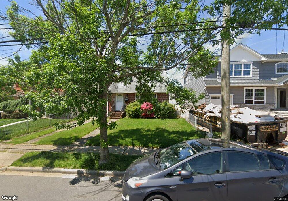
280 Semton Blvd Franklin Square, NY 11010
Estimated Value: $660,221 - $687,000
--
Bed
1
Bath
1,330
Sq Ft
$506/Sq Ft
Est. Value
About This Home
This home is located at 280 Semton Blvd, Franklin Square, NY 11010 and is currently estimated at $673,611, approximately $506 per square foot. 280 Semton Blvd is a home located in Nassau County with nearby schools including Hebrew Academy of Nassau County (HANC).
Ownership History
Date
Name
Owned For
Owner Type
Purchase Details
Closed on
Jun 28, 2010
Sold by
Nuccio Joan M and Nuccio Stephen J
Bought by
Guo Mona Y
Current Estimated Value
Home Financials for this Owner
Home Financials are based on the most recent Mortgage that was taken out on this home.
Original Mortgage
$285,000
Outstanding Balance
$189,953
Interest Rate
4.78%
Mortgage Type
Purchase Money Mortgage
Estimated Equity
$483,658
Create a Home Valuation Report for This Property
The Home Valuation Report is an in-depth analysis detailing your home's value as well as a comparison with similar homes in the area
Home Values in the Area
Average Home Value in this Area
Purchase History
| Date | Buyer | Sale Price | Title Company |
|---|---|---|---|
| Guo Mona Y | $357,000 | -- |
Source: Public Records
Mortgage History
| Date | Status | Borrower | Loan Amount |
|---|---|---|---|
| Open | Guo Mona Y | $285,000 |
Source: Public Records
Tax History Compared to Growth
Tax History
| Year | Tax Paid | Tax Assessment Tax Assessment Total Assessment is a certain percentage of the fair market value that is determined by local assessors to be the total taxable value of land and additions on the property. | Land | Improvement |
|---|---|---|---|---|
| 2025 | $10,751 | $489 | $240 | $249 |
| 2024 | $4,255 | $489 | $240 | $249 |
| 2023 | $9,947 | $489 | $240 | $249 |
| 2022 | $9,947 | $489 | $240 | $249 |
| 2021 | $12,396 | $480 | $236 | $244 |
| 2020 | $11,413 | $502 | $436 | $66 |
| 2019 | $7,847 | $537 | $437 | $100 |
| 2018 | $7,969 | $573 | $0 | $0 |
| 2017 | $5,068 | $609 | $440 | $169 |
| 2016 | $8,166 | $645 | $420 | $225 |
| 2015 | $3,237 | $681 | $443 | $238 |
| 2014 | $3,237 | $681 | $443 | $238 |
| 2013 | $3,180 | $716 | $466 | $250 |
Source: Public Records
Map
Nearby Homes
- 279 Semton Blvd
- 231 Dogwood Ave
- 249 Grange St
- 198 Guildford Ct
- 576 Western Park Dr
- 594 Fenworth Blvd
- 19 Richard St
- 350 Paul Place
- 149 Rule St
- 190 Commonwealth St
- 303 Nassau Blvd
- 144 Rintin St
- 56 Fendale St
- 757 Marion St
- 474 Roy St
- 676 Sobo Ave
- 31 Claflin Blvd
- 126 Oakland Ave
- 537 Madison Ave
- 242 James St
- 284 Semton Blvd Unit Lower level
- 284 Semton Blvd
- 288 Semton Blvd
- 275 Fendale St
- 281 Fendale St
- 689 Naple Ave
- 292 Semton Blvd
- 287 Fendale St
- 265 Fendale St
- 275 Semton Blvd
- 296 Semton Blvd
- 271 Semton Blvd
- 293 Fendale St
- 675 Naple Ave
- 300 Semton Blvd
- 264 Semton Blvd
- 297 Fendale St
- 696 Naple Ave
- 292 Dogwood Ave
- 280 Fendale St