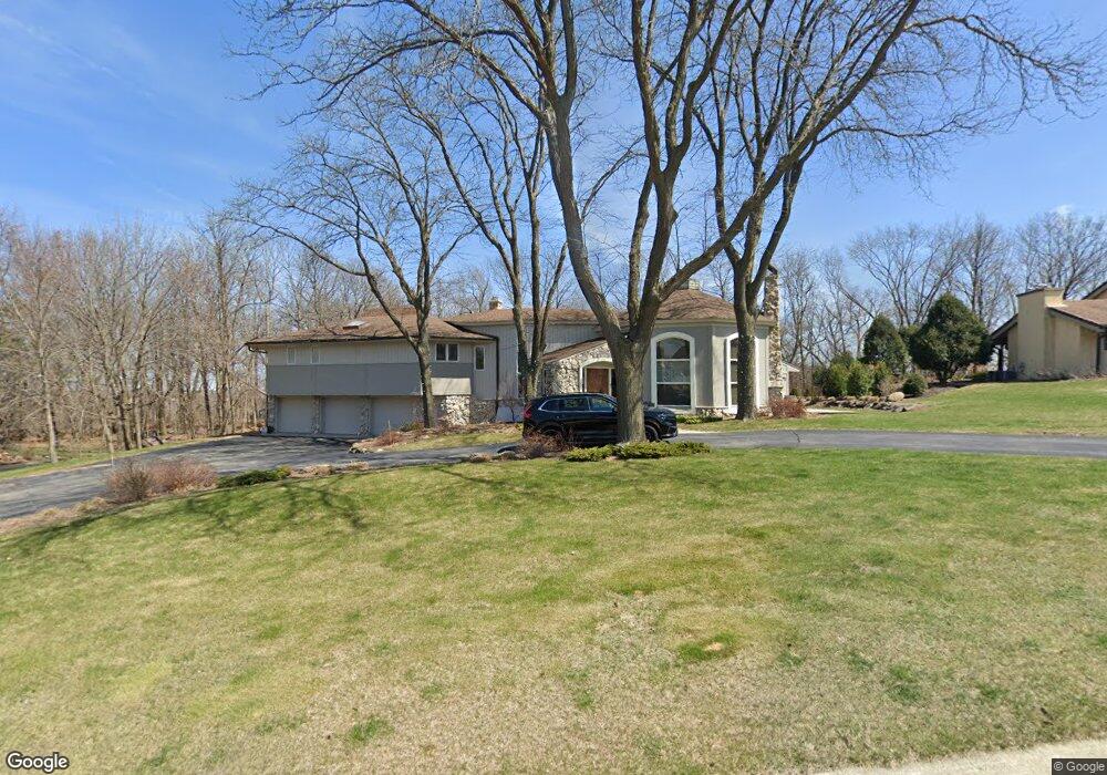
280 Sheffield Dr Brookfield, WI 53005
Estimated Value: $714,852 - $782,000
2
Beds
3
Baths
3,370
Sq Ft
$221/Sq Ft
Est. Value
About This Home
This home is located at 280 Sheffield Dr, Brookfield, WI 53005 and is currently estimated at $744,463, approximately $220 per square foot. 280 Sheffield Dr is a home located in Waukesha County with nearby schools including Swanson Elementary School, Wisconsin Hills Middle School, and Brookfield Central High School.
Ownership History
Date
Name
Owned For
Owner Type
Purchase Details
Closed on
Jun 22, 2016
Sold by
Gambatese Susan and Hebett Thomas
Bought by
Kuzba Anthony J and Malensek Katherine Sullivan
Current Estimated Value
Home Financials for this Owner
Home Financials are based on the most recent Mortgage that was taken out on this home.
Original Mortgage
$240,000
Outstanding Balance
$191,013
Interest Rate
3.57%
Mortgage Type
New Conventional
Estimated Equity
$553,450
Purchase Details
Closed on
Sep 24, 2013
Sold by
Hebert Alfred A
Bought by
The A A Herbert Jr Survivors Trust and The A A Herber Jr And Dorothy D Herbert
Create a Home Valuation Report for This Property
The Home Valuation Report is an in-depth analysis detailing your home's value as well as a comparison with similar homes in the area
Home Values in the Area
Average Home Value in this Area
Purchase History
We collect this data history from publicly available records. To have your information removed, we recommend requesting removal directly through your county’s website.
| Date | Buyer | Sale Price | Title Company |
|---|---|---|---|
| Kuzba Anthony J | $300,000 | None Available | |
| The A A Herbert Jr Survivors Trust | -- | None Available |
Source: Public Records
Mortgage History
We collect this data history from publicly available records. To have your information removed, we recommend requesting removal directly through your county’s website.
| Date | Status | Borrower | Loan Amount |
|---|---|---|---|
| Open | Kuzba Anthony J | $240,000 |
Source: Public Records
Tax History
| Year | Tax Paid | Tax Assessment Tax Assessment Total Assessment is a certain percentage of the fair market value that is determined by local assessors to be the total taxable value of land and additions on the property. | Land | Improvement |
|---|---|---|---|---|
| 2024 | $6,770 | $547,300 | $145,000 | $402,300 |
| 2023 | $6,145 | $547,300 | $145,000 | $402,300 |
| 2022 | $7,071 | $420,600 | $140,000 | $280,600 |
| 2021 | $7,021 | $420,600 | $140,000 | $280,600 |
| 2020 | $6,655 | $420,600 | $140,000 | $280,600 |
| 2019 | $6,394 | $420,600 | $140,000 | $280,600 |
| 2018 | $6,846 | $416,900 | $130,000 | $286,900 |
| 2017 | $7,459 | $416,900 | $130,000 | $286,900 |
| 2016 | $7,453 | $468,200 | $130,000 | $338,200 |
| 2015 | $7,406 | $468,200 | $130,000 | $338,200 |
| 2014 | $7,418 | $468,200 | $130,000 | $338,200 |
| 2013 | $7,683 | $468,200 | $130,000 | $338,200 |
Source: Public Records
Map
Nearby Homes
- 150 Bunker Hill Dr
- 530 Park Cir
- 13350 W Bluemound Rd Unit 2
- 295 N Elm Grove Rd Unit A
- 825 Kurtis Dr
- 840 Kurtis Dr
- 738 Elm Grove Rd Unit 738
- 575 Kenmar Rd
- 305 Leanore Ln
- 215 Leanore Ln
- 13050 W Bluemound Rd Unit 307
- 12990 W Bluemound Rd Unit 103
- 14745 Timberidge Trail
- 13060 W Bluemound Rd Unit 201
- 13060 W Bluemound Rd Unit 101
- 805 Lone Tree Rd
- 825 Lone Tree Rd
- 1065 Lower Ridgeway
- 13335 Watertown Plank Rd Unit 105
- 13335 Watertown Plank Rd Unit 303
- 320 Sheffield Dr
- 265 Sheffield Dr
- 350 Sheffield Dr
- 230 Bunker Hill Dr
- 335 Sheffield Dr
- 190 Bunker Hill Dr
- 365 Sheffield Dr
- 260 Bunker Hill Dr
- 380 Sheffield Dr
- 300 Bunker Hill Dr
- 395 Sheffield Dr
- 205 Bunker Hill Dr
- 330 Bunker Hill Dr
- 225 Bunker Hill Dr
- 360 Bunker Hill Dr
- 175 Bunker Hill Dr
- 410 Sheffield Dr
- 390 Bunker Hill Dr
- 255 Bunker Hill Dr
- 415 Sheffield Dr
Your Personal Tour Guide
Ask me questions while you tour the home.