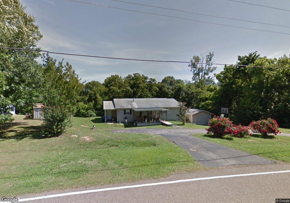
280 Thunderbird Dr N Hernando, MS 38632
Estimated Value: $293,000 - $326,000
3
Beds
2
Baths
2,096
Sq Ft
$145/Sq Ft
Est. Value
About This Home
This home is located at 280 Thunderbird Dr N, Hernando, MS 38632 and is currently estimated at $304,034, approximately $145 per square foot. 280 Thunderbird Dr N is a home located in DeSoto County with nearby schools including Oak Grove Central Elementary School, Hernando Elementary School, and Hernando Hills Elementary.
Ownership History
Date
Name
Owned For
Owner Type
Purchase Details
Closed on
Mar 9, 2023
Sold by
Fink Jeffrey C
Bought by
Fink Dennis L and Fink Kathleen A
Current Estimated Value
Purchase Details
Closed on
Mar 2, 2023
Sold by
Rooker William T
Bought by
Fink Sarah Alizann and Fink Jeffery Calvin
Purchase Details
Closed on
Feb 17, 2015
Sold by
Mcgee Sammy R and Mcgee Bonnie
Bought by
Wells Fargo Bank Na
Purchase Details
Closed on
Apr 3, 2013
Sold by
Mcgee Sammy Rex
Bought by
Mcgee Bonnie Loraine
Purchase Details
Closed on
Mar 24, 2008
Sold by
Mcbroom Clara M and Kirby Pauline D
Bought by
Mcgee Sammy R and Mcgee Bonnie
Home Financials for this Owner
Home Financials are based on the most recent Mortgage that was taken out on this home.
Original Mortgage
$101,408
Interest Rate
5.97%
Mortgage Type
FHA
Create a Home Valuation Report for This Property
The Home Valuation Report is an in-depth analysis detailing your home's value as well as a comparison with similar homes in the area
Home Values in the Area
Average Home Value in this Area
Purchase History
| Date | Buyer | Sale Price | Title Company |
|---|---|---|---|
| Fink Dennis L | -- | -- | |
| Fink Sarah Alizann | -- | Realty Title | |
| Wells Fargo Bank Na | $85,440 | None Available | |
| Mcgee Bonnie Loraine | -- | None Available | |
| Mcgee Sammy R | -- | None Available |
Source: Public Records
Mortgage History
| Date | Status | Borrower | Loan Amount |
|---|---|---|---|
| Previous Owner | Mcgee Sammy R | $101,408 |
Source: Public Records
Tax History
| Year | Tax Paid | Tax Assessment Tax Assessment Total Assessment is a certain percentage of the fair market value that is determined by local assessors to be the total taxable value of land and additions on the property. | Land | Improvement |
|---|---|---|---|---|
| 2025 | $1,284 | $15,379 | $1,500 | $13,879 |
| 2024 | $1,076 | $10,656 | $1,500 | $9,156 |
| 2023 | $1,076 | $10,656 | $0 | $0 |
| 2022 | $1,076 | $10,656 | $1,500 | $9,156 |
| 2021 | $1,076 | $10,656 | $1,500 | $9,156 |
| 2020 | $1,016 | $10,060 | $0 | $0 |
| 2019 | $1,016 | $10,060 | $1,500 | $8,560 |
| 2017 | $962 | $17,418 | $9,459 | $7,959 |
| 2016 | $962 | $9,459 | $1,500 | $7,959 |
| 2015 | $962 | $17,418 | $9,459 | $7,959 |
| 2014 | $962 | $9,459 | $0 | $0 |
| 2013 | -- | $9,459 | $0 | $0 |
Source: Public Records
Map
Nearby Homes
- 387 Black Bear Cove
- 8722 Bobwhite Dr
- 753 S Thunderbird Dr
- 681 Gaines Rd
- 7848 Missy Cove
- 1201 Wheeler Rd
- 8420 Milne Way
- 0 Gaines Rd
- 7203 Angie Dr
- 2733 Wheeler Rd
- 0 Ranch Rd
- 5441 Grays Valley Dr
- Ranch Road Lot: 1
- 713 West St
- 5665 McIngvale Rd
- 9170 U S Highway 51
- 809 Green Acres Dr
- 586 Central Ave
- 5333 Cane Creek Cove
- 5341 Cane Creek Cove
- 296 Thunderbird Dr N
- 235 N Thunderbird Dr
- 76 Thunderbird Dr
- 261 N Thunderbird Dr
- 8700 Thunderbird Dr E
- 291 Thunderbird Dr N
- 312 Thunderbird
- 312 Thunderbird Dr N
- 307 Thunderbird Dr N
- 8629 Thunderbird Dr E
- 323 Thunderbird Dr N
- 8871 S Hwy Unit 51
- 8647 Thunderbird Dr E
- 9 E Thunderbird Dr
- 0 Highway Unit 51 2253892
- 0 Highway Unit 51 2235283
- 0 Highway Unit 51 2235256
- 0 Highway Unit 301 2227285
- 0 Highway Unit 304 2282354
- 0 Highway Unit 304 2253124
Your Personal Tour Guide
Ask me questions while you tour the home.