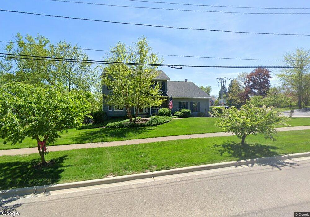
280 W Cole Ave Wheaton, IL 60187
Northside-Wheaton NeighborhoodEstimated Value: $601,028 - $765,000
Studio
--
Bath
2,472
Sq Ft
$272/Sq Ft
Est. Value
About This Home
This home is located at 280 W Cole Ave, Wheaton, IL 60187 and is currently estimated at $673,507, approximately $272 per square foot. 280 W Cole Ave is a home located in DuPage County with nearby schools including Washington Elementary School, Franklin Middle School, and Wheaton North High School.
Ownership History
Date
Name
Owned For
Owner Type
Purchase Details
Closed on
Dec 9, 2014
Sold by
Kosirog Glenn R and Kosirog Debra L
Bought by
Kosirog Debra L and Debra L Kosirog Trust
Current Estimated Value
Purchase Details
Closed on
Jul 15, 1996
Sold by
Skarin James G and Skarin Linda S
Bought by
Kosirog Glenn R and Kosirog Debra L
Home Financials for this Owner
Home Financials are based on the most recent Mortgage that was taken out on this home.
Original Mortgage
$200,000
Outstanding Balance
$9,625
Interest Rate
6.25%
Estimated Equity
$663,882
Create a Home Valuation Report for This Property
The Home Valuation Report is an in-depth analysis detailing your home's value as well as a comparison with similar homes in the area
Home Values in the Area
Average Home Value in this Area
Purchase History
| Date | Buyer | Sale Price | Title Company |
|---|---|---|---|
| Kosirog Debra L | -- | None Available | |
| Kosirog Glenn R | $300,000 | -- |
Source: Public Records
Mortgage History
| Date | Status | Borrower | Loan Amount |
|---|---|---|---|
| Open | Kosirog Glenn R | $200,000 |
Source: Public Records
Tax History
| Year | Tax Paid | Tax Assessment Tax Assessment Total Assessment is a certain percentage of the fair market value that is determined by local assessors to be the total taxable value of land and additions on the property. | Land | Improvement |
|---|---|---|---|---|
| 2024 | $11,063 | $187,643 | $55,450 | $132,193 |
| 2023 | $10,591 | $172,720 | $51,040 | $121,680 |
| 2022 | $10,543 | $163,240 | $48,250 | $114,990 |
| 2021 | $10,575 | $159,360 | $47,100 | $112,260 |
| 2020 | $10,820 | $157,870 | $46,660 | $111,210 |
| 2019 | $10,575 | $153,710 | $45,430 | $108,280 |
| 2018 | $10,729 | $154,130 | $42,800 | $111,330 |
| 2017 | $10,571 | $148,440 | $41,220 | $107,220 |
| 2016 | $10,434 | $142,510 | $39,570 | $102,940 |
| 2015 | $10,358 | $135,960 | $37,750 | $98,210 |
| 2014 | $10,943 | $140,960 | $35,470 | $105,490 |
| 2013 | $10,662 | $141,390 | $35,580 | $105,810 |
Source: Public Records
Map
Nearby Homes
- 2018 N West St
- 1902 N Washington St
- 1920 N Washington St
- 0 Ellis Ave
- 405 Turf Ln
- 111 W Prairie Ave
- 114 W Prairie Ave
- 1115 N Main St
- 1310 N Carlton Ave
- 1N248 Darling St
- N405 Gary Ave
- 1N264 Darling St
- Lot 11 Ellis Ave
- 933 Wheaton Oaks Dr
- 1037 Wheaton Oaks Dr
- 1327 Shagbark Ln
- 25W275 Doris Ave
- 0N105 Lot 1 Nepil Ave
- 0N105 Lot 2 Nepil Ave
- 314 E Jefferson Ave
- 260 W Cole Ave
- 1811 Wheaton Ct
- 300 W Cole Ave
- 240 W Cole Ave
- 1801 Wheaton Ct
- 1801 Wheaton Ct Unit C
- 1810 Wheaton Ct
- 308 W Cole Ave
- 220 W Cole Ave
- 310 W Cole Ave
- 314 W Cole Ave
- 1904 N Main St
- 402 W Cole Ave
- 1901 Jessica Ct
- 407 W Thomas Rd
- 1911 Jessica Ct
- 403 W Thomas Rd
- 408 W Cole Ave
- 414 W Cole Ave
- 411 W Thomas Rd
Your Personal Tour Guide
Ask me questions while you tour the home.