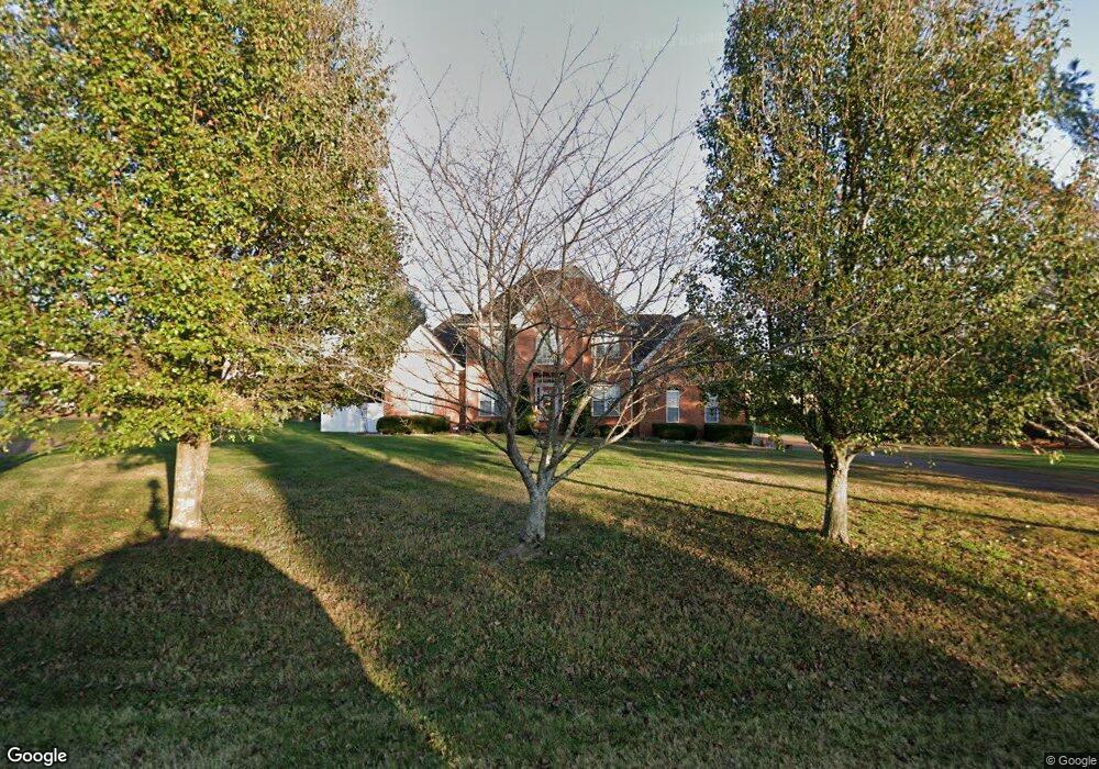
2800 Stacey St Thompsons Station, TN 37179
Estimated Value: $782,115 - $991,000
--
Bed
5
Baths
2,550
Sq Ft
$347/Sq Ft
Est. Value
About This Home
This home is located at 2800 Stacey St, Thompsons Station, TN 37179 and is currently estimated at $885,529, approximately $347 per square foot. 2800 Stacey St is a home located in Williamson County with nearby schools including Thompson's Station Middle School, Summit High School, and Primrose School of Spring Hill.
Ownership History
Date
Name
Owned For
Owner Type
Purchase Details
Closed on
Oct 21, 2001
Sold by
King Wayne
Bought by
Gunn Gary P and Gunn Delilah K
Current Estimated Value
Home Financials for this Owner
Home Financials are based on the most recent Mortgage that was taken out on this home.
Original Mortgage
$222,800
Outstanding Balance
$84,853
Interest Rate
6.67%
Estimated Equity
$800,676
Purchase Details
Closed on
Feb 20, 2001
Sold by
Marvin H Pratt Family Ltd Partnership
Bought by
King Wayne
Home Financials for this Owner
Home Financials are based on the most recent Mortgage that was taken out on this home.
Original Mortgage
$180,000
Interest Rate
7.03%
Mortgage Type
Construction
Create a Home Valuation Report for This Property
The Home Valuation Report is an in-depth analysis detailing your home's value as well as a comparison with similar homes in the area
Home Values in the Area
Average Home Value in this Area
Purchase History
| Date | Buyer | Sale Price | Title Company |
|---|---|---|---|
| Gunn Gary P | $278,500 | -- | |
| King Wayne | $49,600 | Mid State Title & Escrow Inc |
Source: Public Records
Mortgage History
| Date | Status | Borrower | Loan Amount |
|---|---|---|---|
| Open | Gunn Gary P | $222,800 | |
| Previous Owner | King Wayne | $180,000 | |
| Closed | Gunn Gary P | $41,700 |
Source: Public Records
Tax History Compared to Growth
Tax History
| Year | Tax Paid | Tax Assessment Tax Assessment Total Assessment is a certain percentage of the fair market value that is determined by local assessors to be the total taxable value of land and additions on the property. | Land | Improvement |
|---|---|---|---|---|
| 2025 | $2,403 | $197,750 | $52,850 | $144,900 |
| 2024 | $2,403 | $121,175 | $33,350 | $87,825 |
| 2023 | $2,403 | $121,175 | $33,350 | $87,825 |
| 2022 | $2,403 | $121,175 | $33,350 | $87,825 |
| 2021 | $2,403 | $121,175 | $33,350 | $87,825 |
| 2020 | $1,983 | $85,350 | $18,325 | $67,025 |
| 2019 | $1,983 | $85,350 | $18,325 | $67,025 |
| 2018 | $1,923 | $85,350 | $18,325 | $67,025 |
| 2017 | $1,906 | $85,350 | $18,325 | $67,025 |
| 2016 | $0 | $85,350 | $18,325 | $67,025 |
| 2015 | -- | $77,175 | $16,650 | $60,525 |
| 2014 | -- | $77,175 | $16,650 | $60,525 |
Source: Public Records
Map
Nearby Homes
- 797 Saint Clair Ave
- 799 Saint Clair Ave
- 781 Saint Clair Ave
- 316 Huron Dr
- 310 Huron Dr
- 328 Huron Dr
- 145 Salton Ln
- 155 Salton Ln
- 157 Salton Ln
- 148 Salton Ln
- 140 Salton Ln
- 147 Salton Ln
- 150 Salton Ln
- 151 Salton Ln
- 153 Salton Ln
- 159 Salton Ln
- 149 Salton Ln
- 2752 Thompson Station Rd E
- 630 Mayswift Dr
- 2756 Buckner Ln
- 2804 Stacey St
- 2784 Thompson Station Rd E
- 2801 Stacey St
- 2788 Thompson Station Rd E
- 2805 Stacey St
- 2701 Brenda St
- 2707 Brenda St
- 2809 Stacey St
- 2711 Brenda St
- 2792 Thompson Station Rd E
- 2780 Thompson Station Rd E
- 2813 Stacey St
- 2715 Brenda St
- 2796 Thompson Station Rd E
- 2700 Brenda St
- 2704 Brenda St
- 2817 Stacey St
- 2600 Sherrie Ln
- 2708 Brenda St
- 2719 Brenda St