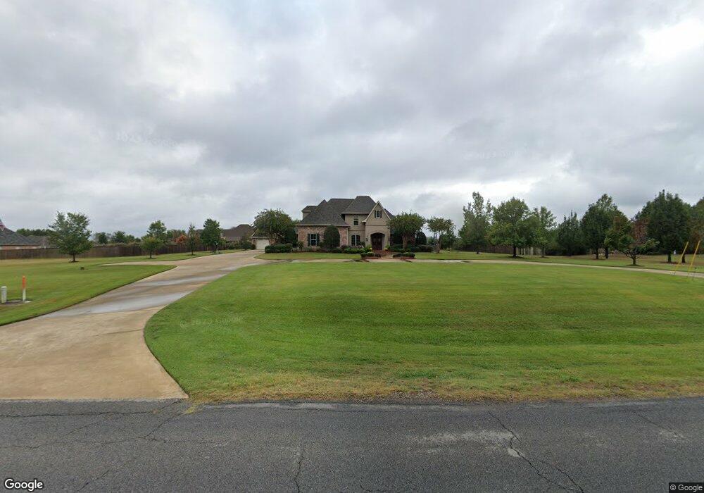
2801 Highway 821 Ruston, LA 71270
Estimated Value: $428,000 - $567,970
--
Bed
--
Bath
3,370
Sq Ft
$154/Sq Ft
Est. Value
About This Home
This home is located at 2801 Highway 821, Ruston, LA 71270 and is currently estimated at $519,993, approximately $154 per square foot. 2801 Highway 821 is a home located in Lincoln Parish with nearby schools including Choudrant Elementary School, Choudrant High School, and Ruston Junior High School.
Ownership History
Date
Name
Owned For
Owner Type
Purchase Details
Closed on
Apr 7, 2006
Sold by
Stc Llc
Bought by
Anderson Critselous Russell Dale and Anderson Critselous Cathy
Current Estimated Value
Home Financials for this Owner
Home Financials are based on the most recent Mortgage that was taken out on this home.
Original Mortgage
$28,800
Outstanding Balance
$16,407
Interest Rate
6.21%
Mortgage Type
Construction
Estimated Equity
$503,586
Create a Home Valuation Report for This Property
The Home Valuation Report is an in-depth analysis detailing your home's value as well as a comparison with similar homes in the area
Home Values in the Area
Average Home Value in this Area
Purchase History
| Date | Buyer | Sale Price | Title Company |
|---|---|---|---|
| Anderson Critselous Russell Dale | $40,000 | None Available |
Source: Public Records
Mortgage History
| Date | Status | Borrower | Loan Amount |
|---|---|---|---|
| Open | Anderson Critselous Russell Dale | $28,800 |
Source: Public Records
Tax History Compared to Growth
Tax History
| Year | Tax Paid | Tax Assessment Tax Assessment Total Assessment is a certain percentage of the fair market value that is determined by local assessors to be the total taxable value of land and additions on the property. | Land | Improvement |
|---|---|---|---|---|
| 2024 | $4,118 | $52,370 | $5,968 | $46,402 |
| 2023 | $3,604 | $43,937 | $3,760 | $40,177 |
| 2022 | $3,579 | $43,937 | $3,760 | $40,177 |
| 2021 | $3,522 | $43,936 | $3,760 | $40,176 |
| 2020 | $3,528 | $43,936 | $3,760 | $40,176 |
| 2019 | $3,686 | $45,261 | $3,760 | $41,501 |
| 2018 | $3,688 | $45,261 | $3,760 | $41,501 |
| 2017 | $3,697 | $45,261 | $3,760 | $41,501 |
| 2016 | $3,773 | $0 | $0 | $0 |
| 2015 | $3,366 | $37,272 | $3,700 | $33,572 |
| 2013 | $3,417 | $37,272 | $3,700 | $33,572 |
Source: Public Records
Map
Nearby Homes
- 186 Deer Creek Rd
- 111 Evergreen Dr
- 145 Woodshire Ln
- 3252 Highway 821
- 209 Mount Harmony Church Rd
- 611 Stable Rd
- 193 Mount Harmony Church Rd
- 641 Goodgoin Rd
- 128 Marlou Cir
- 137 Mount Harmony Church Rd
- Lot 1B Unit 1 Harmony Church Rd
- 197 Baxter Rd
- 0 Goodgoin Rd
- 136 Shade Tree Trace
- 2116 Cook Rd
- 294 Moody Rd
- 145 Timber Ridge Cir
- 0 Spillers Rd
- 1950 Louisiana 821
- 201 Vintage Ln
- 2781 Highway 821
- 2781 Highway 821
- 2823 Highway 821
- 2823 Highway 821
- 2781 Louisiana 821
- 147 Ramsey Cir
- 135 Ramsey Cir
- 114 Stow Creek Rd
- 2763 Highway 821
- 2763 Highway 821
- 146 Ramsey Cir
- 105 Stow Creek Rd
- 125 Ramsey Cir
- 171 Ramsey Cir
- 170 Ramsey Cir
- 197 Belle Pointe Dr
- 2857 Highway 821
- 173 Belle Pointe Dr
- 255 Turtle Creek Rd
- 155 Belle Pointe Dr