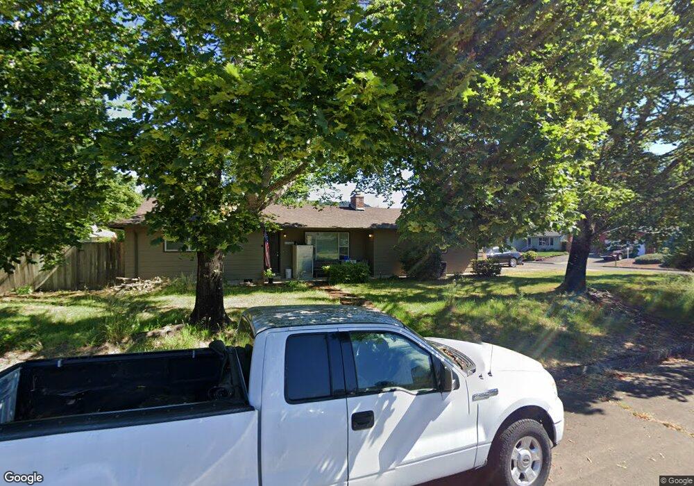
2802 20th St Springfield, OR 97477
North Springfield NeighborhoodEstimated Value: $432,000 - $475,000
4
Beds
2
Baths
1,741
Sq Ft
$261/Sq Ft
Est. Value
About This Home
This home is located at 2802 20th St, Springfield, OR 97477 and is currently estimated at $454,323, approximately $260 per square foot. 2802 20th St is a home located in Lane County with nearby schools including Yolanda Elementary School, Briggs Middle School, and Thurston High School.
Ownership History
Date
Name
Owned For
Owner Type
Purchase Details
Closed on
Jan 8, 2021
Sold by
Waske Gordon D and Waske Donna C
Bought by
Waske James C
Current Estimated Value
Home Financials for this Owner
Home Financials are based on the most recent Mortgage that was taken out on this home.
Original Mortgage
$280,000
Outstanding Balance
$248,709
Interest Rate
2.7%
Mortgage Type
New Conventional
Estimated Equity
$205,614
Purchase Details
Closed on
Jul 15, 2010
Sold by
Brooks Bonnie Jo
Bought by
Waske Gordon D and Waske Donna C
Home Financials for this Owner
Home Financials are based on the most recent Mortgage that was taken out on this home.
Original Mortgage
$191,250
Interest Rate
4.76%
Mortgage Type
Seller Take Back
Purchase Details
Closed on
Apr 21, 2006
Sold by
Brooks Bonnie Jo and Nay Bonnie Jo
Bought by
Brooks Bonnie Jo and Bonnie Jo Brooks Revocable Living Trust
Create a Home Valuation Report for This Property
The Home Valuation Report is an in-depth analysis detailing your home's value as well as a comparison with similar homes in the area
Home Values in the Area
Average Home Value in this Area
Purchase History
| Date | Buyer | Sale Price | Title Company |
|---|---|---|---|
| Waske James C | $350,000 | Fidelity Natl Ttl Co Of Or | |
| Waske Gordon D | $225,000 | Cascade Title Co | |
| Brooks Bonnie Jo | -- | None Available |
Source: Public Records
Mortgage History
| Date | Status | Borrower | Loan Amount |
|---|---|---|---|
| Open | Waske James C | $280,000 | |
| Previous Owner | Waske Gordon D | $191,250 |
Source: Public Records
Tax History
| Year | Tax Paid | Tax Assessment Tax Assessment Total Assessment is a certain percentage of the fair market value that is determined by local assessors to be the total taxable value of land and additions on the property. | Land | Improvement |
|---|---|---|---|---|
| 2025 | $3,047 | $244,174 | -- | -- |
| 2024 | $2,961 | $237,063 | -- | -- |
| 2023 | $2,961 | $230,159 | $0 | $0 |
| 2022 | $2,818 | $223,456 | $0 | $0 |
| 2021 | $2,750 | $216,948 | $0 | $0 |
| 2020 | $2,665 | $210,630 | $0 | $0 |
| 2019 | $2,563 | $204,496 | $0 | $0 |
| 2018 | $2,460 | $192,757 | $0 | $0 |
| 2017 | $2,381 | $192,757 | $0 | $0 |
| 2016 | $2,327 | $187,143 | $0 | $0 |
| 2015 | $2,274 | $181,692 | $0 | $0 |
| 2014 | $2,167 | $176,400 | $0 | $0 |
Source: Public Records
Map
Nearby Homes
- 1990 Hayden Bridge Rd
- 2822 20th St
- 1995 Hayden Bridge Rd
- 2784 20th St
- 2832 20th St
- 2801 20th St
- 2823 20th St
- 2783 20th St
- 2831 20th St
- 2775 20th St
- 2756 20th St
- 2097 Hayden Bridge Rd
- 2092 Hayden Bridge Rd
- 2780 21st St
- 2833 20th St
- 2751 20th St
- 2744 20th St
- 2772 N 21st St
- 2772 21st St
- 2100 Hayden Bridge Rd
Your Personal Tour Guide
Ask me questions while you tour the home.