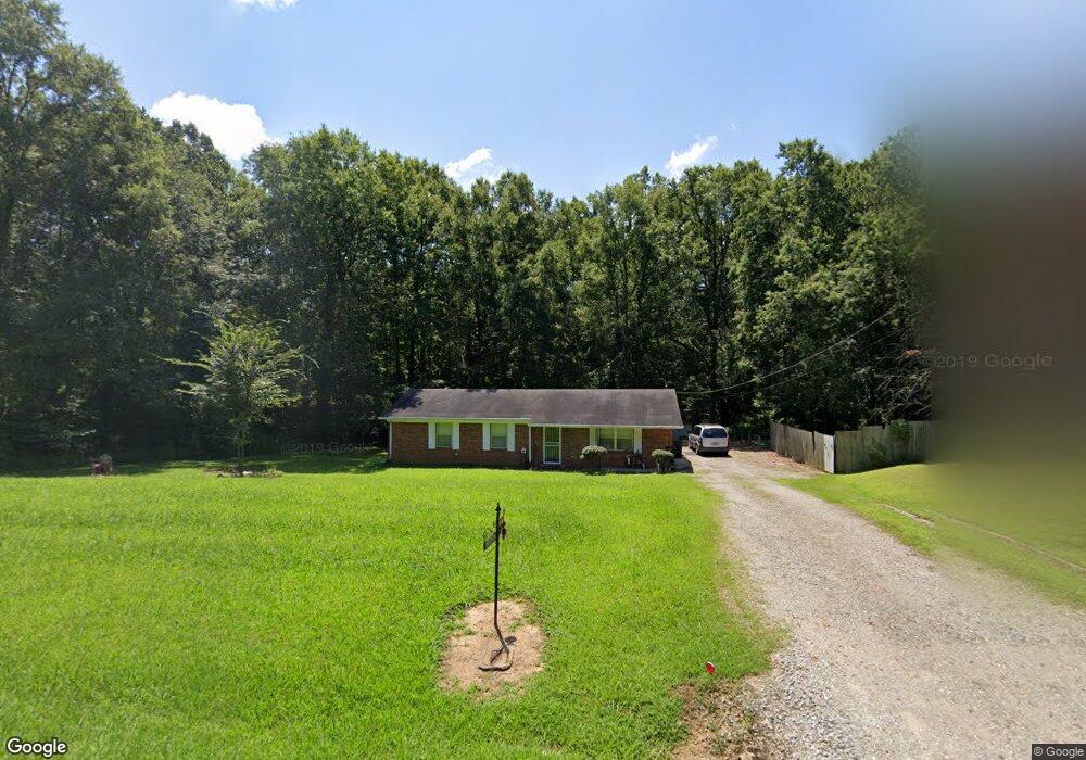
2802 Ashport Rd Jackson, TN 38305
Estimated Value: $134,000 - $168,000
Studio
2
Baths
1,275
Sq Ft
$119/Sq Ft
Est. Value
About This Home
This home is located at 2802 Ashport Rd, Jackson, TN 38305 and is currently estimated at $151,652, approximately $118 per square foot. 2802 Ashport Rd is a home located in Madison County with nearby schools including East Elementary School, Northeast Middle School, and North Side High School.
Ownership History
Date
Name
Owned For
Owner Type
Purchase Details
Closed on
Jul 27, 2023
Sold by
Jones Michael L
Bought by
Jones Timothy G
Current Estimated Value
Home Financials for this Owner
Home Financials are based on the most recent Mortgage that was taken out on this home.
Original Mortgage
$102,850
Outstanding Balance
$59,085
Interest Rate
6.67%
Mortgage Type
New Conventional
Estimated Equity
$92,567
Purchase Details
Closed on
May 19, 2023
Sold by
Griggs Sherry
Bought by
Griggs Sherry and Jones Michael L
Purchase Details
Closed on
Jul 5, 2005
Sold by
Gale Smith Lawanda
Bought by
Sherry Griggs
Purchase Details
Closed on
Sep 28, 2001
Sold by
Smith Lawanda G
Bought by
Etal Smith Lawanda G
Purchase Details
Closed on
Sep 8, 1990
Bought by
Smith Joseph L
Purchase Details
Closed on
Sep 7, 1990
Bought by
Smith Joseph L
Purchase Details
Closed on
Feb 19, 1981
Bought by
Smith Joseph L
Purchase Details
Closed on
Oct 24, 1980
Purchase Details
Closed on
Jan 1, 1980
Create a Home Valuation Report for This Property
The Home Valuation Report is an in-depth analysis detailing your home's value as well as a comparison with similar homes in the area
Purchase History
| Date | Buyer | Sale Price | Title Company |
|---|---|---|---|
| Jones Timothy G | $120,800 | None Listed On Document | |
| Griggs Sherry | $112,000 | None Listed On Document | |
| Sherry Griggs | -- | -- | |
| Etal Smith Lawanda G | -- | -- | |
| Smith Joseph L | -- | -- | |
| Smith Joseph L | -- | -- | |
| Smith Joseph L | -- | -- | |
| -- | -- | -- | |
| -- | $4,000 | -- |
Source: Public Records
Mortgage History
| Date | Status | Borrower | Loan Amount |
|---|---|---|---|
| Open | Jones Timothy G | $102,850 |
Source: Public Records
Tax History
| Year | Tax Paid | Tax Assessment Tax Assessment Total Assessment is a certain percentage of the fair market value that is determined by local assessors to be the total taxable value of land and additions on the property. | Land | Improvement |
|---|---|---|---|---|
| 2025 | $552 | $29,450 | $3,375 | $26,075 |
| 2024 | $552 | $29,450 | $3,375 | $26,075 |
| 2022 | $552 | $29,450 | $3,375 | $26,075 |
| 2021 | $377 | $16,025 | $3,000 | $13,025 |
| 2020 | $377 | $16,025 | $3,000 | $13,025 |
| 2019 | $377 | $16,025 | $3,000 | $13,025 |
| 2018 | $377 | $16,025 | $3,000 | $13,025 |
| 2017 | $392 | $16,000 | $3,000 | $13,000 |
| 2016 | $344 | $16,000 | $3,000 | $13,000 |
| 2015 | $344 | $16,000 | $3,000 | $13,000 |
| 2014 | $344 | $16,000 | $3,000 | $13,000 |
Source: Public Records
Map
Nearby Homes
- 0 Highway 70 E
- 41 Cambridge Dr
- 53 Beaumont Dr
- 228 Joy Ln
- 31 Bryce Dr
- 199 Joy Ln
- 0 Christmasville Rd Unit 25899461
- 92 Barnes Rd
- 2830 Christmasville Rd
- 257 Lakeshore Dr
- 0 Wild Valley Drive & Watson Rd
- 98 Cotton Ridge Dr
- 0 Wild Valley Dr
- 3138 Christmasville Rd
- 2142 Hwy 70 E
- 0 Hwy 70 & Bedford White Rd
- 0 Rider Dr
- 37 Crestwood Dr
- 212 Springview Dr
- 80 Pinewood Dr
- 2780 Ashport Rd
- 2774 Ashport Rd
- 2804 Ashport Rd
- 2770 Ashport Rd
- 2766 Ashport Rd
- 2762 Ashport Rd
- 2763 Ashport Rd
- 2760 Ashport Rd
- 2756 Ashport Rd
- 2745 Ashport Rd
- 2750 Ashport Rd
- 2746 Ashport Rd
- 2721 Ashport Rd
- 2740 Ashport Rd
- 2769 Ashport Rd
- 2816 Ashport Rd
- 2736 Ashport Rd
- 2732 Ashport Rd
- 2827 Ashport Rd
- 2730 Ashport Rd
Your Personal Tour Guide
Ask me questions while you tour the home.