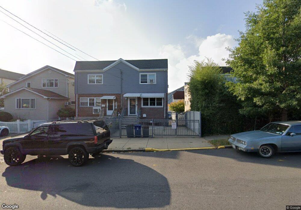
2804 Sampson Ave Bronx, NY 10465
Throgs Neck-Edgewater Park NeighborhoodEstimated Value: $571,992 - $718,000
Studio
--
Bath
1,296
Sq Ft
$503/Sq Ft
Est. Value
About This Home
This home is located at 2804 Sampson Ave, Bronx, NY 10465 and is currently estimated at $651,998, approximately $503 per square foot. 2804 Sampson Ave is a home located in Bronx County with nearby schools including P.S. 72 - Dr. William Dorney, Herbert H Lehman High School, and St. Frances de Chantal School.
Ownership History
Date
Name
Owned For
Owner Type
Purchase Details
Closed on
Dec 17, 2004
Sold by
Ramos Ana Hilda
Bought by
Belliard Juan C and Cano Elizabeth
Current Estimated Value
Home Financials for this Owner
Home Financials are based on the most recent Mortgage that was taken out on this home.
Original Mortgage
$314,880
Outstanding Balance
$157,482
Interest Rate
5.71%
Mortgage Type
Purchase Money Mortgage
Estimated Equity
$494,516
Create a Home Valuation Report for This Property
The Home Valuation Report is an in-depth analysis detailing your home's value as well as a comparison with similar homes in the area
Home Values in the Area
Average Home Value in this Area
Purchase History
| Date | Buyer | Sale Price | Title Company |
|---|---|---|---|
| Belliard Juan C | $393,600 | -- |
Source: Public Records
Mortgage History
| Date | Status | Borrower | Loan Amount |
|---|---|---|---|
| Open | Belliard Juan C | $314,880 |
Source: Public Records
Tax History
| Year | Tax Paid | Tax Assessment Tax Assessment Total Assessment is a certain percentage of the fair market value that is determined by local assessors to be the total taxable value of land and additions on the property. | Land | Improvement |
|---|---|---|---|---|
| 2025 | $6,341 | $33,350 | $8,707 | $24,643 |
| 2024 | $6,341 | $32,970 | $8,524 | $24,446 |
| 2023 | $6,033 | $31,104 | $7,136 | $23,968 |
| 2022 | $5,594 | $37,740 | $9,540 | $28,200 |
| 2021 | $5,546 | $34,500 | $9,540 | $24,960 |
| 2020 | $5,587 | $30,540 | $9,540 | $21,000 |
| 2019 | $5,455 | $28,740 | $9,540 | $19,200 |
| 2018 | $4,986 | $25,920 | $9,540 | $16,380 |
| 2017 | $4,705 | $24,549 | $8,771 | $15,778 |
| 2016 | $4,320 | $23,160 | $9,540 | $13,620 |
| 2015 | $2,926 | $23,760 | $10,620 | $13,140 |
| 2014 | $2,926 | $23,760 | $10,620 | $13,140 |
Source: Public Records
Map
Nearby Homes
- 346 Brinsmade Ave
- 2780 Sampson Ave
- 310 Huntington Ave
- 426 Calhoun Ave
- 2738 Miles Ave
- 416 Revere Ave
- 280 Balcom Ave
- 278 Balcom Ave
- 249 Calhoun Ave
- 449 Revere Ave
- 238 Swinton Ave
- 2866 Dewey Ave
- 239 Brinsmade Ave
- 269 Balcom Ave
- 4190 E Tremont Ave
- 227 Calhoun Ave
- 244 Revere Ave
- 285 Logan Ave
- 281 Graff Ave
- 2832 Harding Ave
- 2806 Sampson Ave
- 350 Swinton Ave
- 2822 Sampson Ave
- 2822 Sampson Ave
- 348 Swinton Ave
- 344 Swinton Ave
- 347 Quincy Ave
- 349 Quincy Ave
- 351 Quincy Ave
- 345 Quincy Ave
- 340 Swinton Ave
- 2788 Sampson Ave
- 2819 Sampson Ave
- 343 Quincy Ave
- 339 Quincy Ave
- 2786 Sampson Ave
- 336 Swinton Ave
- 2805 Sampson Ave
- 2803 Sampson Ave
- 2807 Sampson Ave
Your Personal Tour Guide
Ask me questions while you tour the home.