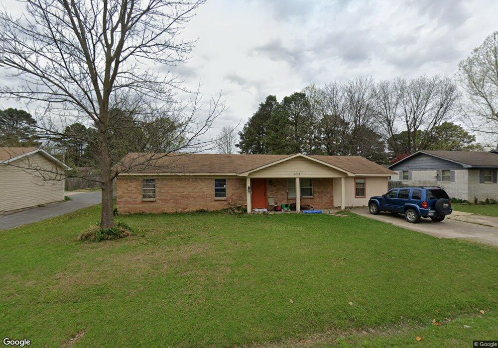
2805 Case St Paragould, AR 72450
Estimated Value: $145,595 - $176,000
Studio
1
Bath
1,560
Sq Ft
$104/Sq Ft
Est. Value
About This Home
This home is located at 2805 Case St, Paragould, AR 72450 and is currently estimated at $161,899, approximately $103 per square foot. 2805 Case St is a home located in Greene County with nearby schools including Paragould High School and Crowley's Ridge Academy.
Ownership History
Date
Name
Owned For
Owner Type
Purchase Details
Closed on
Oct 4, 2007
Sold by
Dean Thomas O and Dean Christina
Bought by
Mansfield Angela and Mansfield Bobby
Current Estimated Value
Home Financials for this Owner
Home Financials are based on the most recent Mortgage that was taken out on this home.
Original Mortgage
$74,000
Outstanding Balance
$46,248
Interest Rate
6.32%
Mortgage Type
New Conventional
Estimated Equity
$115,651
Purchase Details
Closed on
May 7, 2002
Bought by
Dean James T and Dean Vonda S
Purchase Details
Closed on
Jun 6, 2000
Bought by
Adams John C and Adams Becky L
Purchase Details
Closed on
May 31, 1994
Bought by
Patricia A Huckabee
Create a Home Valuation Report for This Property
The Home Valuation Report is an in-depth analysis detailing your home's value as well as a comparison with similar homes in the area
Purchase History
| Date | Buyer | Sale Price | Title Company |
|---|---|---|---|
| Mansfield Angela | $74,000 | None Available | |
| Dean James T | $58,000 | -- | |
| Adams John C | $53,000 | -- | |
| Patricia A Huckabee | $42,000 | -- |
Source: Public Records
Mortgage History
| Date | Status | Borrower | Loan Amount |
|---|---|---|---|
| Open | Mansfield Angela | $74,000 |
Source: Public Records
Tax History
| Year | Tax Paid | Tax Assessment Tax Assessment Total Assessment is a certain percentage of the fair market value that is determined by local assessors to be the total taxable value of land and additions on the property. | Land | Improvement |
|---|---|---|---|---|
| 2025 | $924 | $23,850 | $3,300 | $20,550 |
| 2024 | $887 | $23,850 | $3,300 | $20,550 |
| 2023 | $813 | $18,710 | $4,000 | $14,710 |
| 2022 | $438 | $18,710 | $4,000 | $14,710 |
| 2021 | $401 | $18,710 | $4,000 | $14,710 |
| 2020 | $740 | $16,070 | $4,000 | $12,070 |
| 2019 | $365 | $16,070 | $4,000 | $12,070 |
| 2018 | $390 | $16,070 | $4,000 | $12,070 |
| 2017 | $717 | $16,070 | $4,000 | $12,070 |
| 2016 | $367 | $16,070 | $4,000 | $12,070 |
| 2015 | $370 | $16,140 | $3,600 | $12,540 |
| 2014 | -- | $16,140 | $3,600 | $12,540 |
Source: Public Records
Map
Nearby Homes
- 4063 GRE 934 Rd
- 0 Lot 5 Foxboro
- 0 Mcpherson Ln
- 102 Magnolia Dr
- 106 Magnolia Dr
- 1312 N 20th St
- 21 N 29th St
- 18 N 29th St
- Lot 18 N 29th St
- 20 N 29th St
- Lot 20 N 29th St
- Lot 21 N 29th St
- 1803 Pete's Place
- 1803 Petes Place
- 301 Foxfire Dr
- 2601 Dallas Dr
- 2505 Dallas Dr
- 501 Walnut Dr
- 2712 Fairview Rd
- 3202 Fairview Rd
Your Personal Tour Guide
Ask me questions while you tour the home.