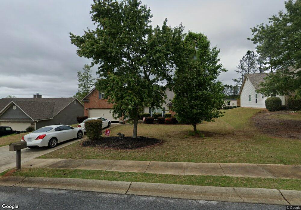
2807 S Port Dr Bethlehem, GA 30620
Estimated Value: $359,000 - $422,000
4
Beds
2
Baths
2,300
Sq Ft
$169/Sq Ft
Est. Value
About This Home
This home is located at 2807 S Port Dr, Bethlehem, GA 30620 and is currently estimated at $389,029, approximately $169 per square foot. 2807 S Port Dr is a home located in Barrow County with nearby schools including Yargo Elementary School, Haymon-Morris Middle School, and Apalachee High School.
Ownership History
Date
Name
Owned For
Owner Type
Purchase Details
Closed on
Mar 26, 2010
Sold by
Southfork Homes Llc
Bought by
Roebuck Gene C and Roebuck Melinda K
Current Estimated Value
Home Financials for this Owner
Home Financials are based on the most recent Mortgage that was taken out on this home.
Original Mortgage
$166,822
Outstanding Balance
$109,083
Interest Rate
4.87%
Mortgage Type
FHA
Estimated Equity
$279,946
Purchase Details
Closed on
Jan 21, 2010
Sold by
Ridgeview Partners Llc
Bought by
Southfork Homes
Purchase Details
Closed on
Oct 8, 2006
Sold by
Reynolds Tripp
Bought by
Ridgeview Partners Llc
Create a Home Valuation Report for This Property
The Home Valuation Report is an in-depth analysis detailing your home's value as well as a comparison with similar homes in the area
Home Values in the Area
Average Home Value in this Area
Purchase History
| Date | Buyer | Sale Price | Title Company |
|---|---|---|---|
| Roebuck Gene C | $169,900 | -- | |
| Southfork Homes | $32,500 | -- | |
| Ridgeview Partners Llc | $1,950,000 | -- |
Source: Public Records
Mortgage History
| Date | Status | Borrower | Loan Amount |
|---|---|---|---|
| Open | Roebuck Gene C | $166,822 |
Source: Public Records
Tax History
| Year | Tax Paid | Tax Assessment Tax Assessment Total Assessment is a certain percentage of the fair market value that is determined by local assessors to be the total taxable value of land and additions on the property. | Land | Improvement |
|---|---|---|---|---|
| 2025 | $1,152 | $144,083 | $30,000 | $114,083 |
| 2024 | $3,450 | $140,704 | $30,000 | $110,704 |
| 2023 | $2,902 | $135,304 | $24,000 | $111,304 |
| 2022 | $3,046 | $107,647 | $24,000 | $83,647 |
| 2021 | $2,944 | $98,453 | $18,000 | $80,453 |
| 2020 | $2,231 | $74,612 | $18,000 | $56,612 |
| 2019 | $2,269 | $74,612 | $18,000 | $56,612 |
| 2018 | $2,243 | $74,612 | $18,000 | $56,612 |
| 2017 | $1,916 | $65,814 | $18,000 | $47,814 |
| 2016 | $1,820 | $64,114 | $18,000 | $46,114 |
| 2015 | $1,844 | $64,595 | $18,000 | $46,595 |
| 2014 | $1,591 | $55,415 | $8,820 | $46,595 |
| 2013 | -- | $56,377 | $8,820 | $47,557 |
Source: Public Records
Map
Nearby Homes
- 1130 Lyndhurst Ln
- 1978 Waterside Cir
- Lancaster Plan at The Estates at Casteel
- Buckley Plan at The Estates at Casteel
- Cardiff Plan at The Estates at Casteel
- Pearson Plan at The Estates at Casteel
- Savoy Plan at The Estates at Casteel
- Hampstead Plan at The Estates at Casteel
- Pembroke Plan at The Estates at Casteel
- 280 Silverleaf Trail
- 268 Silverleaf Trail
- 16 Casteel Cir
- 117 Kensington Trace
- 50 Gillis Ln
- 64 Silverleaf Trail
- 78 Silverleaf Trail
- 85 Silverleaf Trail
- 73 Silverleaf Trail
- Europa Plan at Casteel
- Astro Plan at Casteel
- 2807 S Port Dr
- 2805 S Port Dr
- 2809 S Port Dr Unit 25
- 2809 S Port Dr
- 2805 S Port Dr
- 2811 S Port Dr
- 2803 S Port Dr
- 2808 S Port Dr
- 2806 S Port Dr Unit 3E
- 2806 S Port Dr
- 2802 S Port Dr
- 2810 S Port Dr
- 2813 S Port Dr
- S S Port Dr Unit 3E
- S S Port Dr Unit 25
- S S Port Dr Unit 20
- S S Port Dr
- S S Port Dr Unit 7
- 1410 Nantucket Dr
- 1412 Nantucket Dr Unit 30C