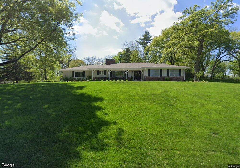
2808 Whitman Dr Saint Joseph, MO 64506
Lovers Lane NeighborhoodEstimated Value: $415,325 - $493,000
--
Bed
--
Bath
3,373
Sq Ft
$136/Sq Ft
Est. Value
About This Home
This home is located at 2808 Whitman Dr, Saint Joseph, MO 64506 and is currently estimated at $460,081, approximately $136 per square foot. 2808 Whitman Dr is a home located in Buchanan County with nearby schools including Field Elementary School, Bode Middle School, and Central High School.
Ownership History
Date
Name
Owned For
Owner Type
Purchase Details
Closed on
Apr 28, 2020
Sold by
Edgley Kevin D and Edgley Deborah A
Bought by
Duvall Brian Lee and Duvall Dlo Renae
Current Estimated Value
Home Financials for this Owner
Home Financials are based on the most recent Mortgage that was taken out on this home.
Original Mortgage
$170,000
Outstanding Balance
$118,911
Interest Rate
3.3%
Mortgage Type
New Conventional
Estimated Equity
$341,170
Purchase Details
Closed on
Aug 1, 2008
Sold by
Simpson Robert L and Simpson Kay
Bought by
Edgley Kevin D and Edgley Deborah A
Home Financials for this Owner
Home Financials are based on the most recent Mortgage that was taken out on this home.
Original Mortgage
$195,918
Interest Rate
6.47%
Mortgage Type
FHA
Create a Home Valuation Report for This Property
The Home Valuation Report is an in-depth analysis detailing your home's value as well as a comparison with similar homes in the area
Home Values in the Area
Average Home Value in this Area
Purchase History
| Date | Buyer | Sale Price | Title Company |
|---|---|---|---|
| Duvall Brian Lee | -- | First American Title Ins Co | |
| Edgley Kevin D | -- | First American Hall Abstract |
Source: Public Records
Mortgage History
| Date | Status | Borrower | Loan Amount |
|---|---|---|---|
| Open | Duvall Brian Lee | $170,000 | |
| Previous Owner | Edgley Kevin D | $195,918 |
Source: Public Records
Tax History Compared to Growth
Tax History
| Year | Tax Paid | Tax Assessment Tax Assessment Total Assessment is a certain percentage of the fair market value that is determined by local assessors to be the total taxable value of land and additions on the property. | Land | Improvement |
|---|---|---|---|---|
| 2024 | $3,289 | $45,790 | $9,390 | $36,400 |
| 2023 | $3,289 | $45,790 | $9,390 | $36,400 |
| 2022 | $3,036 | $45,790 | $9,390 | $36,400 |
| 2021 | $2,731 | $40,930 | $9,390 | $31,540 |
| 2020 | $2,714 | $40,930 | $9,390 | $31,540 |
| 2019 | $2,622 | $40,930 | $9,390 | $31,540 |
| 2018 | $2,369 | $40,930 | $9,390 | $31,540 |
| 2017 | $2,347 | $40,930 | $0 | $0 |
| 2015 | $1 | $40,930 | $0 | $0 |
| 2014 | $2,571 | $40,930 | $0 | $0 |
Source: Public Records
Map
Nearby Homes
- 3015 Miller Rd
- 2519 Forest Ave
- 3028 Ashland Ave
- 3815 Miller Rd
- 2211 Lovers Ln
- 3309 Westwood Dr
- 3128 Floral Ave
- 2521 Essex St
- 3004 C Garden Gate N A N
- 2110 Ashland Ave
- 1814 Manchester Rd
- 1805 6th Ave
- 3326 Chatham Ave
- 2906 Cook Rd
- 3315 Chatham Ave
- 2715 Cook Rd
- 00 Lot 2 Highway 169
- 00 Lot 1 Highway 169
- 1802 N 22nd St
- 2011 E Highland Ave
- 2702 Lovers Ln
- 2802 Whitman Dr
- 2818 Whitman Dr
- 2807 Whitman Dr
- 2801 Whitman Dr
- 2714 Lovers Ln
- 2815 Whitman Dr
- 3006 Miller Rd
- 2712 Lovers Ln
- 3002 Miller Rd
- 3010 Miller Rd
- 2800 Whitman Dr
- 2760 Lovers Ln
- 2721 Southeast Trail
- 2645 Lovers Ln
- 2705 Lovers Ln
- 2710 Lovers Ln
- 2709 Lovers Ln
- 2717 Southeast Trail
- 2715 Southeast Trail