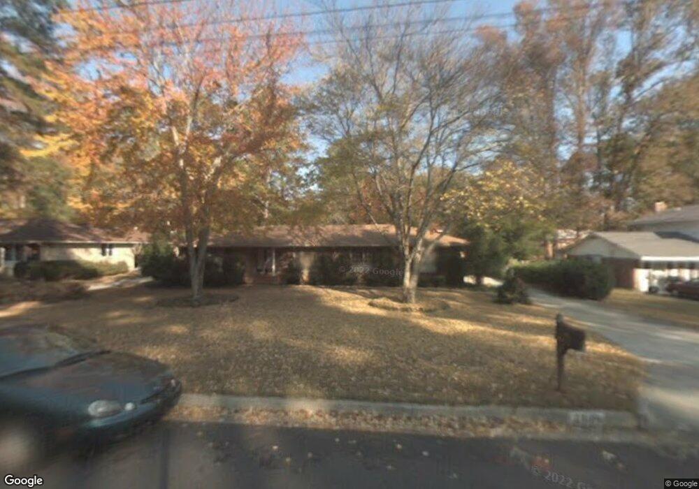
2809 Farrar Place Augusta, GA 30909
West Augusta NeighborhoodEstimated Value: $300,000 - $334,000
3
Beds
2
Baths
1,980
Sq Ft
$159/Sq Ft
Est. Value
About This Home
This home is located at 2809 Farrar Place, Augusta, GA 30909 and is currently estimated at $314,555, approximately $158 per square foot. 2809 Farrar Place is a home located in Richmond County with nearby schools including First Coast Technical Institute, R.B. Hunt Elementary School, and A. Brian Merry Elementary School.
Ownership History
Date
Name
Owned For
Owner Type
Purchase Details
Closed on
Sep 14, 2004
Sold by
Sanders Wilbert F and Sanders Eleanor
Bought by
Thompson Richard C and Thompson Martha C
Current Estimated Value
Home Financials for this Owner
Home Financials are based on the most recent Mortgage that was taken out on this home.
Original Mortgage
$122,400
Outstanding Balance
$60,374
Interest Rate
5.92%
Mortgage Type
Purchase Money Mortgage
Estimated Equity
$254,181
Create a Home Valuation Report for This Property
The Home Valuation Report is an in-depth analysis detailing your home's value as well as a comparison with similar homes in the area
Home Values in the Area
Average Home Value in this Area
Purchase History
| Date | Buyer | Sale Price | Title Company |
|---|---|---|---|
| Thompson Richard C | $153,000 | -- |
Source: Public Records
Mortgage History
| Date | Status | Borrower | Loan Amount |
|---|---|---|---|
| Open | Thompson Richard C | $122,400 |
Source: Public Records
Tax History Compared to Growth
Tax History
| Year | Tax Paid | Tax Assessment Tax Assessment Total Assessment is a certain percentage of the fair market value that is determined by local assessors to be the total taxable value of land and additions on the property. | Land | Improvement |
|---|---|---|---|---|
| 2025 | $3,070 | $101,760 | $15,200 | $86,560 |
| 2024 | $3,070 | $106,416 | $15,200 | $91,216 |
| 2023 | $2,364 | $100,944 | $15,200 | $85,744 |
| 2022 | $3,135 | $102,824 | $15,200 | $87,624 |
| 2021 | $2,711 | $79,571 | $15,200 | $64,371 |
| 2020 | $2,275 | $67,336 | $13,320 | $54,016 |
| 2019 | $2,412 | $67,336 | $13,320 | $54,016 |
| 2018 | $2,429 | $67,336 | $13,320 | $54,016 |
| 2017 | $2,375 | $67,336 | $13,320 | $54,016 |
| 2016 | $2,376 | $67,336 | $13,320 | $54,016 |
| 2015 | $2,393 | $67,336 | $13,320 | $54,016 |
| 2014 | $2,396 | $67,336 | $13,320 | $54,016 |
Source: Public Records
Map
Nearby Homes
- 525 Henderson Dr
- 2711 Wellington Dr
- 2924 Mayfair Ct
- 427 Aumond Rd
- 12 Shadowbrook Cir
- 2920 Sussex Rd
- 2743 Blount Ave
- 503 Sheffield Dr
- 2531 Tupelo Dr
- 441 Aumond Rd
- 533 Basin St
- 2823 Walters Ct
- 2914 Westchester Dr
- 542 Basin St
- 543 Basin St
- 505 Stratford Dr
- 3101 Trafalgar Dr
- 2918 Arrowhead Dr
- 552 Whitehead Dr
- 565 Martin Ln
- 2807 Farrar Place
- 2811 Farrar Place
- 2810 Ingleside Dr
- 2805 Farrar Place
- 505 Loyola Dr
- 2813 Farrar Place
- 2812 Ingleside Dr
- 2808 Ingleside Dr
- 504 Loyola Dr
- 506 Ashland Dr
- 2814 Ingleside Dr
- 2806 Ingleside Dr
- 2803 Farrar Place
- 2803 Farrah Place
- 506 Loyola Dr
- 507 Loyola Dr
- 508 Ashland Dr
- 2804 Ingleside Dr
- 0 Ashland Dr Unit 7607720
- 0 Ashland Dr