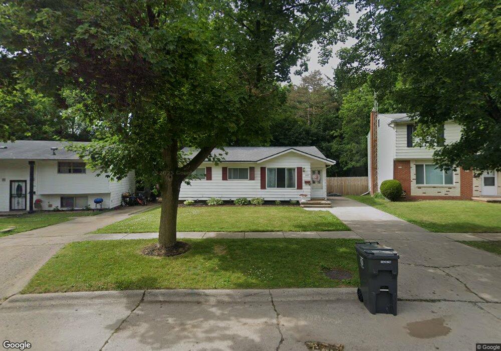
2809 Hampstead Dr Flint, MI 48506
Northeast Flint NeighborhoodEstimated Value: $62,000 - $98,000
3
Beds
2
Baths
933
Sq Ft
$80/Sq Ft
Est. Value
About This Home
This home is located at 2809 Hampstead Dr, Flint, MI 48506 and is currently estimated at $74,841, approximately $80 per square foot. 2809 Hampstead Dr is a home located in Genesee County with nearby schools including Brownell STEM Academy, Richfield Public School Academy, and Richfield Early Learning Center.
Ownership History
Date
Name
Owned For
Owner Type
Purchase Details
Closed on
Jun 28, 2023
Sold by
Hopson Desharia
Bought by
Hopson Desharia
Current Estimated Value
Purchase Details
Closed on
Nov 29, 2011
Sold by
Secretary Of Housing & Urban Development
Bought by
Hopson Ivan and Hopson Desharia
Purchase Details
Closed on
Apr 13, 2011
Sold by
Fifth Third Mortgage Company
Bought by
Secretary Of Housing & Urban Development
Purchase Details
Closed on
Jan 5, 2011
Sold by
Day Kevin D
Bought by
Fifth Third Mortgage Company
Purchase Details
Closed on
Jul 6, 2000
Sold by
Cook Robert H and Cook Peggy R
Bought by
Day Kevin D
Purchase Details
Closed on
Mar 25, 1970
Sold by
Cook Peggy R and Holland Peggy R
Bought by
Cook Robert H and Cook Peggy R
Create a Home Valuation Report for This Property
The Home Valuation Report is an in-depth analysis detailing your home's value as well as a comparison with similar homes in the area
Home Values in the Area
Average Home Value in this Area
Purchase History
| Date | Buyer | Sale Price | Title Company |
|---|---|---|---|
| Hopson Desharia | -- | None Listed On Document | |
| Hopson Ivan | $6,450 | None Available | |
| Secretary Of Housing & Urban Development | -- | None Available | |
| Fifth Third Mortgage Company | $51,493 | None Available | |
| Day Kevin D | $55,500 | Chicago Title Insurance Co | |
| Cook Robert H | -- | -- |
Source: Public Records
Tax History
| Year | Tax Paid | Tax Assessment Tax Assessment Total Assessment is a certain percentage of the fair market value that is determined by local assessors to be the total taxable value of land and additions on the property. | Land | Improvement |
|---|---|---|---|---|
| 2025 | $856 | $24,900 | $0 | $0 |
| 2024 | $780 | $21,000 | $0 | $0 |
| 2023 | $768 | $17,800 | $0 | $0 |
| 2022 | $0 | $12,700 | $0 | $0 |
| 2021 | $796 | $12,200 | $0 | $0 |
| 2020 | $722 | $9,600 | $0 | $0 |
| 2019 | $911 | $10,400 | $0 | $0 |
| 2018 | $1,842 | $10,600 | $0 | $0 |
| 2017 | $1,963 | $0 | $0 | $0 |
| 2016 | $800 | $0 | $0 | $0 |
| 2015 | -- | $0 | $0 | $0 |
| 2014 | -- | $0 | $0 | $0 |
| 2012 | -- | $15,500 | $0 | $0 |
Source: Public Records
Map
Nearby Homes
- 5919 Western Rd
- 2919 Hampstead Dr
- 2727 Eaton Place
- 2825 Eaton Place
- 4923 Alpha Way
- 4907 Delta Dr
- 4808 Alpha Way
- 1704 E Webster Rd
- 3364 E Pierson Rd
- 5910 N Dort Hwy
- 3456 E Pierson Rd
- 4298 N Center Rd
- 3294 Huggins Ave
- 4081 Hidden View Dr
- 2935 Richfield Rd
- 4141 Hidden View Dr
- 1218 E Piper Ave
- 00 Richfield Rd
- E E Carpenter Rd
- 3006 Agree Ave
- 2805 Hampstead Dr
- 2801 Hampstead Dr
- 2813 Hampstead Dr
- 2802 Hampstead Dr
- 5931 Western Rd
- 2817 Hampstead Dr
- 5920 Western Rd
- 2810 Hampstead Dr
- 5925 Western Rd
- 2821 Hampstead Dr
- 5914 Western Rd
- 2818 Hampstead Dr
- 2825 Hampstead Dr Unit Bldg-Unit
- 2825 Hampstead Dr
- 5913 Western Rd
- 2801 Margate Cir
- 2807 Margate Cir
- 2813 Margate Cir
- 5907 Western Rd
- 2828 Hampstead Dr
Your Personal Tour Guide
Ask me questions while you tour the home.