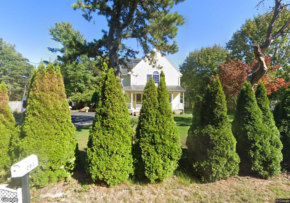
281 Charge Pond Rd Wareham, MA 02571
Estimated Value: $614,790 - $642,000
2
Beds
2
Baths
1,001
Sq Ft
$629/Sq Ft
Est. Value
About This Home
This home is located at 281 Charge Pond Rd, Wareham, MA 02571 and is currently estimated at $629,448, approximately $628 per square foot. 281 Charge Pond Rd is a home located in Plymouth County.
Ownership History
Date
Name
Owned For
Owner Type
Purchase Details
Closed on
Aug 11, 2005
Sold by
Taouk Mahrousse
Bought by
Lim Jong Yeol and Lim Yang Hee
Current Estimated Value
Home Financials for this Owner
Home Financials are based on the most recent Mortgage that was taken out on this home.
Original Mortgage
$268,000
Outstanding Balance
$139,697
Interest Rate
5.54%
Mortgage Type
Purchase Money Mortgage
Estimated Equity
$489,751
Purchase Details
Closed on
Sep 19, 2002
Sold by
Elkallassi Boutros
Bought by
Taouk Mahrousse
Purchase Details
Closed on
Jun 3, 2002
Sold by
Ag Nt and Gargano Saverio
Bought by
Charge Pond T and Elkallassi Nazih
Create a Home Valuation Report for This Property
The Home Valuation Report is an in-depth analysis detailing your home's value as well as a comparison with similar homes in the area
Purchase History
| Date | Buyer | Sale Price | Title Company |
|---|---|---|---|
| Lim Jong Yeol | $335,000 | -- | |
| Lim Jong Yeol | $335,000 | -- | |
| Taouk Mahrousse | $50,000 | -- | |
| Taouk Mahrousse | $50,000 | -- | |
| Charge Pond T | $50,000 | -- | |
| Charge Pond T | $50,000 | -- |
Source: Public Records
Mortgage History
| Date | Status | Borrower | Loan Amount |
|---|---|---|---|
| Open | Charge Pond T | $268,000 | |
| Closed | Charge Pond T | $33,500 | |
| Closed | Charge Pond T | $268,000 |
Source: Public Records
Tax History
| Year | Tax Paid | Tax Assessment Tax Assessment Total Assessment is a certain percentage of the fair market value that is determined by local assessors to be the total taxable value of land and additions on the property. | Land | Improvement |
|---|---|---|---|---|
| 2025 | $5,189 | $498,000 | $110,600 | $387,400 |
| 2024 | $5,196 | $462,700 | $86,700 | $376,000 |
| 2023 | $4,544 | $409,200 | $78,800 | $330,400 |
| 2022 | $4,544 | $344,800 | $78,800 | $266,000 |
| 2021 | $4,459 | $331,500 | $78,800 | $252,700 |
| 2020 | $4,161 | $313,800 | $78,800 | $235,000 |
| 2019 | $4,000 | $301,000 | $76,700 | $224,300 |
| 2018 | $3,799 | $278,700 | $76,700 | $202,000 |
| 2017 | $3,570 | $265,400 | $76,700 | $188,700 |
| 2016 | $3,209 | $237,200 | $75,200 | $162,000 |
| 2015 | $3,100 | $237,200 | $75,200 | $162,000 |
| 2014 | $3,160 | $245,900 | $71,500 | $174,400 |
Source: Public Records
Map
Nearby Homes
- 223 Charge Pond Rd
- 0 Charge Pond Rd
- 102 Maple Springs Rd
- 18 Red Pine Ln
- 91 Agawam Lake Shore Dr
- 7 Crane Landing Rd
- 9 Blissful Ln
- 3 Michael Dr
- 2711 Cranberry Hwy
- 2697 Cranberry Hwy Unit 21
- 47 Mayflower Way
- 2743 Cranberry Hwy Unit 5D
- 31 Owls Nest
- 14 Owls Nest Unit 6
- 2838 Cranberry Hwy
- 167 Park Ave
- 2645 Cranberry Hwy Unit A
- 263 Lake Ave
- 9 Old Glen Charlie Rd
- 156 Sandwich Rd
- 279 Charge Pond Rd
- 44 Sarah Beth Ln Unit 44
- 283 Charge Pond Rd
- 30 Sarah Beth Ln Unit 30
- 280 Charge Pond Rd
- 22 Sarah Beth Ln Unit 22
- 285 Charge Pond Rd
- 12 Sarahbeth Ln
- 12 Sarah Beth Ln
- 277 Charge Pond Rd
- 3 Sloop Ln
- 4 Shallop Ln Unit 2
- 4 Shallop Ln
- 276 Charge Pond Rd
- 21 Sarah Beth Ln Unit 28
- 21 Sarah Beth Ln Unit 21
- 19 Sarah Beth Ln Unit 27
- 3 Shallop Ln
- 4 Sloop Ln
- 7 Sarah Beth Ln
Your Personal Tour Guide
Ask me questions while you tour the home.