Estimated Value: $191,834 - $221,000
3
Beds
1
Bath
999
Sq Ft
$203/Sq Ft
Est. Value
About This Home
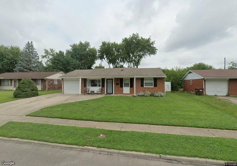
This home is located at 281 Colorado Dr, Xenia, OH 45385 and is currently estimated at $202,959, approximately $203 per square foot. 281 Colorado Dr is a home located in Greene County with nearby schools including Xenia High School and Summit Academy Community School for Alternative Learners - Xenia.
Ownership History
Date
Name
Owned For
Owner Type
Purchase Details
Closed on
Oct 2, 2019
Sold by
Maine Jr Richard and Maine Robert C
Bought by
Eldridge Zoey R and Eldridge Roger Dale
Current Estimated Value
Purchase Details
Closed on
Apr 1, 2009
Sold by
Maine Richard M and Maine Patricia A
Bought by
Maine Richard M and Maine Patricia A
Create a Home Valuation Report for This Property
The Home Valuation Report is an in-depth analysis detailing your home's value as well as a comparison with similar homes in the area
Home Values in the Area
Average Home Value in this Area
Purchase History
| Date | Buyer | Sale Price | Title Company |
|---|---|---|---|
| Eldridge Zoey R | $159,600 | None Available | |
| Maine Richard M | -- | Attorney |
Source: Public Records
Tax History Compared to Growth
Tax History
| Year | Tax Paid | Tax Assessment Tax Assessment Total Assessment is a certain percentage of the fair market value that is determined by local assessors to be the total taxable value of land and additions on the property. | Land | Improvement |
|---|---|---|---|---|
| 2024 | $2,083 | $48,690 | $10,680 | $38,010 |
| 2023 | $2,083 | $48,690 | $10,680 | $38,010 |
| 2022 | $1,737 | $34,630 | $6,280 | $28,350 |
| 2021 | $1,761 | $34,630 | $6,280 | $28,350 |
| 2020 | $1,687 | $34,630 | $6,280 | $28,350 |
| 2019 | $1,335 | $25,790 | $6,240 | $19,550 |
| 2018 | $862 | $25,790 | $6,240 | $19,550 |
| 2017 | $726 | $25,790 | $6,240 | $19,550 |
| 2016 | $727 | $22,850 | $6,240 | $16,610 |
| 2015 | $728 | $22,850 | $6,240 | $16,610 |
| 2014 | $697 | $22,850 | $6,240 | $16,610 |
Source: Public Records
Map
Nearby Homes
- 219 Kansas Dr
- 2758 Wyoming Dr
- 414 Whisper Ln
- 2142 Michigan Dr
- 2545 Harmony Dr
- 1653 Seneca Dr
- 1568 Cheyenne Dr
- 2257 Maryland Dr
- 1769 Gayhart Dr
- 1618 Navajo Dr
- 1829 Gayhart Dr
- 121 S Progress Dr
- 1908 Whitt St
- 1778 Arapaho Dr
- 1107 Arkansas Dr
- 2345 Tennessee Dr
- 1255 Colorado Dr
- 1866 Roxbury Dr
- 1144 Rockwell Dr
- 2692 Kingman Dr
- 277 Colorado Dr
- 295 Colorado Dr
- 286 Kansas Dr
- 309 Colorado Dr
- 263 Colorado Dr
- 300 Kansas Dr
- 272 Kansas Dr
- 314 Kansas Dr
- 258 Kansas Dr
- 278 Colorado Dr
- 292 Colorado Dr
- 249 Colorado Dr
- 323 Colorado Dr
- 306 Colorado Dr
- 328 Kansas Dr
- 244 Kansas Dr
- 250 Colorado Dr
- 320 Colorado Dr
- 235 Colorado Dr
- 337 Colorado Dr