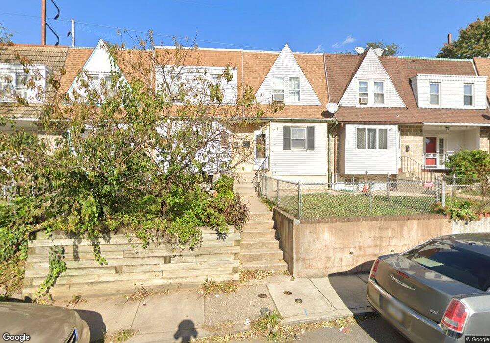
281 Coverly Rd Lansdowne, PA 19050
Estimated Value: $137,667 - $184,000
3
Beds
1
Bath
1,028
Sq Ft
$154/Sq Ft
Est. Value
About This Home
This home is located at 281 Coverly Rd, Lansdowne, PA 19050 and is currently estimated at $157,917, approximately $153 per square foot. 281 Coverly Rd is a home located in Delaware County with nearby schools including Charles Kelly El School, Upper Darby Kdg Center, and Upper Darby High School.
Ownership History
Date
Name
Owned For
Owner Type
Purchase Details
Closed on
Jul 12, 2010
Sold by
Atkinson Louis E and Atkinson Laura N
Bought by
Robinson Mitchell
Current Estimated Value
Home Financials for this Owner
Home Financials are based on the most recent Mortgage that was taken out on this home.
Original Mortgage
$94,724
Outstanding Balance
$60,216
Interest Rate
3.87%
Mortgage Type
FHA
Estimated Equity
$97,702
Create a Home Valuation Report for This Property
The Home Valuation Report is an in-depth analysis detailing your home's value as well as a comparison with similar homes in the area
Home Values in the Area
Average Home Value in this Area
Purchase History
| Date | Buyer | Sale Price | Title Company |
|---|---|---|---|
| Robinson Mitchell | $96,000 | None Available |
Source: Public Records
Mortgage History
| Date | Status | Borrower | Loan Amount |
|---|---|---|---|
| Open | Robinson Mitchell | $94,724 |
Source: Public Records
Tax History Compared to Growth
Tax History
| Year | Tax Paid | Tax Assessment Tax Assessment Total Assessment is a certain percentage of the fair market value that is determined by local assessors to be the total taxable value of land and additions on the property. | Land | Improvement |
|---|---|---|---|---|
| 2025 | $2,761 | $65,280 | $13,740 | $51,540 |
| 2024 | $2,761 | $65,280 | $13,740 | $51,540 |
| 2023 | $2,735 | $65,280 | $13,740 | $51,540 |
| 2022 | $2,661 | $65,280 | $13,740 | $51,540 |
| 2021 | $3,588 | $65,280 | $13,740 | $51,540 |
| 2020 | $2,845 | $43,980 | $12,490 | $31,490 |
| 2019 | $2,795 | $43,980 | $12,490 | $31,490 |
| 2018 | $2,763 | $43,980 | $0 | $0 |
| 2017 | $2,691 | $43,980 | $0 | $0 |
| 2016 | $241 | $43,980 | $0 | $0 |
| 2015 | $241 | $43,980 | $0 | $0 |
| 2014 | $241 | $43,980 | $0 | $0 |
Source: Public Records
Map
Nearby Homes
- 291 N Wycombe Ave
- 243 Coverly Rd
- 239 N Maple Ave
- 143 Springton Rd
- 149 Springton Rd
- 149 Blackburn Ave
- 142 Springton Rd
- 163 Springton Rd
- 7265 Calvin Rd
- 7247 Guilford Rd
- 127 Sherbrook Blvd
- 339 Huntley Rd
- 404 Croyden Rd
- 209 Wabash Ave
- 164 Woodland Ave
- 178 N Union Ave
- 346 Long Ln
- 319 E Essex Ave
- 317 E Essex Ave
- 315 E Essex Ave
- 297 Coverly Rd
- 293 Coverly Rd
- 291 Coverly Rd
- 287 Coverly Rd
- 285 Coverly Rd
- 283 Coverly Rd
- 277 Coverly Rd
- 271 Coverly Rd
- 269 Coverly Rd
- 267 Coverly Rd
- 265 Coverly Rd
- 263 Coverly Rd
- 259 Coverly Rd
- 257 Coverly Rd
- 255 Coverly Rd
- 235 Coverly Rd
- 275 Coverly Rd
- 279 Coverly Rd
- 285 Sheffield Rd
- 283 Sheffield Rd