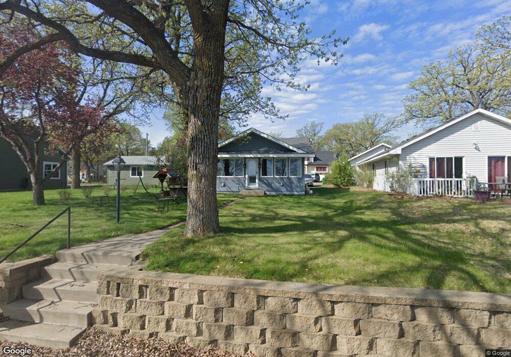
281 Lakeshore Dr Big Lake, MN 55309
Estimated Value: $258,678 - $296,000
1
Bed
1
Bath
784
Sq Ft
$343/Sq Ft
Est. Value
About This Home
This home is located at 281 Lakeshore Dr, Big Lake, MN 55309 and is currently estimated at $268,920, approximately $343 per square foot. 281 Lakeshore Dr is a home located in Sherburne County with nearby schools including Liberty Elementary School, Independence Elementary School, and Big Lake Middle School.
Ownership History
Date
Name
Owned For
Owner Type
Purchase Details
Closed on
Sep 6, 2019
Sold by
Rysdam Jeanette
Bought by
Rysdam Randy
Current Estimated Value
Purchase Details
Closed on
Apr 18, 2014
Sold by
Wigren Thomas J and Wigren Julie A
Bought by
Rysdam Randy and Rysdam Jeanette
Home Financials for this Owner
Home Financials are based on the most recent Mortgage that was taken out on this home.
Original Mortgage
$100,000
Interest Rate
4.41%
Mortgage Type
Seller Take Back
Purchase Details
Closed on
Dec 22, 2006
Sold by
Puhek Florence
Bought by
Wigren Thomas J and Wigren Julie A
Create a Home Valuation Report for This Property
The Home Valuation Report is an in-depth analysis detailing your home's value as well as a comparison with similar homes in the area
Home Values in the Area
Average Home Value in this Area
Purchase History
| Date | Buyer | Sale Price | Title Company |
|---|---|---|---|
| Rysdam Randy | -- | None Available | |
| Rysdam Randy | $100,000 | None Available | |
| Wigren Thomas J | $158,000 | -- |
Source: Public Records
Mortgage History
| Date | Status | Borrower | Loan Amount |
|---|---|---|---|
| Previous Owner | Rysdam Randy | $100,000 |
Source: Public Records
Tax History Compared to Growth
Tax History
| Year | Tax Paid | Tax Assessment Tax Assessment Total Assessment is a certain percentage of the fair market value that is determined by local assessors to be the total taxable value of land and additions on the property. | Land | Improvement |
|---|---|---|---|---|
| 2025 | $2,832 | $252,400 | $137,600 | $114,800 |
| 2024 | $2,794 | $247,200 | $137,600 | $109,600 |
| 2023 | $2,428 | $242,300 | $134,600 | $107,700 |
| 2022 | $2,300 | $207,500 | $106,100 | $101,400 |
| 2020 | $2,190 | $167,200 | $86,100 | $81,100 |
| 2019 | $2,052 | $158,300 | $81,800 | $76,500 |
| 2018 | $1,992 | $148,400 | $71,600 | $76,800 |
| 2017 | $1,894 | $139,900 | $69,000 | $70,900 |
| 2016 | $1,818 | $130,500 | $65,900 | $64,600 |
| 2015 | $1,462 | $101,300 | $48,900 | $52,400 |
| 2014 | $1,790 | $81,800 | $34,800 | $47,000 |
| 2013 | -- | $102,200 | $46,000 | $56,200 |
Source: Public Records
Map
Nearby Homes
- 491 Highland Ave
- 679 Lakeshore Dr
- 241 Leighton Dr
- TBD Highway 10 NW
- 20050 County Road 81 NW
- TBD Manitou St
- 20311 Gordon Ln
- 240 Wyoming Ave
- 3300 Lake View Ln
- 100 Park Ave
- 637 Norwood Ln
- 5008 Bluff Rd
- 4637 Pond View Cir
- 3250 Lake Ridge Dr
- 4265 Lake Ridge Dr
- 110 Powell Cir E
- 20189 Esther Pkwy
- 20172 Truman Dr
- 874 Independence Dr NW
- 541 William St
- 291 Lakeshore Dr
- 241 Lakeshore Dr
- 211 Euclid Ave
- 301 Lakeshore Dr
- 201 Lakeshore Dr
- 100 Oak Ave
- 321 Lakeshore Dr
- 231 Euclid Ave
- 210 Euclid Ave
- 110 Oak Ave
- 220 Euclid Ave
- 140 Oak Ave
- 341 Lakeshore Dr
- 241 Euclid Ave
- 251 Euclid Ave
- 191 Lakeshore Dr
- 361 Lakeshore Dr
- 121 Oak Ave
- 381 Lakeshore Dr
- 311 Lake Ave