Estimated Value: $208,189 - $237,000
3
Beds
2
Baths
1,702
Sq Ft
$129/Sq Ft
Est. Value
About This Home
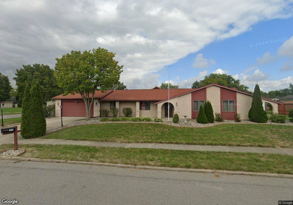
This home is located at 2810 Plymouth Dr, Lima, OH 45805 and is currently estimated at $219,797, approximately $129 per square foot. 2810 Plymouth Dr is a home located in Allen County with nearby schools including Elida Elementary School, Elida Middle School, and Elida High School.
Ownership History
Date
Name
Owned For
Owner Type
Purchase Details
Closed on
Sep 19, 1997
Sold by
Wardell Robert
Bought by
Whitacre William
Current Estimated Value
Home Financials for this Owner
Home Financials are based on the most recent Mortgage that was taken out on this home.
Original Mortgage
$90,950
Interest Rate
7.55%
Mortgage Type
VA
Purchase Details
Closed on
Sep 1, 1982
Bought by
Wardell Robert S
Create a Home Valuation Report for This Property
The Home Valuation Report is an in-depth analysis detailing your home's value as well as a comparison with similar homes in the area
Home Values in the Area
Average Home Value in this Area
Purchase History
| Date | Buyer | Sale Price | Title Company |
|---|---|---|---|
| Whitacre William | $89,200 | -- | |
| Wardell Robert S | $64,900 | -- |
Source: Public Records
Mortgage History
| Date | Status | Borrower | Loan Amount |
|---|---|---|---|
| Closed | Whitacre William | $90,950 |
Source: Public Records
Tax History Compared to Growth
Tax History
| Year | Tax Paid | Tax Assessment Tax Assessment Total Assessment is a certain percentage of the fair market value that is determined by local assessors to be the total taxable value of land and additions on the property. | Land | Improvement |
|---|---|---|---|---|
| 2024 | $2,273 | $61,950 | $10,500 | $51,450 |
| 2023 | $1,963 | $49,180 | $8,330 | $40,850 |
| 2022 | $2,023 | $49,180 | $8,330 | $40,850 |
| 2021 | $1,971 | $48,020 | $8,330 | $39,690 |
| 2020 | $1,760 | $41,340 | $8,370 | $32,970 |
| 2019 | $1,760 | $41,340 | $8,370 | $32,970 |
| 2018 | $1,660 | $41,340 | $8,370 | $32,970 |
| 2017 | $1,555 | $38,330 | $8,370 | $29,960 |
| 2016 | $1,550 | $38,330 | $8,370 | $29,960 |
| 2015 | $1,430 | $38,330 | $8,370 | $29,960 |
| 2014 | $1,430 | $35,000 | $7,770 | $27,230 |
| 2013 | $1,285 | $35,000 | $7,770 | $27,230 |
Source: Public Records
Map
Nearby Homes
- 37 Beaumont Place
- 224 Buckingham Dr
- 174 Bridle Trail
- 8 Bridle Trail
- 14 Deer Run
- 1392 Chancellor Dr
- 858 Mackenzie Dr
- 2108 Elida Rd
- 3637 Comanche Dr
- 3660 Comanche Dr
- 3624 Comanche Dr
- 3790 Comanche Dr
- 3619 Comanche Dr
- 1113 Crestwood Dr
- 3687 Comanche
- 102 Charwood Dr
- 3705 Comanche
- 514 N Cable Rd
- 2225 N Cable Rd
- 1730 Homeward Ave
- 1722 Benham Dr
- 2800 Plymouth Dr
- 2811 Plymouth Dr
- 1717 Whitehall Dr
- 1734 Benham Dr
- 2830 Plymouth Dr
- 1675 Whitehall Dr
- 1729 Whitehall Dr
- 1646 Benham Dr
- 1657 Benham Dr
- 1735 Benham Dr
- 1659 Whitehall Dr
- 1748 Benham Dr
- 1741 Whitehall Dr
- 1647 Benham Dr
- 1718 Whitehall Dr
- 1684 Whitehall Dr
- 2840 Plymouth Dr
- 1749 Benham Dr