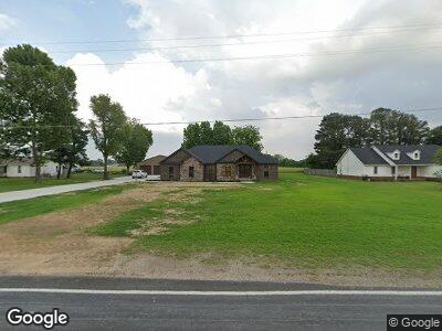
2810 State Highway Y Kennett, MO 63857
Estimated Value: $193,598 - $223,000
--
Bed
--
Bath
2,274
Sq Ft
$93/Sq Ft
Est. Value
About This Home
This home is located at 2810 State Highway Y, Kennett, MO 63857 and is currently estimated at $211,400, approximately $92 per square foot. 2810 State Highway Y is a home with nearby schools including Senath-Hornersville Elementary School, Senath-Hornersville C-8, and Senath-Hornersville Senior High School.
Ownership History
Date
Name
Owned For
Owner Type
Purchase Details
Closed on
Nov 29, 2021
Sold by
Bell Ralph Glen and Bell Deidra Dawn
Bought by
Martin Glenn and Martin Konya
Current Estimated Value
Purchase Details
Closed on
Aug 23, 2007
Sold by
Staggs Bobby and Staggs Patricia Ann
Bought by
Bell Ralph Glen and Bell Connie
Home Financials for this Owner
Home Financials are based on the most recent Mortgage that was taken out on this home.
Original Mortgage
$83,150
Interest Rate
6.72%
Mortgage Type
New Conventional
Create a Home Valuation Report for This Property
The Home Valuation Report is an in-depth analysis detailing your home's value as well as a comparison with similar homes in the area
Home Values in the Area
Average Home Value in this Area
Purchase History
| Date | Buyer | Sale Price | Title Company |
|---|---|---|---|
| Martin Glenn | -- | None Available | |
| Bell Ralph Glen | -- | Pelts Title Insurance |
Source: Public Records
Mortgage History
| Date | Status | Borrower | Loan Amount |
|---|---|---|---|
| Open | Martin Glenn | $117,654 | |
| Open | Martin Glenn | $350,036 | |
| Previous Owner | Bell Ralph Glen | $83,150 | |
| Previous Owner | Staggs Bobby Loen | $110,000 |
Source: Public Records
Tax History Compared to Growth
Tax History
| Year | Tax Paid | Tax Assessment Tax Assessment Total Assessment is a certain percentage of the fair market value that is determined by local assessors to be the total taxable value of land and additions on the property. | Land | Improvement |
|---|---|---|---|---|
| 2024 | $1,005 | $21,670 | $0 | $0 |
| 2023 | $60 | $1,310 | $0 | $0 |
| 2022 | $110 | $2,450 | $0 | $0 |
| 2021 | $112 | $2,450 | $0 | $0 |
| 2020 | $112 | $10,790 | $0 | $0 |
| 2019 | $112 | $10,790 | $0 | $0 |
| 2018 | $110 | $10,790 | $0 | $0 |
| 2017 | $110 | $10,790 | $0 | $0 |
| 2016 | -- | $1,310 | $0 | $0 |
| 2015 | -- | $10,790 | $0 | $0 |
| 2014 | -- | $10,790 | $0 | $0 |
| 2013 | -- | $10,790 | $0 | $0 |
Source: Public Records
Map
Nearby Homes
- 17531 Division St
- 1407 S Jackson St
- 15149 County Road 551
- 902 S Sutton Place
- 600 Butler Dr
- 204 W 8th St
- 313 W Linden Cir
- 300 Butler Dr
- 707 Slicer St
- 708 Slicer St
- 0 S Vandeventer St
- 0 S Park St
- 105 W 5th St
- 1315 Ballard St
- 208 John R St
- 215 Homecrest St
- 107 N Everett St
- 509 King St
- 717 Michael St
- 605 W Washington St