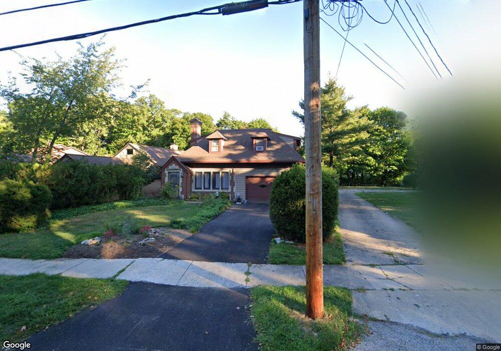
28101 Gilchrist Dr Euclid, OH 44132
Estimated Value: $188,000 - $223,000
3
Beds
2
Baths
1,547
Sq Ft
$129/Sq Ft
Est. Value
About This Home
This home is located at 28101 Gilchrist Dr, Euclid, OH 44132 and is currently estimated at $200,094, approximately $129 per square foot. 28101 Gilchrist Dr is a home located in Cuyahoga County with nearby schools including Shoreview Elementary School, Euclid High School, and Ss. Robert & William Catholic School.
Ownership History
Date
Name
Owned For
Owner Type
Purchase Details
Closed on
Jan 24, 2007
Sold by
Cupp Elizabeth A
Bought by
Calderwood Lois J
Current Estimated Value
Home Financials for this Owner
Home Financials are based on the most recent Mortgage that was taken out on this home.
Original Mortgage
$21,000
Interest Rate
5.97%
Mortgage Type
Stand Alone Second
Purchase Details
Closed on
May 7, 1999
Sold by
Cupp Elizabeth Anne and Cupp Elizabeth
Bought by
Cupp Elizabeth A
Purchase Details
Closed on
Sep 28, 1992
Sold by
Mcleod Edna V
Bought by
Mcleod Edna V Trustee
Purchase Details
Closed on
Mar 31, 1988
Sold by
Reed Helen M and Mcleod Edna V
Bought by
Mcleod Edna
Purchase Details
Closed on
Jan 1, 1975
Bought by
Reed Helen M and Mcleod Edna
Create a Home Valuation Report for This Property
The Home Valuation Report is an in-depth analysis detailing your home's value as well as a comparison with similar homes in the area
Home Values in the Area
Average Home Value in this Area
Purchase History
| Date | Buyer | Sale Price | Title Company |
|---|---|---|---|
| Calderwood Lois J | $210,000 | Progressive Land Title Ag | |
| Cupp Elizabeth A | -- | -- | |
| Mcleod Edna V Trustee | -- | -- | |
| Mcleod Edna | -- | -- | |
| Mcleod Edna | $18,800 | -- | |
| Reed Helen M | -- | -- |
Source: Public Records
Mortgage History
| Date | Status | Borrower | Loan Amount |
|---|---|---|---|
| Closed | Calderwood Lois J | $21,000 | |
| Closed | Calderwood Lois J | $168,000 |
Source: Public Records
Tax History Compared to Growth
Tax History
| Year | Tax Paid | Tax Assessment Tax Assessment Total Assessment is a certain percentage of the fair market value that is determined by local assessors to be the total taxable value of land and additions on the property. | Land | Improvement |
|---|---|---|---|---|
| 2024 | $3,558 | $62,510 | $13,230 | $49,280 |
| 2023 | $3,491 | $50,580 | $10,400 | $40,180 |
| 2022 | $3,443 | $50,580 | $10,400 | $40,180 |
| 2021 | $3,849 | $50,580 | $10,400 | $40,180 |
| 2020 | $3,843 | $46,830 | $9,630 | $37,210 |
| 2019 | $3,477 | $133,800 | $27,500 | $106,300 |
| 2018 | $3,900 | $46,830 | $9,630 | $37,210 |
| 2017 | $4,558 | $41,550 | $15,750 | $25,800 |
| 2016 | $4,617 | $41,550 | $15,750 | $25,800 |
| 2015 | $4,196 | $41,550 | $15,750 | $25,800 |
| 2014 | $4,196 | $41,550 | $15,750 | $25,800 |
Source: Public Records
Map
Nearby Homes
- 150 Westbrook Dr
- 28805 Cresthaven Dr
- 28812 Cresthaven Dr
- 251 E 286th St
- 278 E 286th St
- 295 E 276th St
- 557 Ezmor Ln
- 335 Blissfield Dr
- 27709 Parkwood Dr
- 260 E 293rd St
- 29524 Bruce Dr
- 459 Lloyd Rd
- 29616 Grand Blvd
- 625 Lloyd Rd
- 29121 Oakdale Rd
- 369 E 270th St
- 445 E 275th St
- 840 Talmadge Ave
- 29034 Barjode Rd
- 29103 Barjode Rd
- 28071 Gilchrist Dr
- 28051 Gilchrist Dr
- 28151 Gilchrist Dr
- 28049 Gilchrist Dr
- 28201 Gilchrist Dr
- 28047 Gilchrist Dr
- 28130 Gilchrist Dr
- 28150 Gilchrist Dr
- 28211 Gilchrist Dr
- 28001 Gilchrist Dr
- 28200 Gilchrist Dr
- 120 Eastbrook Dr
- 28230 Gilchrist Dr
- 85 E 280th St
- 28251 Gilchrist Dr
- 130 Eastbrook Dr
- 131 Westbrook Dr
- 115 Eastbrook Dr
- 91 E 280th St
- 28232 Gilchrist Dr