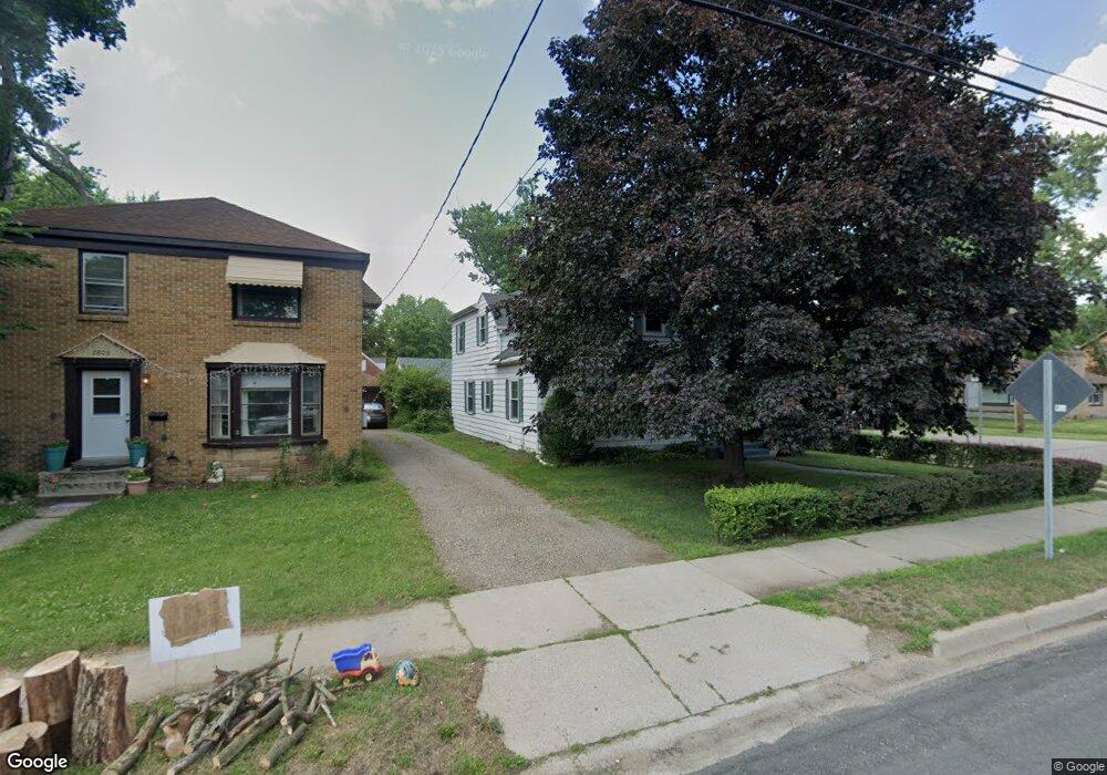
2811 E Main St Kalamazoo, MI 49048
Estimated Value: $179,000 - $209,000
4
Beds
2
Baths
1,503
Sq Ft
$126/Sq Ft
Est. Value
About This Home
This home is located at 2811 E Main St, Kalamazoo, MI 49048 and is currently estimated at $189,666, approximately $126 per square foot. 2811 E Main St is a home located in Kalamazoo County with nearby schools including Northeastern Elementary School, Linden Grove Middle School, and Kalamazoo Central High School.
Ownership History
Date
Name
Owned For
Owner Type
Purchase Details
Closed on
May 6, 2013
Sold by
Rangel Kathy J
Bought by
Rangel Kathy J and Bradley S Rangel S
Current Estimated Value
Purchase Details
Closed on
Jan 16, 2004
Sold by
Rangel Kathy J and Rangel Michael P
Bought by
Rangel Kathy J
Home Financials for this Owner
Home Financials are based on the most recent Mortgage that was taken out on this home.
Original Mortgage
$89,600
Interest Rate
5.74%
Mortgage Type
Stand Alone Refi Refinance Of Original Loan
Create a Home Valuation Report for This Property
The Home Valuation Report is an in-depth analysis detailing your home's value as well as a comparison with similar homes in the area
Home Values in the Area
Average Home Value in this Area
Purchase History
| Date | Buyer | Sale Price | Title Company |
|---|---|---|---|
| Rangel Kathy J | -- | None Available | |
| Rangel Kathy J | -- | -- |
Source: Public Records
Mortgage History
| Date | Status | Borrower | Loan Amount |
|---|---|---|---|
| Closed | Rangel Kathy J | $89,600 |
Source: Public Records
Tax History
| Year | Tax Paid | Tax Assessment Tax Assessment Total Assessment is a certain percentage of the fair market value that is determined by local assessors to be the total taxable value of land and additions on the property. | Land | Improvement |
|---|---|---|---|---|
| 2025 | $411 | $94,400 | $0 | $0 |
| 2024 | $399 | $79,400 | $0 | $0 |
| 2023 | $380 | $69,900 | $0 | $0 |
| 2022 | $1,899 | $64,400 | $0 | $0 |
| 2021 | $1,782 | $55,800 | $0 | $0 |
| 2020 | $1,753 | $52,000 | $0 | $0 |
| 2019 | $1,675 | $47,300 | $0 | $0 |
| 2018 | $1,633 | $38,400 | $0 | $0 |
| 2017 | $0 | $38,400 | $0 | $0 |
| 2016 | -- | $34,400 | $0 | $0 |
| 2015 | -- | $31,200 | $0 | $0 |
| 2014 | -- | $29,400 | $0 | $0 |
Source: Public Records
Map
Nearby Homes
- 1022 Dayton Ave
- 3011 E Main St
- 925 Dayton Ave
- 926 Washburn Ave
- 705 Dayton Ave
- 1727 Sunnyside Dr
- 1008 Cooper Ave
- 1726 Upland Dr
- 561 Arthur Ave
- 905 Cooper Ave
- 3221 Miami Ave
- 811 Craft Ave
- 557 Ira Ave
- 546 Washburn Ave
- 1308 Colgrove Ave
- 601 Chicago Ave
- 1824 Humphrey St
- 611 Fenimore Ave
- 2117 Lakewood Dr
- 1934 Nazareth Rd
- 2809 E Main St
- 1206 Texel Dr
- 2731 E Main St
- 1229 Texel Dr
- 57281 E Main St
- 1130 Dayton Ave
- 1220 Texel Dr
- 2831 E Main St
- 1220 Woodrow Dr
- 2816 E Main St
- 1226 Texel Dr
- 2820 E Main St
- 1126 Dayton Ave
- 1228 Woodrow Dr
- 1230 Texel Dr
- 1127 Arthur Ave
- 2903 E Main St
- 2726 E Main St
- 1241 Texel Dr
- 1122 Dayton Ave
Your Personal Tour Guide
Ask me questions while you tour the home.