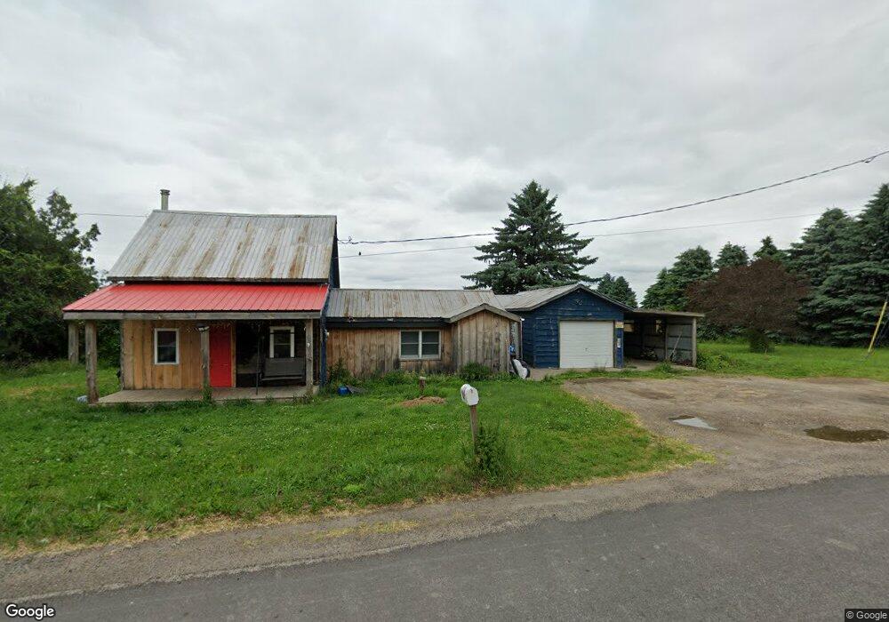
2811 State Route 11 North Bangor, NY 12966
Estimated Value: $66,821 - $216,000
3
Beds
1
Bath
1,286
Sq Ft
$89/Sq Ft
Est. Value
About This Home
This home is located at 2811 State Route 11, North Bangor, NY 12966 and is currently estimated at $114,455, approximately $89 per square foot. 2811 State Route 11 is a home located in Franklin County with nearby schools including Davis Elementary School, Malone Middle School, and Franklin Academy High School.
Ownership History
Date
Name
Owned For
Owner Type
Purchase Details
Closed on
May 1, 2008
Sold by
Scott Daniel
Bought by
Clark Carol
Current Estimated Value
Home Financials for this Owner
Home Financials are based on the most recent Mortgage that was taken out on this home.
Original Mortgage
$30,400
Outstanding Balance
$19,363
Interest Rate
5.99%
Mortgage Type
Purchase Money Mortgage
Estimated Equity
$95,092
Purchase Details
Closed on
Jun 15, 2000
Sold by
Shantie Virginia
Bought by
Scott Daniel C
Create a Home Valuation Report for This Property
The Home Valuation Report is an in-depth analysis detailing your home's value as well as a comparison with similar homes in the area
Home Values in the Area
Average Home Value in this Area
Purchase History
| Date | Buyer | Sale Price | Title Company |
|---|---|---|---|
| Clark Carol | $32,000 | Richard Edwards | |
| Scott Daniel C | $28,000 | John T Snell |
Source: Public Records
Mortgage History
| Date | Status | Borrower | Loan Amount |
|---|---|---|---|
| Open | Clark Carol | $30,400 |
Source: Public Records
Tax History Compared to Growth
Tax History
| Year | Tax Paid | Tax Assessment Tax Assessment Total Assessment is a certain percentage of the fair market value that is determined by local assessors to be the total taxable value of land and additions on the property. | Land | Improvement |
|---|---|---|---|---|
| 2024 | $973 | $36,000 | $9,500 | $26,500 |
| 2023 | $1,327 | $36,000 | $9,500 | $26,500 |
| 2022 | $1,283 | $36,000 | $9,500 | $26,500 |
| 2021 | $1,282 | $36,000 | $9,500 | $26,500 |
| 2020 | $827 | $36,000 | $9,500 | $26,500 |
| 2019 | $819 | $36,000 | $9,500 | $26,500 |
| 2018 | $800 | $36,000 | $9,500 | $26,500 |
| 2017 | $788 | $36,000 | $9,500 | $26,500 |
| 2016 | $796 | $36,000 | $9,500 | $26,500 |
| 2015 | -- | $36,000 | $9,500 | $26,500 |
| 2014 | -- | $36,000 | $9,500 | $26,500 |
Source: Public Records
Map
Nearby Homes
- 1482 U S 11
- 2945 State Route 11
- 87 Van Dusen Dr
- 156 Meehan Rd
- 1107 County Rt 53
- 188 Meehan Rd
- 2422 U S 11
- 1984 County Route 8
- 1434 County Route 22
- 3401 Sh 11
- 20 Mill St
- 161 Franklin St
- 109 Franklin St
- 102 Fort Covington St
- 278 W Main St
- 280 W Main St
- 662 Baker Rd
- 0 Limekiln Rd
- 9 Jones St
- 21 Shepard St
- 2818 State Route 11b
- 2800 State Route 11
- 2792 State Route 11
- 2796 State Route 11
- 2852 State Route 11
- 2770 State Route 11
- 2728 State Route 11
- 2913 State Route 11
- 2702 State Route 11
- 2698 State Route 11
- 2690 State Route 11
- 2690 State Rt 11
- 2690 U S 11
- 2939 State Route 11
- 2939 State Rt 11
- 2689 State Route 11
- 2686 State Route 11
- 2945 St Rt 11
- 2949 State Route 11
- 2949 State Route 11