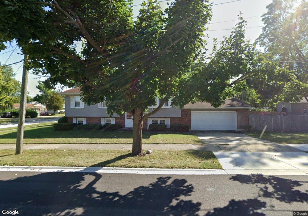
2811 University Ave Waukegan, IL 60085
West Waukegan NeighborhoodEstimated Value: $252,000 - $298,000
4
Beds
2
Baths
1,144
Sq Ft
$242/Sq Ft
Est. Value
About This Home
This home is located at 2811 University Ave, Waukegan, IL 60085 and is currently estimated at $276,990, approximately $242 per square foot. 2811 University Ave is a home located in Lake County with nearby schools including Whittier Elementary School, Robert E. Abbott Middle School, and Waukegan High School.
Ownership History
Date
Name
Owned For
Owner Type
Purchase Details
Closed on
Apr 15, 2025
Sold by
Griffin Henry E and Massie Leonor P
Bought by
Griffin Henry E and Griffin Leon
Current Estimated Value
Purchase Details
Closed on
Aug 4, 1995
Sold by
Crawley Tyrone W and Crawley Frances D
Bought by
Massie Leonor Perez and Griffin Henry E
Home Financials for this Owner
Home Financials are based on the most recent Mortgage that was taken out on this home.
Original Mortgage
$118,610
Interest Rate
7.56%
Mortgage Type
FHA
Create a Home Valuation Report for This Property
The Home Valuation Report is an in-depth analysis detailing your home's value as well as a comparison with similar homes in the area
Home Values in the Area
Average Home Value in this Area
Purchase History
| Date | Buyer | Sale Price | Title Company |
|---|---|---|---|
| Griffin Henry E | -- | None Listed On Document | |
| Massie Leonor Perez | $126,000 | Imperial Land Title Inc |
Source: Public Records
Mortgage History
| Date | Status | Borrower | Loan Amount |
|---|---|---|---|
| Previous Owner | Massie Leonor Perez | $118,610 |
Source: Public Records
Tax History Compared to Growth
Tax History
| Year | Tax Paid | Tax Assessment Tax Assessment Total Assessment is a certain percentage of the fair market value that is determined by local assessors to be the total taxable value of land and additions on the property. | Land | Improvement |
|---|---|---|---|---|
| 2024 | $3,731 | $82,758 | $12,472 | $70,286 |
| 2023 | $3,731 | $74,094 | $11,167 | $62,927 |
| 2022 | $4,357 | $75,090 | $10,288 | $64,802 |
| 2021 | $5,550 | $64,230 | $8,790 | $55,440 |
| 2020 | $5,052 | $59,838 | $8,189 | $51,649 |
| 2019 | $5,475 | $54,832 | $7,504 | $47,328 |
| 2018 | $5,070 | $49,198 | $9,654 | $39,544 |
| 2017 | $5,338 | $43,526 | $8,541 | $34,985 |
| 2016 | $4,918 | $37,823 | $7,422 | $30,401 |
| 2015 | $4,705 | $33,852 | $6,643 | $27,209 |
| 2014 | $3,997 | $29,164 | $7,284 | $21,880 |
| 2012 | $5,174 | $31,595 | $7,891 | $23,704 |
Source: Public Records
Map
Nearby Homes
- 0 Brookside Ave
- 621 N Austin Ave
- 34887 N Austin Ave
- 603 N Austin Ave
- 102 Baldwin Ave
- 24 Washington Terrace
- 12698 W Grandview Ave
- 615 Tiffany Dr
- 3170 W Monroe St Unit 309
- 12716 W Grandview Ave
- 2115 Lydia St
- 3210 W Grandview Ave
- 525 Lawrence Ave
- 1213 Grand Ave
- 2813 Theresa Ave
- 3482 Ellis Ave
- 35400 N Green Bay Rd
- 1005 N Lewis Ave
- 1023 N Elmwood Ave
- 3409 Glen Flora Ave
- 532 N Metropolitan Ave
- 2810 University Ave
- 528 N Metropolitan Ave
- 2821 University Ave
- 531 Baldwin Ave
- 604 N Metropolitan Ave
- 2820 University Ave
- 537 N Metropolitan Ave
- 533 N Metropolitan Ave
- 520 N Metropolitan Ave
- 601 N Metropolitan Ave
- 529 N Metropolitan Ave
- 605 Baldwin Ave
- 525 Baldwin Ave
- 608 N Metropolitan Ave
- 605 N Metropolitan Ave
- 525 N Metropolitan Ave
- 516 N Metropolitan Ave
- 609 Baldwin Ave
- 521 Baldwin Ave