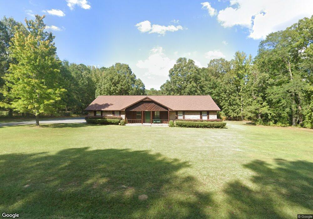
2813 Dan Rd White Hall, AR 71602
Estimated Value: $242,000 - $330,000
Studio
2
Baths
2,480
Sq Ft
$120/Sq Ft
Est. Value
About This Home
This home is located at 2813 Dan Rd, White Hall, AR 71602 and is currently estimated at $297,068, approximately $119 per square foot. 2813 Dan Rd is a home located in Jefferson County with nearby schools including Moody Elementary School, White Hall Junior High School, and White Hall High School.
Ownership History
Date
Name
Owned For
Owner Type
Purchase Details
Closed on
Oct 24, 2011
Sold by
Robertson Kenneth and Michele Robertson M
Bought by
Poore Jimmy and Poore Katherine L
Current Estimated Value
Home Financials for this Owner
Home Financials are based on the most recent Mortgage that was taken out on this home.
Original Mortgage
$100,000
Outstanding Balance
$39,523
Interest Rate
4.14%
Mortgage Type
Purchase Money Mortgage
Estimated Equity
$257,545
Purchase Details
Closed on
Apr 23, 1992
Bought by
Robertson Kenneth and Robertson Wf
Purchase Details
Closed on
Sep 5, 1986
Bought by
Terry Bruce and Terry Wf
Create a Home Valuation Report for This Property
The Home Valuation Report is an in-depth analysis detailing your home's value as well as a comparison with similar homes in the area
Purchase History
| Date | Buyer | Sale Price | Title Company |
|---|---|---|---|
| Poore Jimmy | -- | -- | |
| Robertson Kenneth | $8,000 | -- | |
| Terry Bruce | $5,000 | -- |
Source: Public Records
Mortgage History
| Date | Status | Borrower | Loan Amount |
|---|---|---|---|
| Open | Poore Jimmy | $100,000 |
Source: Public Records
Tax History
| Year | Tax Paid | Tax Assessment Tax Assessment Total Assessment is a certain percentage of the fair market value that is determined by local assessors to be the total taxable value of land and additions on the property. | Land | Improvement |
|---|---|---|---|---|
| 2025 | $1,305 | $51,670 | $4,080 | $47,590 |
| 2024 | $1,405 | $51,670 | $4,080 | $47,590 |
| 2023 | $1,480 | $51,670 | $4,080 | $47,590 |
| 2022 | $1,530 | $41,480 | $7,200 | $34,280 |
| 2021 | $1,530 | $41,480 | $7,200 | $34,280 |
| 2020 | $1,530 | $41,480 | $7,200 | $34,280 |
| 2019 | $1,424 | $41,480 | $7,200 | $34,280 |
| 2018 | $1,449 | $41,480 | $7,200 | $34,280 |
| 2017 | $1,449 | $36,820 | $7,200 | $29,620 |
| 2016 | $1,449 | $36,820 | $7,200 | $29,620 |
| 2015 | $1,439 | $36,820 | $7,200 | $29,620 |
| 2014 | -- | $36,820 | $7,200 | $29,620 |
Source: Public Records
Map
Nearby Homes
- 2786 Nestlewood
- 4403 Oakhaven Dr
- 2601 Whippoorwill Ln
- 2204 Meadow Pond Trail
- Sassafras Trail
- 14130 Dollarway Rd
- Tract 2 TBD Lanni Ln
- 0000 Lanni Ln
- 102 Farah Dr
- 10807 Dollarway Rd
- 2915 Ashley Rd
- 0 Michael Ann Dr
- 4522 Chandler Rd
- 1003 Camp Rd
- 1107 Katie Ln
- 10321 Dollarway Rd
- 1013 Michael Ann Dr
- 10200 Dollarway Rd
- 3216 Donaldson Ln
- 0 Mcdaniel
- 2901 Dan Rd
- 2814 Dan Rd
- 2900 Dan Rd
- 2900 Walridge Cove
- 2904 Dan Rd
- 2800 Walridge Cove
- 2906 Walridge Cove
- 2905 Dan Rd
- 2800 Dan Rd
- 2910 Walridge Cove
- 2831 Cedar Ridge Rd
- 2861 Cedar Ridge Rd
- 3000 Walridge Cove
- 2907 Walridge Cove
- 0 Walridge
- 3003 Dan Rd
- 3000 Dan Rd
- 2901 Walridge Cove
- 3911 Highway 104
- 0 Hwy 104 Unit 20039144
Your Personal Tour Guide
Ask me questions while you tour the home.