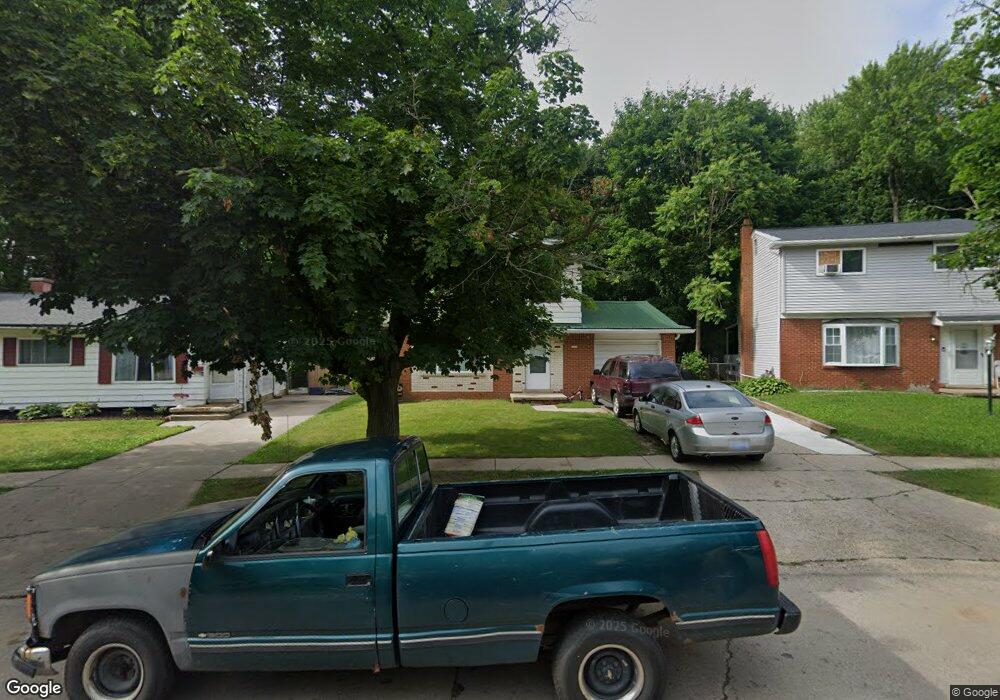
2813 Hampstead Dr Flint, MI 48506
Northeast Flint NeighborhoodEstimated Value: $66,259 - $105,000
3
Beds
2
Baths
1,099
Sq Ft
$77/Sq Ft
Est. Value
About This Home
This home is located at 2813 Hampstead Dr, Flint, MI 48506 and is currently estimated at $84,315, approximately $76 per square foot. 2813 Hampstead Dr is a home located in Genesee County with nearby schools including Brownell STEM Academy, Richfield Public School Academy, and Richfield Early Learning Center.
Ownership History
Date
Name
Owned For
Owner Type
Purchase Details
Closed on
Feb 20, 2001
Sold by
Khirfan Pamela D
Bought by
Mackey Darryl C
Current Estimated Value
Home Financials for this Owner
Home Financials are based on the most recent Mortgage that was taken out on this home.
Original Mortgage
$49,112
Outstanding Balance
$17,873
Interest Rate
7.18%
Mortgage Type
FHA
Estimated Equity
$66,442
Purchase Details
Closed on
Jul 30, 1999
Sold by
Khirfan G Khirfan M and Khirfan P D
Bought by
Khirfan Pamela D
Home Financials for this Owner
Home Financials are based on the most recent Mortgage that was taken out on this home.
Original Mortgage
$44,750
Interest Rate
7.68%
Mortgage Type
Purchase Money Mortgage
Create a Home Valuation Report for This Property
The Home Valuation Report is an in-depth analysis detailing your home's value as well as a comparison with similar homes in the area
Home Values in the Area
Average Home Value in this Area
Purchase History
| Date | Buyer | Sale Price | Title Company |
|---|---|---|---|
| Mackey Darryl C | $49,000 | Lawyers Title Insurance Corp | |
| Khirfan Pamela D | -- | First American Title |
Source: Public Records
Mortgage History
| Date | Status | Borrower | Loan Amount |
|---|---|---|---|
| Open | Mackey Darryl C | $49,112 | |
| Previous Owner | Khirfan Pamela D | $44,750 |
Source: Public Records
Tax History Compared to Growth
Tax History
| Year | Tax Paid | Tax Assessment Tax Assessment Total Assessment is a certain percentage of the fair market value that is determined by local assessors to be the total taxable value of land and additions on the property. | Land | Improvement |
|---|---|---|---|---|
| 2025 | $892 | $27,100 | $0 | $0 |
| 2024 | $812 | $22,400 | $0 | $0 |
| 2023 | $799 | $18,900 | $0 | $0 |
| 2022 | $0 | $13,500 | $0 | $0 |
| 2021 | $828 | $12,900 | $0 | $0 |
| 2020 | $751 | $10,200 | $0 | $0 |
| 2019 | $774 | $10,900 | $0 | $0 |
| 2018 | $801 | $11,300 | $0 | $0 |
| 2017 | $779 | $0 | $0 | $0 |
| 2016 | $774 | $0 | $0 | $0 |
| 2015 | -- | $0 | $0 | $0 |
| 2014 | -- | $0 | $0 | $0 |
| 2012 | -- | $14,800 | $0 | $0 |
Source: Public Records
Map
Nearby Homes
- 5919 Western Rd
- 2910 Hampstead Dr
- 5501 Western Rd
- 2802 Eaton Place
- 2710 Eaton Place
- 5220 Western Rd
- 2713 Alpha Way
- 2801 Epsilon Trail
- 4907 Delta Dr
- 4923 Alpha Way
- 3299 E Pierson Rd
- 3009 Plainfield Ave
- 3364 E Pierson Rd
- 6000 N Dort Hwy
- 5910 N Dort Hwy
- 3456 E Pierson Rd
- 3499 E Carpenter Rd
- 2990 E Carpenter Rd
- 4127 Coggins Ave
- 3200 N Averill Ave
- 2817 Hampstead Dr
- 2821 Hampstead Dr
- 2809 Hampstead Dr
- 2825 Hampstead Dr Unit Bldg-Unit
- 2825 Hampstead Dr
- 2805 Hampstead Dr
- 2810 Hampstead Dr
- 2802 Hampstead Dr
- 2818 Hampstead Dr
- 2801 Hampstead Dr
- 5920 Western Rd
- 2833 Hampstead Dr
- 5931 Western Rd
- 2828 Hampstead Dr
- 5914 Western Rd
- 5925 Western Rd
- 2837 Hampstead Dr
- 2813 Margate Cir
- 2819 Margate Cir
- 2807 Margate Cir