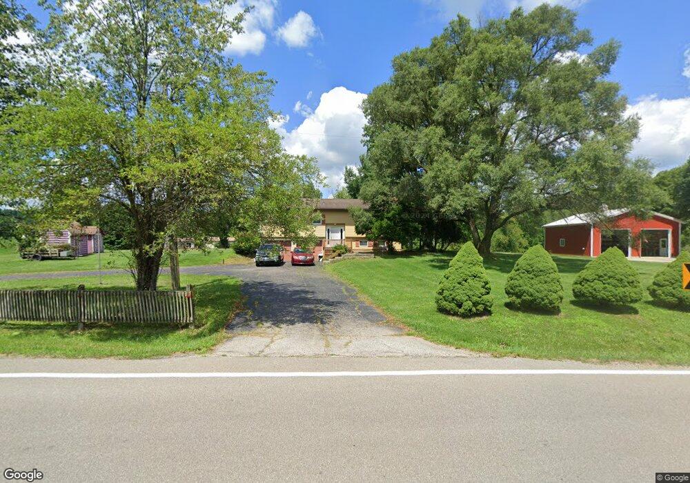
2815 County Road 775 Loudonville, OH 44842
Estimated Value: $212,300 - $264,000
3
Beds
2
Baths
1,750
Sq Ft
$138/Sq Ft
Est. Value
About This Home
This home is located at 2815 County Road 775, Loudonville, OH 44842 and is currently estimated at $241,325, approximately $137 per square foot. 2815 County Road 775 is a home located in Ashland County with nearby schools including Budd Elementary School, McMullen Elementary School, and Loudonville High School.
Ownership History
Date
Name
Owned For
Owner Type
Purchase Details
Closed on
Aug 31, 2012
Sold by
Maddy James F
Bought by
Malvecino Ltd
Current Estimated Value
Purchase Details
Closed on
Oct 14, 2008
Sold by
Maddy James F and Lee Barbara
Bought by
Kick Darrell D and Kick Erin R
Purchase Details
Closed on
Jul 16, 1998
Sold by
Combs Anne
Bought by
Maddy James F
Purchase Details
Closed on
Jun 23, 1983
Bought by
Combs Anne
Create a Home Valuation Report for This Property
The Home Valuation Report is an in-depth analysis detailing your home's value as well as a comparison with similar homes in the area
Home Values in the Area
Average Home Value in this Area
Purchase History
| Date | Buyer | Sale Price | Title Company |
|---|---|---|---|
| Malvecino Ltd | -- | -- | |
| Kick Darrell D | $89,000 | -- | |
| Maddy James F | $115,000 | -- | |
| Combs Anne | $57,000 | -- |
Source: Public Records
Tax History Compared to Growth
Tax History
| Year | Tax Paid | Tax Assessment Tax Assessment Total Assessment is a certain percentage of the fair market value that is determined by local assessors to be the total taxable value of land and additions on the property. | Land | Improvement |
|---|---|---|---|---|
| 2024 | $1,955 | $49,370 | $7,870 | $41,500 |
| 2023 | $1,955 | $49,370 | $7,870 | $41,500 |
| 2022 | $1,551 | $34,050 | $5,430 | $28,620 |
| 2021 | $1,538 | $34,050 | $5,430 | $28,620 |
| 2020 | $1,450 | $34,050 | $5,430 | $28,620 |
| 2019 | $1,410 | $32,700 | $5,720 | $26,980 |
| 2018 | $1,419 | $32,700 | $5,720 | $26,980 |
| 2017 | $1,212 | $32,700 | $5,720 | $26,980 |
| 2016 | $1,212 | $28,430 | $4,970 | $23,460 |
| 2015 | $1,203 | $28,430 | $4,970 | $23,460 |
| 2013 | $1,355 | $31,590 | $4,980 | $26,610 |
Source: Public Records
Map
Nearby Homes
- 1406 Pearl Dr
- 723 Pearl Dr
- 513 N Mount Vernon Ave
- 2818 Township Road 2812
- 500 Stone Meadow Cir
- 524 N Union St
- 316 E Campbell St
- 333 E Campbell St
- 518 Snyder Dr
- 526 E Campbell St
- 0 County Road 917
- 136 Bridge St
- 609 Ohio 95
- 560 Township Road 2402
- 78 Forest Hill Rd
- 3183 County Road 3175
- 968 Township Road 2506
- 6620 Township Road 451
- 68.40 Acres Trumpower Rd
- 0 Trumpower Rd
- 2817 Cr-775
- 2812 County Road 775
- 2814 County Road 775
- 2773 County Road 687
- 2802 County Road 775
- 2802 Cr 775
- 2833 County Road 775
- 2757 County Road 687
- 719 Ohio 39
- 652 Township Road 2724
- 2755 County Road 687
- 659 Township Road 2724
- 2855 County Road 775
- 2855 Cr 775
- 2855 County Highway 775
- 2730 County Road 687
- 635 Township Road 2724
- 665 State Route 39
- 692 State Route 39
- 653 State Route 39