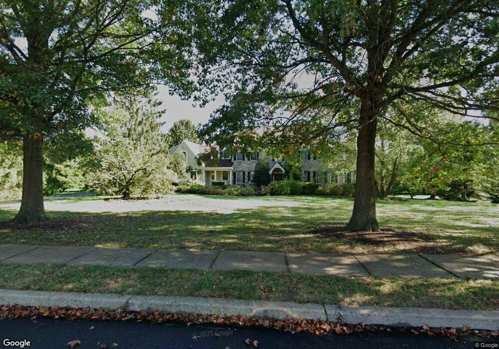
2815 Stover Trail Doylestown, PA 18902
Estimated Value: $1,311,976 - $1,541,000
5
Beds
4
Baths
4,759
Sq Ft
$291/Sq Ft
Est. Value
About This Home
This home is located at 2815 Stover Trail, Doylestown, PA 18902 and is currently estimated at $1,382,994, approximately $290 per square foot. 2815 Stover Trail is a home located in Bucks County with nearby schools including Buckingham Elementary School, Holicong Middle School, and Central Bucks High School - East.
Ownership History
Date
Name
Owned For
Owner Type
Purchase Details
Closed on
Apr 21, 1997
Sold by
Riley Bernard L and Riley Marilyn M
Bought by
Riley Marilyn M
Current Estimated Value
Purchase Details
Closed on
Feb 17, 1997
Sold by
Fisher Darryl J and Fisher Nancy J
Bought by
Riley Bernard L and Riley Marilyn M
Home Financials for this Owner
Home Financials are based on the most recent Mortgage that was taken out on this home.
Original Mortgage
$170,000
Interest Rate
6.25%
Purchase Details
Closed on
May 26, 1993
Bought by
Fisher Darryl J and Fisher Nancy J
Create a Home Valuation Report for This Property
The Home Valuation Report is an in-depth analysis detailing your home's value as well as a comparison with similar homes in the area
Home Values in the Area
Average Home Value in this Area
Purchase History
| Date | Buyer | Sale Price | Title Company |
|---|---|---|---|
| Riley Marilyn M | $500,000 | -- | |
| Riley Bernard L | $500,000 | -- | |
| Fisher Darryl J | $486,000 | -- |
Source: Public Records
Mortgage History
| Date | Status | Borrower | Loan Amount |
|---|---|---|---|
| Previous Owner | Riley Bernard L | $170,000 |
Source: Public Records
Tax History Compared to Growth
Tax History
| Year | Tax Paid | Tax Assessment Tax Assessment Total Assessment is a certain percentage of the fair market value that is determined by local assessors to be the total taxable value of land and additions on the property. | Land | Improvement |
|---|---|---|---|---|
| 2025 | $16,060 | $98,640 | $18,760 | $79,880 |
| 2024 | $16,060 | $98,640 | $18,760 | $79,880 |
| 2023 | $15,515 | $98,640 | $18,760 | $79,880 |
| 2022 | $15,330 | $98,640 | $18,760 | $79,880 |
| 2021 | $15,146 | $98,640 | $18,760 | $79,880 |
| 2020 | $15,146 | $98,640 | $18,760 | $79,880 |
| 2019 | $15,048 | $98,640 | $18,760 | $79,880 |
| 2018 | $15,048 | $98,640 | $18,760 | $79,880 |
| 2017 | $14,924 | $98,640 | $18,760 | $79,880 |
| 2016 | $15,072 | $98,640 | $18,760 | $79,880 |
| 2015 | -- | $98,640 | $18,760 | $79,880 |
| 2014 | -- | $98,640 | $18,760 | $79,880 |
Source: Public Records
Map
Nearby Homes
- 5025 Anderson Rd
- 2565 Bogarts Tavern Rd
- 4604 Sands Way
- 4871 E Blossom Dr
- 5358 York Rd
- 5110 Harmony Ct W
- 2880 Snake Hill Rd
- 2855 Ash Mill Rd
- 3111 Burnt House Hill Rd
- 2728 Red Gate Dr
- 4928 Edgewood Rd
- 2905 Ash Mill Rd
- 2799 Manion Way
- 4350 Church Rd
- 3479 Durham Rd
- 3455 Durham Rd
- 3468 Holicong Rd
- 3146 Mill Rd
- 3196 Mill Rd
- 5765 Valley Stream Dr
- 2775 Stover Trail
- 2835 White Tail Ct
- 4928 Fawn Ct
- 4943 Fawn Ct
- 5008 Anderson Rd
- 2843 White Tail Ct
- 2745 Stover Trail
- 2840 Stover Trail
- 4923 Fawn Ct
- 2750 Stover Trail
- 2853 White Tail Ct
- 4918 Fawn Ct
- 4913 Fawn Ct
- 4913 Fawn Ct
- 2875 Stover Trail
- 2725 Stover Trail
- 2872 White Tail Ct
- 2870 Stover Trail
- 2869 White Tail Ct
- 4998 Anderson Rd