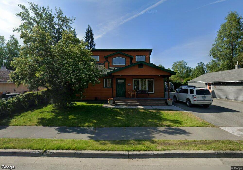
2818 E 20th Ave Anchorage, AK 99508
Airport Heights NeighborhoodEstimated Value: $207,000 - $568,389
5
Beds
3
Baths
1,864
Sq Ft
$228/Sq Ft
Est. Value
About This Home
This home is located at 2818 E 20th Ave, Anchorage, AK 99508 and is currently estimated at $424,597, approximately $227 per square foot. 2818 E 20th Ave is a home located in Anchorage Municipality with nearby schools including Airport Heights Elementary School, Wendler Middle School, and Bettye Davis East Anchorage High School.
Ownership History
Date
Name
Owned For
Owner Type
Purchase Details
Closed on
Jan 8, 2007
Sold by
Jones Robert D
Bought by
Jones Robert D and Jones Celeste M
Current Estimated Value
Home Financials for this Owner
Home Financials are based on the most recent Mortgage that was taken out on this home.
Original Mortgage
$270,000
Outstanding Balance
$157,886
Interest Rate
6.1%
Mortgage Type
New Conventional
Estimated Equity
$266,711
Purchase Details
Closed on
Jan 1, 1990
Sold by
Federal National Mortgage Assn
Bought by
Jones Robert D
Home Financials for this Owner
Home Financials are based on the most recent Mortgage that was taken out on this home.
Original Mortgage
$61,100
Interest Rate
9.84%
Mortgage Type
Seller Take Back
Create a Home Valuation Report for This Property
The Home Valuation Report is an in-depth analysis detailing your home's value as well as a comparison with similar homes in the area
Home Values in the Area
Average Home Value in this Area
Purchase History
| Date | Buyer | Sale Price | Title Company |
|---|---|---|---|
| Jones Robert D | -- | Pacific Northwest Title Of A | |
| Jones Robert D | -- | -- | |
| Jones Robert D | -- | -- | |
| Jones Robert D | -- | -- |
Source: Public Records
Mortgage History
| Date | Status | Borrower | Loan Amount |
|---|---|---|---|
| Open | Jones Robert D | $270,000 | |
| Closed | Jones Robert D | $61,100 |
Source: Public Records
Tax History
| Year | Tax Paid | Tax Assessment Tax Assessment Total Assessment is a certain percentage of the fair market value that is determined by local assessors to be the total taxable value of land and additions on the property. | Land | Improvement |
|---|---|---|---|---|
| 2025 | $7,843 | $601,000 | $87,000 | $514,000 |
| 2024 | $7,843 | $560,800 | $87,000 | $473,800 |
| 2023 | $8,428 | $494,900 | $87,000 | $407,900 |
| 2022 | $8,265 | $490,800 | $87,000 | $403,800 |
| 2021 | $7,776 | $431,500 | $87,000 | $344,500 |
| 2020 | $6,535 | $434,700 | $87,000 | $347,700 |
| 2019 | $6,217 | $430,000 | $87,000 | $343,000 |
| 2018 | $5,871 | $408,000 | $81,700 | $326,300 |
| 2017 | $5,926 | $398,400 | $81,700 | $316,700 |
| 2016 | $5,432 | $396,600 | $70,200 | $326,400 |
| 2015 | $5,432 | $385,800 | $70,200 | $315,600 |
| 2014 | $5,432 | $390,100 | $62,100 | $328,000 |
Source: Public Records
Map
Nearby Homes
- 1703 Alder Dr
- 1701 Aleutian St
- 000 Tr A Thurston
- 3215 E 18th Cir
- 1760 Eastridge Dr
- 2601 Darby Cir
- 1414 Airport Heights Dr
- 1524 Rosemary St
- 2068 Cliffside Dr Unit 11
- 2007 Parkview Cir
- 3401 E 15th Ave
- 1913 Parkview Cir
- 2124 Sorbus Way
- 1536 Valarian St
- 1655 Sitka St Unit 103
- 3714 E 17th Ave
- 3964 Reka Dr Unit D3
- 4010 Reka Dr Unit F6
- 1715 Katrina Cir
- 1421 E 17th Ave Unit 3
- 2810 E 20th Ave
- 2828 E 20th Ave
- 2819 Aspen Grove Ct
- 2811 Aspen Grove Ct
- 2829 Aspen Grove Ct
- 2900 E 20th Ave
- 2001 Alder Dr
- 2815 E 20th Ave
- 2909 Aspen Grove Ct
- 2017 Alder Dr
- 2000 Sunrise Dr
- 2018 Sunrise Dr
- 2905 E 20th Ave
- 1925 Alder Dr
- 2000 Alder Dr
- 2763 E 20th Ave
- 2818 Aspen Grove Ct
- 2828 Aspen Grove Ct
- 2111 Alder Dr
- 2908 Aspen Grove Ct