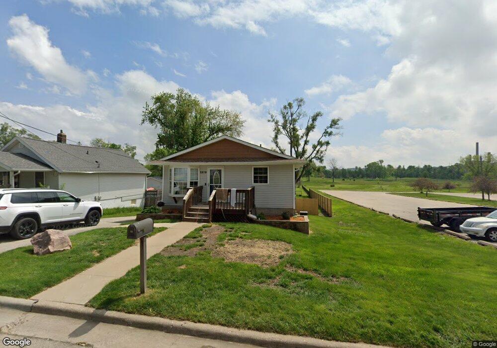
2819 Fruitland Blvd SW Cedar Rapids, IA 52404
Southwest Area NeighborhoodEstimated Value: $187,000 - $247,000
3
Beds
2
Baths
2,080
Sq Ft
$103/Sq Ft
Est. Value
About This Home
This home is located at 2819 Fruitland Blvd SW, Cedar Rapids, IA 52404 and is currently estimated at $214,573, approximately $103 per square foot. 2819 Fruitland Blvd SW is a home located in Linn County with nearby schools including Wilson Middle School, Thomas Jefferson High School, and Tanager Place School.
Ownership History
Date
Name
Owned For
Owner Type
Purchase Details
Closed on
Dec 29, 2017
Sold by
Zimmerman Rocky E and Zimmerman Rocky Eugene
Bought by
Hopkins Paige L and Aossey Sam H
Current Estimated Value
Home Financials for this Owner
Home Financials are based on the most recent Mortgage that was taken out on this home.
Original Mortgage
$160,650
Outstanding Balance
$138,551
Interest Rate
3.9%
Mortgage Type
New Conventional
Purchase Details
Closed on
Mar 11, 2010
Sold by
Wharton Paula S and Zimmerman Paula S
Bought by
Zimmerman Rocky Eugene
Home Financials for this Owner
Home Financials are based on the most recent Mortgage that was taken out on this home.
Original Mortgage
$132,215
Interest Rate
5%
Mortgage Type
New Conventional
Purchase Details
Closed on
Feb 2, 2007
Sold by
Zimmerman Paula
Bought by
Zimmerman Rocky
Home Financials for this Owner
Home Financials are based on the most recent Mortgage that was taken out on this home.
Original Mortgage
$132,000
Interest Rate
6.22%
Mortgage Type
Unknown
Create a Home Valuation Report for This Property
The Home Valuation Report is an in-depth analysis detailing your home's value as well as a comparison with similar homes in the area
Home Values in the Area
Average Home Value in this Area
Purchase History
| Date | Buyer | Sale Price | Title Company |
|---|---|---|---|
| Hopkins Paige L | $178,500 | None Available | |
| Zimmerman Rocky Eugene | -- | Accommodation | |
| Zimmerman Rocky | $25,000 | None Available |
Source: Public Records
Mortgage History
| Date | Status | Borrower | Loan Amount |
|---|---|---|---|
| Open | Hopkins Paige L | $160,650 | |
| Previous Owner | Zimmerman Rocky | $136,800 | |
| Previous Owner | Zimmerman Rocky | $7,000 | |
| Previous Owner | Zimmerman Rocky Eugene | $132,215 | |
| Previous Owner | Zimmerman Rocky E | $35,000 | |
| Previous Owner | Zimmerman Rocky E | $132,000 | |
| Previous Owner | Zimmerman Rocky E | $16,500 | |
| Previous Owner | Zimmerman Rocky E | $20,000 |
Source: Public Records
Tax History Compared to Growth
Tax History
| Year | Tax Paid | Tax Assessment Tax Assessment Total Assessment is a certain percentage of the fair market value that is determined by local assessors to be the total taxable value of land and additions on the property. | Land | Improvement |
|---|---|---|---|---|
| 2023 | $3,998 | $190,500 | $25,300 | $165,200 |
| 2022 | $3,500 | $189,600 | $25,300 | $164,300 |
| 2021 | $3,488 | $169,000 | $25,300 | $143,700 |
| 2020 | $3,488 | $158,100 | $20,800 | $137,300 |
| 2019 | $3,418 | $158,600 | $17,900 | $140,700 |
| 2018 | $3,142 | $158,600 | $17,900 | $140,700 |
| 2017 | $3,209 | $148,500 | $17,900 | $130,600 |
| 2016 | $3,209 | $151,000 | $17,900 | $133,100 |
| 2015 | $3,293 | $154,753 | $17,850 | $136,903 |
| 2014 | $3,108 | $154,753 | $17,850 | $136,903 |
| 2013 | $3,036 | $154,753 | $17,850 | $136,903 |
Source: Public Records
Map
Nearby Homes
- 2816 Fruitland Blvd SW
- 51 29th Avenue Dr SW Unit 9
- 51 29th Avenue Dr SW Unit C22
- 2426 Deborah Dr SW
- 101 26th Avenue Dr SW
- 1120 Quarry Ave SW
- 2200 Fruitland Blvd SW
- 2430 Victoria Dr SW
- 2469 1st St SW
- 2628 1st St SW
- Lot A-D 41st Avenue Dr SW
- Lot D 41st Avenue Dr SW
- Lot C 41st Avenue Dr SW
- Lot B 41st Avenue Dr SW
- Lot A 41st Avenue Dr SW
- 25-85 Aossey Ln SW
- 2219 Hamilton St SW
- 2220 D St SW
- 3104 Woodland Dr SW
- 233 26th Ave SW
- 2817 Fruitland Blvd SW
- 2813 Fruitland Blvd SW
- 2820 Fruitland Blvd SW
- 2818 Fruitland Blvd SW
- 2807 Fruitland Blvd SW
- 2812 Fruitland Blvd SW
- 2801 Fruitland Blvd SW
- 2806 Fruitland Blvd SW
- 2699 Fruitland Blvd SW
- 2693 Fruitland Blvd SW
- 2687 Fruitland Blvd SW
- 2696 Fruitland Blvd SW
- 2681 Fruitland Blvd SW
- 2674 Fruitland Blvd SW
- 2672 Fruitland Blvd SW
- 2673 Fruitland Blvd SW
- 2667 Fruitland Blvd SW
- 2666 Fruitland Blvd SW
- 2663 Fruitland Blvd SW
- 2662 Fruitland Blvd SW