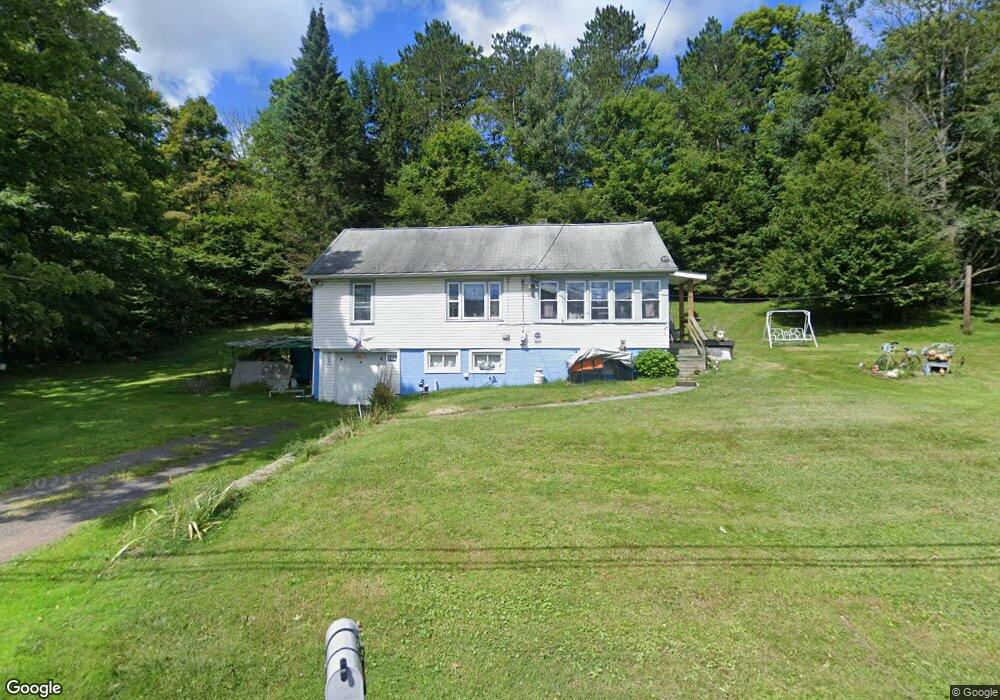
2819 Hancock Hwy Equinunk, PA 18417
Estimated Value: $207,957 - $281,000
3
Beds
1
Bath
1,040
Sq Ft
$241/Sq Ft
Est. Value
About This Home
This home is located at 2819 Hancock Hwy, Equinunk, PA 18417 and is currently estimated at $250,989, approximately $241 per square foot. 2819 Hancock Hwy is a home located in Wayne County with nearby schools including Honesdale High School.
Ownership History
Date
Name
Owned For
Owner Type
Purchase Details
Closed on
Oct 22, 2010
Sold by
Estate Of Gerard J Earls and Earls Gerard Joyce
Bought by
League Maureen
Current Estimated Value
Home Financials for this Owner
Home Financials are based on the most recent Mortgage that was taken out on this home.
Original Mortgage
$65,000
Outstanding Balance
$42,937
Interest Rate
4.37%
Mortgage Type
New Conventional
Estimated Equity
$208,052
Create a Home Valuation Report for This Property
The Home Valuation Report is an in-depth analysis detailing your home's value as well as a comparison with similar homes in the area
Home Values in the Area
Average Home Value in this Area
Purchase History
| Date | Buyer | Sale Price | Title Company |
|---|---|---|---|
| League Maureen | $115,000 | None Available |
Source: Public Records
Mortgage History
| Date | Status | Borrower | Loan Amount |
|---|---|---|---|
| Open | League Maureen | $65,000 |
Source: Public Records
Tax History Compared to Growth
Tax History
| Year | Tax Paid | Tax Assessment Tax Assessment Total Assessment is a certain percentage of the fair market value that is determined by local assessors to be the total taxable value of land and additions on the property. | Land | Improvement |
|---|---|---|---|---|
| 2025 | $2,533 | $140,400 | $57,700 | $82,700 |
| 2024 | $2,403 | $140,400 | $57,700 | $82,700 |
| 2023 | $3,332 | $140,400 | $57,700 | $82,700 |
| 2022 | $2,153 | $81,900 | $31,000 | $50,900 |
| 2021 | $2,108 | $81,900 | $31,000 | $50,900 |
| 2020 | $2,108 | $81,900 | $31,000 | $50,900 |
| 2019 | $1,978 | $81,900 | $31,000 | $50,900 |
| 2018 | $1,921 | $81,900 | $31,000 | $50,900 |
| 2017 | $513 | $81,900 | $31,000 | $50,900 |
| 2016 | $1,986 | $89,300 | $31,000 | $58,300 |
| 2014 | -- | $81,400 | $31,000 | $50,400 |
Source: Public Records
Map
Nearby Homes
- 0 Hancock Hwy
- 11 Rory Ln
- 57 Lake Shore Dr
- 55 Lake Shore Dr
- 577 Duck Harbor Rd
- Lot 69 Stonegate Rd
- Lot 61 Rock Run Rd
- 64 Mud Pond Rd Unit (3 LOTS!)
- 142 Robbs Rd
- 122 Robbs Rd
- 52 Robbs Rd
- 59 Delaware Dr
- 330 Wescott Rd
- 57B Cemetery Rd
- 1945 Pine Mill Rd
- 188 Baldwin Hill Rd
- 70 Spring Wood Trail
- 0 Fork Mountain Rd Unit PWBPW252909
- 0 River Rd Unit PWBPW252878
- 374 Fork Mountain Rd
- 2839 Hancock Hwy
- 32 Lookout Summit Ct
- 14 Lookout Summit Ct
- 2859 Hancock Hwy
- 2864 Hancock Hwy
- 2864 Hancock Hwy
- 2864 Hancock Hwy
- 19 Lookout Summit Ct
- Lot 7 Lookout Summit Ct
- 0 Lookout Summit Ct
- Lot 8 Lookout Summit Ct
- 13 Factory Rd
- 31 Lookout Summit Ct
- 11 Lookout Summit Ct
- 2880 Hancock Hwy
- 2885 Hancock Hwy
- 36 All Saints Place
- 49 Callicoon Rd
- 2890 Hancock Hwy
- 55 Callicoon Rd