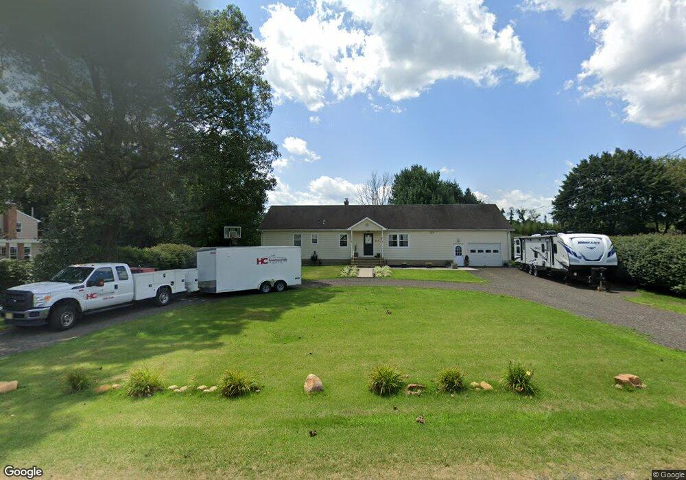
282 Jacobstown Cookstown Rd Wrightstown, NJ 08562
Estimated Value: $436,000 - $554,000
4
Beds
2
Baths
1,366
Sq Ft
$370/Sq Ft
Est. Value
About This Home
This home is located at 282 Jacobstown Cookstown Rd, Wrightstown, NJ 08562 and is currently estimated at $505,934, approximately $370 per square foot. 282 Jacobstown Cookstown Rd is a home located in Burlington County with nearby schools including C.B. Lamb Elementary School, North Hanover Township Upper Elementary School, and Northern Burlington County Regional Middle School.
Ownership History
Date
Name
Owned For
Owner Type
Purchase Details
Closed on
Sep 11, 2020
Sold by
Stevenson Michael P
Bought by
Stevenson Michael P and Mckelvey Catherine M
Current Estimated Value
Home Financials for this Owner
Home Financials are based on the most recent Mortgage that was taken out on this home.
Original Mortgage
$220,000
Outstanding Balance
$185,586
Interest Rate
2.9%
Mortgage Type
New Conventional
Estimated Equity
$320,348
Purchase Details
Closed on
May 27, 2011
Sold by
Cloutier Christine C and Cloutier Suzanne
Bought by
Stevenson Michael P
Home Financials for this Owner
Home Financials are based on the most recent Mortgage that was taken out on this home.
Original Mortgage
$196,879
Interest Rate
4.87%
Mortgage Type
FHA
Create a Home Valuation Report for This Property
The Home Valuation Report is an in-depth analysis detailing your home's value as well as a comparison with similar homes in the area
Home Values in the Area
Average Home Value in this Area
Purchase History
| Date | Buyer | Sale Price | Title Company |
|---|---|---|---|
| Stevenson Michael P | -- | Wfg National Title | |
| Stevenson Michael P | $202,000 | Foundation Title |
Source: Public Records
Mortgage History
| Date | Status | Borrower | Loan Amount |
|---|---|---|---|
| Open | Stevenson Michael P | $220,000 | |
| Previous Owner | Stevenson Michael P | $196,879 |
Source: Public Records
Tax History
| Year | Tax Paid | Tax Assessment Tax Assessment Total Assessment is a certain percentage of the fair market value that is determined by local assessors to be the total taxable value of land and additions on the property. | Land | Improvement |
|---|---|---|---|---|
| 2025 | $6,688 | $280,300 | $77,500 | $202,800 |
| 2024 | $6,195 | $280,300 | $77,500 | $202,800 |
| 2023 | $6,195 | $280,300 | $77,500 | $202,800 |
| 2022 | $6,220 | $280,300 | $77,500 | $202,800 |
| 2021 | $5,901 | $262,400 | $77,500 | $184,900 |
| 2020 | $5,886 | $262,400 | $77,500 | $184,900 |
| 2019 | $5,836 | $262,400 | $77,500 | $184,900 |
| 2018 | $5,573 | $262,400 | $77,500 | $184,900 |
| 2017 | $5,455 | $262,400 | $77,500 | $184,900 |
| 2016 | $5,440 | $262,400 | $77,500 | $184,900 |
| 2015 | $5,440 | $262,400 | $77,500 | $184,900 |
| 2014 | $5,122 | $262,400 | $77,500 | $184,900 |
Source: Public Records
Map
Nearby Homes
- 347 Jacobstown Cookstown Rd
- 301 Meany Rd
- 53 Meany Rd
- 6 Mary St
- 10 Mary St
- 20 Bunting Bridge Rd
- XX Cookstown New Egypt Rd
- 194 Jacobstown New Egypt Rd Unit 2
- 194 Jacobstown New Egypt Rd Unit 4
- 194 Jacobstown New Egypt Rd Unit 73
- 194 Jacobstown New Egypt Rd
- 114 Cookstown New Egypt Rd Unit C7
- 181 Cookstown New Egypt Rd Unit B37
- 83 Chesterfield Jacobstown Rd
- 0 Larrison Rd
- 511 Wrightstown Sykesville Rd Unit 116
- 71 Jacobstown Rd
- 43 Oak Ln
- 20 Belmont Rd
- 697 Monmouth Rd
- 278 Jacobstown Cookstown Rd
- 286 Jacobstown Cookstown Rd
- 274 Jacobstown Cookstown Rd
- 294 Jacobstown Cookstown Rd
- 270 Jacobstown Cookstown Rd
- 298 Jacobstown Cookstown Rd
- 298 Jacobstown Cookstown Rd
- 266 Jacobstown Cookstown Rd
- 302 Jacobstown Cookstown Rd
- 6 Croshaw Rd
- 0 Croshaw Rd
- 0 Croshaw Rd Unit NJBL349502
- 0 Croshaw Rd Unit 1004003296
- 1 Croshaw Rd
- 306 Jacobstown Cookstown Rd
- 10 Croshaw Rd
- 310 Jacobstown Cookstown Rd
- 314 Jacobstown Cookstown Rd
- 309 Jacobstown Cookstown Rd
- 318 Jacobstown Cookstown Rd
Your Personal Tour Guide
Ask me questions while you tour the home.