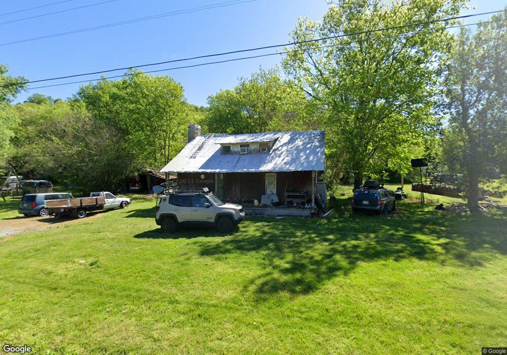
282 Maggart Rd Elmwood, TN 38560
Estimated Value: $102,331 - $224,000
--
Bed
1
Bath
1,314
Sq Ft
$130/Sq Ft
Est. Value
About This Home
This home is located at 282 Maggart Rd, Elmwood, TN 38560 and is currently estimated at $170,333, approximately $129 per square foot. 282 Maggart Rd is a home located in Smith County with nearby schools including Forks River Elementary School, Smith County Middle School, and Smith County High School.
Ownership History
Date
Name
Owned For
Owner Type
Purchase Details
Closed on
Jun 20, 2005
Sold by
Wyatt Gary W
Bought by
Wayne Wyatt Gary
Current Estimated Value
Home Financials for this Owner
Home Financials are based on the most recent Mortgage that was taken out on this home.
Original Mortgage
$48,500
Outstanding Balance
$25,157
Interest Rate
5.66%
Mortgage Type
Cash
Estimated Equity
$145,176
Purchase Details
Closed on
Nov 3, 1993
Sold by
Hackett Jimmy J
Bought by
Black William E
Create a Home Valuation Report for This Property
The Home Valuation Report is an in-depth analysis detailing your home's value as well as a comparison with similar homes in the area
Home Values in the Area
Average Home Value in this Area
Purchase History
| Date | Buyer | Sale Price | Title Company |
|---|---|---|---|
| Wayne Wyatt Gary | $50,000 | -- | |
| Black William E | $9,500 | -- |
Source: Public Records
Mortgage History
| Date | Status | Borrower | Loan Amount |
|---|---|---|---|
| Open | Black William E | $48,500 |
Source: Public Records
Tax History Compared to Growth
Tax History
| Year | Tax Paid | Tax Assessment Tax Assessment Total Assessment is a certain percentage of the fair market value that is determined by local assessors to be the total taxable value of land and additions on the property. | Land | Improvement |
|---|---|---|---|---|
| 2024 | $329 | $18,975 | $9,200 | $9,775 |
| 2023 | $329 | $18,975 | $0 | $0 |
| 2022 | $329 | $18,975 | $9,200 | $9,775 |
| 2021 | $366 | $14,775 | $8,375 | $6,400 |
| 2020 | $403 | $14,775 | $8,375 | $6,400 |
| 2019 | $403 | $14,775 | $8,375 | $6,400 |
| 2018 | $316 | $14,775 | $8,375 | $6,400 |
| 2017 | $316 | $14,775 | $8,375 | $6,400 |
| 2016 | $260 | $11,200 | $6,325 | $4,875 |
| 2015 | $260 | $11,200 | $6,325 | $4,875 |
| 2014 | $260 | $11,200 | $6,325 | $4,875 |
Source: Public Records
Map
Nearby Homes
- 0 Maggart Rd
- 13 Grisham Hollow Ln
- 216 Sullivan Bend Rd
- 14 Cordell Hull Ln
- 670 Cookeville Hwy
- 49 Duck Hollow Rd
- 560 Sullivan Bend Rd
- 560 Pea Ridge Rd
- 552 Pea Ridge Rd
- 0 Sullivans Bend Rd
- 12 Young Rd
- 0 Granville Hwy Unit RTC2929183
- 0 Granville Hwy Unit RTC2975023
- 0 Granville Hwy Unit RTC2929181
- 0 Granville Hwy Unit RTC2929179
- 213 Pea Ridge Rd
- 672 Sullivan Bend Rd
- 49 Saint Marys Rd
- 21.03 AC Watts Hollow Rd
- 0 Watts Hollow Rd
- 11 Alfred Roberts Ln
- 267 Maggart Rd
- 296 Maggart Rd
- 17 Alfred Roberts Ln
- 23 Alfred Roberts Ln
- 301 Maggart Rd
- 306 Maggart Rd
- 251 Maggart Rd
- 0 Alfred Roberts Ln Unit RTC2428695
- 314 Maggart Rd
- 31 Alfred Roberts Ln
- 319 Maggart Rd
- 241 Maggart Rd
- 16 Alfred Roberts Ln
- 325 Maggart Rd
- 237 Maggart Rd
- 35 Alfred Roberts Ln
- 333 Maggart Rd
- 227 Maggart Rd
- 219 Maggart Rd