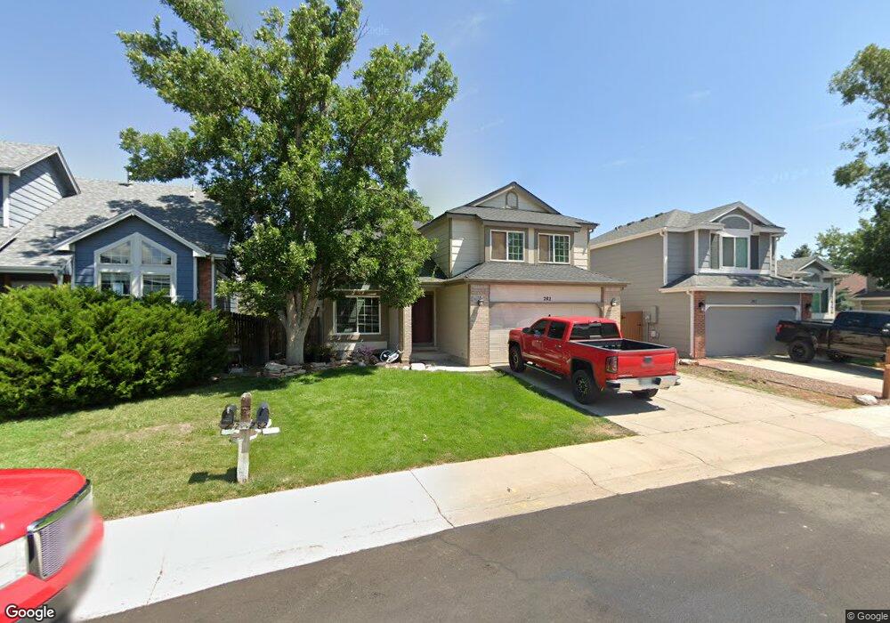
282 S Pembrook St Castle Rock, CO 80104
Founders Village NeighborhoodEstimated Value: $513,087 - $539,000
4
Beds
3
Baths
2,285
Sq Ft
$228/Sq Ft
Est. Value
About This Home
This home is located at 282 S Pembrook St, Castle Rock, CO 80104 and is currently estimated at $521,772, approximately $228 per square foot. 282 S Pembrook St is a home located in Douglas County with nearby schools including Rock Ridge Elementary School, Mesa Middle School, and Douglas County High School.
Ownership History
Date
Name
Owned For
Owner Type
Purchase Details
Closed on
Dec 10, 2009
Sold by
Us Bank Na
Bought by
Thompson Christopher and Thompson Tiffany
Current Estimated Value
Home Financials for this Owner
Home Financials are based on the most recent Mortgage that was taken out on this home.
Original Mortgage
$175,750
Outstanding Balance
$114,634
Interest Rate
4.9%
Mortgage Type
New Conventional
Estimated Equity
$407,138
Purchase Details
Closed on
Sep 23, 2009
Sold by
Vann Cassie A
Bought by
Us Bank Na
Purchase Details
Closed on
Feb 7, 2005
Sold by
Womack Cassie A
Bought by
Vann Cassie A
Home Financials for this Owner
Home Financials are based on the most recent Mortgage that was taken out on this home.
Original Mortgage
$188,000
Interest Rate
1.85%
Mortgage Type
Negative Amortization
Purchase Details
Closed on
Feb 18, 2003
Sold by
Womack Quinton Tyrone and Womack Cassie A
Bought by
Womack Cassie A
Home Financials for this Owner
Home Financials are based on the most recent Mortgage that was taken out on this home.
Original Mortgage
$163,500
Interest Rate
4.75%
Purchase Details
Closed on
Jul 6, 2001
Sold by
Kron Dennis M and Kron Pamela F
Bought by
Womack Quinton Tyrone and Womack Cassie A
Home Financials for this Owner
Home Financials are based on the most recent Mortgage that was taken out on this home.
Original Mortgage
$157,550
Interest Rate
7.16%
Purchase Details
Closed on
Aug 19, 1994
Sold by
Butterfield H Randall H and Butterfield Lea H
Bought by
Kron Dennis M and Kron Pamela F
Home Financials for this Owner
Home Financials are based on the most recent Mortgage that was taken out on this home.
Original Mortgage
$122,850
Interest Rate
6%
Purchase Details
Closed on
May 31, 1991
Sold by
Richmond Homes Inc I
Bought by
Butterfield Randall Butterfield H and Butterfield Lea Butterfield H
Purchase Details
Closed on
Dec 28, 1989
Sold by
Mdc Land Corp
Bought by
Richmond American Homes Colorado Inc Ii
Create a Home Valuation Report for This Property
The Home Valuation Report is an in-depth analysis detailing your home's value as well as a comparison with similar homes in the area
Home Values in the Area
Average Home Value in this Area
Purchase History
| Date | Buyer | Sale Price | Title Company |
|---|---|---|---|
| Thompson Christopher | $185,000 | Security Title | |
| Us Bank Na | -- | None Available | |
| Vann Cassie A | -- | -- | |
| Womack Cassie A | -- | Land Title | |
| Womack Quinton Tyrone | $197,000 | Guardian Title Agency Llc | |
| Kron Dennis M | $136,500 | North American Title | |
| Butterfield Randall Butterfield H | $103,700 | -- | |
| Richmond American Homes Colorado Inc Ii | -- | -- |
Source: Public Records
Mortgage History
| Date | Status | Borrower | Loan Amount |
|---|---|---|---|
| Open | Thompson Christopher | $175,750 | |
| Previous Owner | Vann Cassie A | $188,000 | |
| Previous Owner | Womack Cassie A | $163,500 | |
| Previous Owner | Womack Quinton Tyrone | $157,550 | |
| Previous Owner | Kron Dennis M | $122,850 | |
| Closed | Womack Quinton Tyrone | $29,550 | |
| Closed | Vann Cassie A | $23,500 |
Source: Public Records
Tax History Compared to Growth
Tax History
| Year | Tax Paid | Tax Assessment Tax Assessment Total Assessment is a certain percentage of the fair market value that is determined by local assessors to be the total taxable value of land and additions on the property. | Land | Improvement |
|---|---|---|---|---|
| 2024 | $5,199 | $35,330 | $7,870 | $27,460 |
| 2023 | $5,230 | $35,330 | $7,870 | $27,460 |
| 2022 | $3,878 | $24,490 | $5,860 | $18,630 |
| 2021 | $3,949 | $24,490 | $5,860 | $18,630 |
| 2020 | $3,774 | $24,090 | $4,960 | $19,130 |
| 2019 | $3,776 | $24,090 | $4,960 | $19,130 |
| 2018 | $3,250 | $20,580 | $3,850 | $16,730 |
| 2017 | $3,129 | $20,580 | $3,850 | $16,730 |
| 2016 | $2,621 | $18,000 | $3,780 | $14,220 |
| 2015 | $2,655 | $18,000 | $3,780 | $14,220 |
| 2014 | $2,212 | $14,400 | $3,420 | $10,980 |
Source: Public Records
Map
Nearby Homes
- 176 S Pembrook St
- 5181 Devon Ave
- 510 Fairhaven St
- 5282 Devon Ave
- 576 S Lindsey St
- 321 Lockwood St
- 596 S Lindsey St
- 630 Fairhaven St
- 378 Benton St
- 4590 Wakefield Ave
- 5323 E Sandpiper Ave
- 4372 E Andover Ave
- 5230 E Kensington Ave
- 5326 E Howe St
- NA Ridge Rd
- 157 S Quicksilver Ave
- 1025 S Lindsey St
- 364 N Willow St
- 535 Howe St
- 1005 Parsons Ave
- 272 S Pembrook St
- 256 S Amherst St
- 5119 E Crestone Ave
- 5139 E Crestone Ave
- 240 S Amherst St
- 297 S Pembrook St
- 275 S Pembrook St Unit ST3
- 263 S Pembrook St
- 5108 E Crestone Ave
- 5159 E Crestone Ave
- 251 S Amherst St
- 5118 E Crestone Ave
- 221 S Amherst St
- 224 S Amherst St
- 191 S Amherst St
- 251 S Pembrook St
- 5128 E Crestone Ave
- 5088 E Crestone Ave
- 386 S Lindsey St
- 5179 E Crestone Ave