Estimated Value: $200,000 - $385,000
3
Beds
2
Baths
1,236
Sq Ft
$219/Sq Ft
Est. Value
About This Home
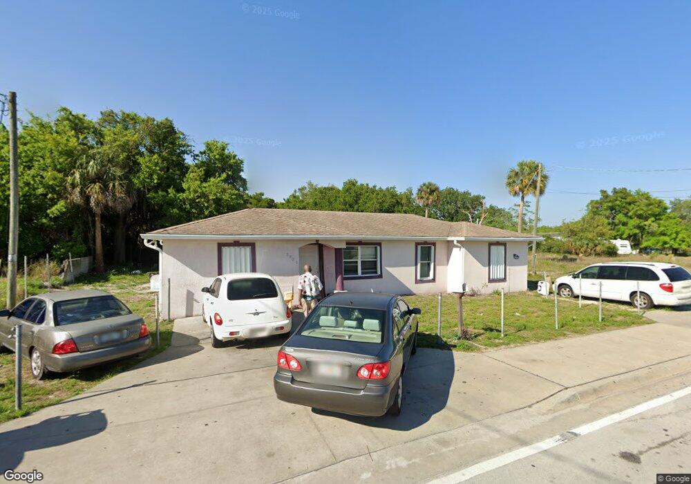
This home is located at 2820 E Main St, Mims, FL 32754 and is currently estimated at $270,177, approximately $218 per square foot. 2820 E Main St is a home located in Brevard County with nearby schools including Mims Elementary School, James Madison Middle School, and Astronaut High School.
Ownership History
Date
Name
Owned For
Owner Type
Purchase Details
Closed on
Feb 7, 2026
Sold by
Berry Betty Rose
Bought by
Berry Betty Rose and Merriel Lester
Current Estimated Value
Purchase Details
Closed on
Jul 22, 2019
Sold by
Berry Betty Rose
Bought by
Moncrief Bail Bonds
Home Financials for this Owner
Home Financials are based on the most recent Mortgage that was taken out on this home.
Original Mortgage
$100,000
Interest Rate
18%
Mortgage Type
Purchase Money Mortgage
Purchase Details
Closed on
Jan 30, 2012
Sold by
Berry Betty Rose
Bought by
Berry Betty Rose
Purchase Details
Closed on
Dec 13, 1996
Sold by
James Sadie
Bought by
Berry Betty Rose
Create a Home Valuation Report for This Property
The Home Valuation Report is an in-depth analysis detailing your home's value as well as a comparison with similar homes in the area
Home Values in the Area
Average Home Value in this Area
Purchase History
| Date | Buyer | Sale Price | Title Company |
|---|---|---|---|
| Berry Betty Rose | $100 | None Listed On Document | |
| Moncrief Bail Bonds | $7,000 | None Available | |
| Berry Betty Rose | -- | None Available | |
| Berry Betty Rose | -- | -- |
Source: Public Records
Mortgage History
| Date | Status | Borrower | Loan Amount |
|---|---|---|---|
| Previous Owner | Moncrief Bail Bonds | $100,000 |
Source: Public Records
Tax History
| Year | Tax Paid | Tax Assessment Tax Assessment Total Assessment is a certain percentage of the fair market value that is determined by local assessors to be the total taxable value of land and additions on the property. | Land | Improvement |
|---|---|---|---|---|
| 2025 | $985 | $84,060 | -- | -- |
| 2024 | $953 | $81,700 | -- | -- |
| 2023 | $953 | $79,330 | $0 | $0 |
| 2022 | $1,013 | $77,020 | $0 | $0 |
| 2021 | $1,009 | $74,780 | $0 | $0 |
| 2020 | $964 | $73,750 | $0 | $0 |
| 2019 | $913 | $72,100 | $0 | $0 |
| 2018 | $915 | $70,760 | $0 | $0 |
| 2017 | $916 | $69,310 | $0 | $0 |
| 2016 | $925 | $67,890 | $7,220 | $60,670 |
| 2015 | $931 | $67,420 | $7,220 | $60,200 |
| 2014 | $936 | $66,890 | $7,220 | $59,670 |
Source: Public Records
Map
Nearby Homes
- 2735 Harry T Moore Ave
- 2829 Warren St
- 2960 Jefferson St
- 0 Myrtle Ave
- TBD Myrtle Ave
- 2529 Mitchell Ave
- 0 Mitchell Ave
- 2971 Carver St
- 0 Carver St
- 2498 Mitchell Ave
- 2627 Myrtle Ave
- 2.57ac Highway 1
- 2561 U S 1
- 2665 Myrtle Ave
- 2720 Pineapple Ave
- 2600 Wiley Ave
- 0 Wiley Ave
- 2585 Wiley Ave
- 3094 Centaur Ln Unit 21
- 2972 Discovery Place Unit 50
- 2823 E Main St
- 2819 E Main St
- 2515 Gray Ln
- 2838 E Main St
- 2530 Bethune Ave
- 2523 Harry T Moore Ave Unit HOUSE
- 2523 Harry T Moore Ave
- 2906 E Main St
- 2527 Harry T Moore Ave
- 2731 E Main St
- 2526 Harry T Moore Ave
- 2535 Harry T Moore Ave
- 2463 Harry T Moore Ave
- 2602 Gray Ln
- 2720 E Main St
- 2531 Gray Ln
- 2530 Gray Ln
- 2532 Plum Ln
- 2545 Harry T Moore Ave
- 2700 E Main St
Your Personal Tour Guide
Ask me questions while you tour the home.