
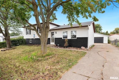
2822 High Point Dr Davenport, IA 52806
North Side NeighborhoodEstimated payment $1,681/month
Highlights
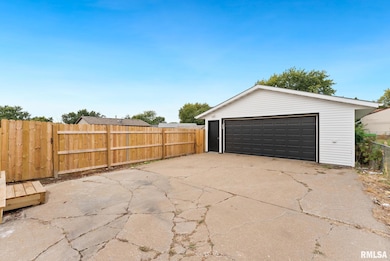
- 2 Car Detached Garage
- Solar Heating System
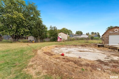
- Level Lot
- Oversized Parking
- Forced Air Heating and Cooling System
About This Home
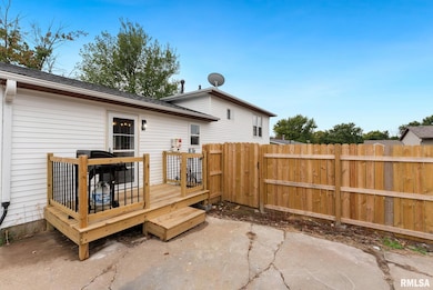
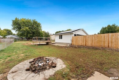
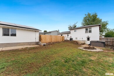
Welcome to 2822 High Point Drive — a charming single-family home located in the desirable 52806 zip code. Built in 1981, this comfortable residence offers 3 bedrooms and 3 bathrooms across approximately 1,220 sq ft of finished living space. Sitting on a 0.29-acre lot, the property features mature landscaping and a private backyard retreat. A detached garage provides convenient off-street parking. The home includes a finished basement, adding usable square footage below grade. Inside, enjoy a warm, efficient layout with a mix of living and dining areas, and bedrooms positioned for privacy. The home is equipped with central heating and cooling systems. With its solid construction, functional footprint, and potential for cosmetic updates, this house is ideal for both first-time buyers empty nesters. Conveniently located in Davenport’s North Side neighborhood, the property offers access to local amenities, schools, and commuter routes. Don’t miss your chance — contact your agent today for more details or to schedule a showing.
Listing Agent
3% Listing Company, LLC Brokerage Phone: 563-505-8140 License #S42304000/471008539 Listed on: 10/14/2025
Home Details
Home Type
- Single Family
Est. Annual Taxes
- $3,816
Year Built
- Built in 1981
Lot Details
- 0.29 Acre Lot
- Lot Dimensions are 65x195
- Level Lot
Parking
- 2 Car Detached Garage
- Oversized Parking
Home Design
- 2,340 Sq Ft Home
- Brick Exterior Construction
- Shingle Roof
- Vinyl Siding
Kitchen
- Range
- Dishwasher
Bedrooms and Bathrooms
- 3 Bedrooms
- 3 Full Bathrooms
Finished Basement
- Walk-Out Basement
- Basement Fills Entire Space Under The House
Schools
- Davenport North High School
Additional Features
- Solar Heating System
- Forced Air Heating and Cooling System
Community Details
- High Point Subdivision
Listing and Financial Details
- Assessor Parcel Number W0437B47
Map
Home Values in the Area
Average Home Value in this Area
Tax History
| Year | Tax Paid | Tax Assessment Tax Assessment Total Assessment is a certain percentage of the fair market value that is determined by local assessors to be the total taxable value of land and additions on the property. | Land | Improvement |
|---|---|---|---|---|
| 2025 | $4,787 | $241,440 | $38,610 | $202,830 |
| 2024 | $4,142 | $213,470 | $38,610 | $174,860 |
| 2023 | $3,990 | $206,520 | $38,610 | $167,910 |
| 2022 | $3,688 | $186,820 | $29,840 | $156,980 |
| 2021 | $3,688 | $171,840 | $29,840 | $142,000 |
| 2020 | $3,354 | $154,390 | $29,840 | $124,550 |
| 2019 | $3,324 | $148,170 | $29,840 | $118,330 |
| 2018 | $3,254 | $148,170 | $29,840 | $118,330 |
| 2017 | $824 | $148,170 | $29,840 | $118,330 |
| 2016 | $3,246 | $148,170 | $0 | $0 |
| 2015 | $3,246 | $146,730 | $0 | $0 |
| 2014 | $3,258 | $146,730 | $0 | $0 |
| 2013 | $3,202 | $0 | $0 | $0 |
| 2012 | -- | $141,040 | $30,220 | $110,820 |
Property History
| Date | Event | Price | List to Sale | Price per Sq Ft |
|---|---|---|---|---|
| 11/14/2025 11/14/25 | Price Changed | $259,900 | -1.9% | $111 / Sq Ft |
| 11/09/2025 11/09/25 | Pending | -- | -- | -- |
| 10/29/2025 10/29/25 | Price Changed | $264,900 | -3.6% | $113 / Sq Ft |
| 10/14/2025 10/14/25 | For Sale | $274,900 | -- | $117 / Sq Ft |
Purchase History
| Date | Type | Sale Price | Title Company |
|---|---|---|---|
| Warranty Deed | $207,000 | None Available | |
| Interfamily Deed Transfer | -- | None Available | |
| Warranty Deed | $145,000 | Security First Title Co |
Mortgage History
| Date | Status | Loan Amount | Loan Type |
|---|---|---|---|
| Open | $199,465 | FHA | |
| Previous Owner | $145,000 | New Conventional |
Source: RMLS Alliance
MLS Number: QC4268354
APN: W0437B47
Disclaimer: Certain information contained herein is derived from information provided by parties other than Homes.com. All information provided is deemed reliable, but is not guaranteed to be accurate and should be independently verified.
![]() IDX information is provided exclusively for personal, non-commercial use, and may not be used for any purpose other than to identify prospective properties consumers may be interested in purchasing. Information is deemed reliable but not guaranteed.
IDX information is provided exclusively for personal, non-commercial use, and may not be used for any purpose other than to identify prospective properties consumers may be interested in purchasing. Information is deemed reliable but not guaranteed.
- 2714 W 66th St
- 6050 Hillandale Rd
- 2514 W 60th St
- 6733 Brookview Ln
- 6504 Cedar St
- 5824 Hillandale Rd
- 5812 Hillandale Rd
- 2110 W 68th St
- 000 W 73rd St
- Lot 55 Franklin
- 2012 W 68th St
- 5556 N Thornwood Ave
- Lot 65 W 66th St
- 7319 Volquardsen Ave
- 000 Pacific St
- 2113 W 75th Place
- 1724 W 69th St
- 5312 Hillandale Rd
- 5510 N Division St
- 5109 N Pine St
