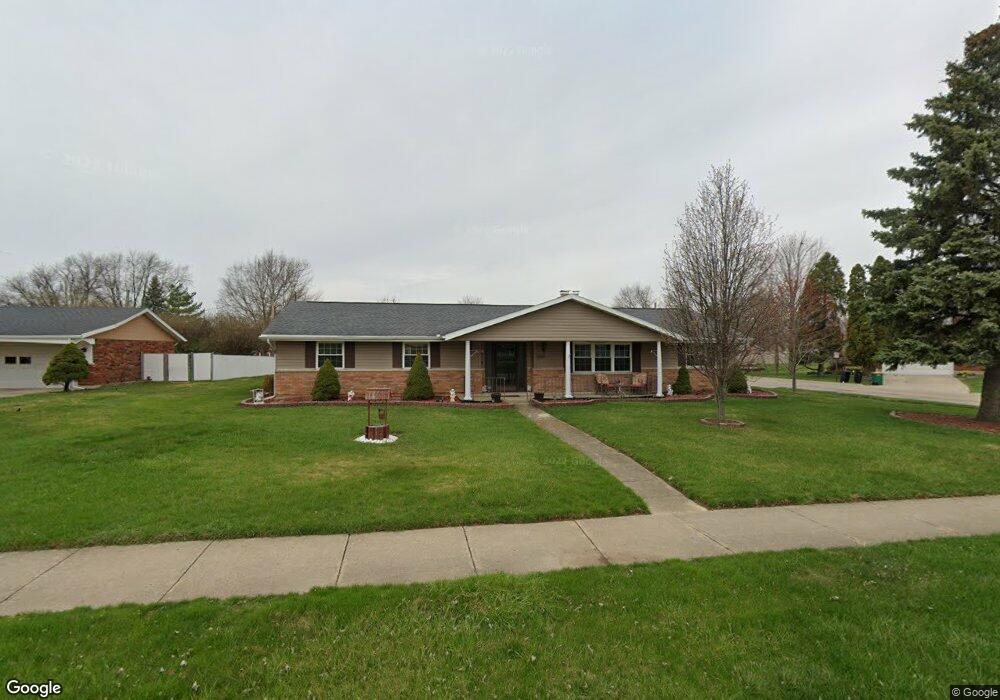
2825 Derr Rd Springfield, OH 45503
Estimated Value: $227,000 - $282,000
3
Beds
3
Baths
1,897
Sq Ft
$136/Sq Ft
Est. Value
About This Home
This home is located at 2825 Derr Rd, Springfield, OH 45503 and is currently estimated at $257,432, approximately $135 per square foot. 2825 Derr Rd is a home located in Clark County with nearby schools including Kenton Elementary School, Roosevelt Middle School, and Springfield High School.
Ownership History
Date
Name
Owned For
Owner Type
Purchase Details
Closed on
Oct 18, 2011
Sold by
Powell James T and Powell Mary L
Bought by
Zorn Larry E and Zorn Debbie J
Current Estimated Value
Purchase Details
Closed on
Jul 12, 2011
Sold by
Wagner J Eric and Wagner Kent A
Bought by
Powell James T and Powell Mary L
Purchase Details
Closed on
Oct 1, 1997
Sold by
Bryant Ruth N
Bought by
Wagner Elizabeth G
Create a Home Valuation Report for This Property
The Home Valuation Report is an in-depth analysis detailing your home's value as well as a comparison with similar homes in the area
Home Values in the Area
Average Home Value in this Area
Purchase History
| Date | Buyer | Sale Price | Title Company |
|---|---|---|---|
| Zorn Larry E | $117,000 | Attorney | |
| Powell James T | $92,000 | Attorney | |
| Wagner Elizabeth G | $114,425 | -- |
Source: Public Records
Tax History Compared to Growth
Tax History
| Year | Tax Paid | Tax Assessment Tax Assessment Total Assessment is a certain percentage of the fair market value that is determined by local assessors to be the total taxable value of land and additions on the property. | Land | Improvement |
|---|---|---|---|---|
| 2024 | $950 | $60,200 | $11,880 | $48,320 |
| 2023 | $2,850 | $60,200 | $11,880 | $48,320 |
| 2022 | $1,345 | $60,200 | $11,880 | $48,320 |
| 2021 | $1,991 | $45,980 | $9,280 | $36,700 |
| 2020 | $1,995 | $45,980 | $9,280 | $36,700 |
| 2019 | $2,000 | $45,980 | $9,280 | $36,700 |
| 2018 | $1,860 | $42,000 | $10,210 | $31,790 |
| 2017 | $1,858 | $45,416 | $10,206 | $35,210 |
| 2016 | $1,091 | $45,416 | $10,206 | $35,210 |
| 2015 | $1,229 | $41,864 | $9,279 | $32,585 |
| 2014 | $1,077 | $41,864 | $9,279 | $32,585 |
| 2013 | $1,110 | $41,864 | $9,279 | $32,585 |
Source: Public Records
Map
Nearby Homes
- 2933 Bahia Dr
- 2683 Home Orchard Dr
- 1506 Hyannis Dr
- 1225 Vester Ave
- 2541 Derr Rd
- 2933 Stonehaven Dr
- 2524 Home Orchard Dr
- 2813 Wellsford Dr
- 2907 Mystic Ln
- 647 Villa Rd Unit A
- 3129 Haverhill St
- 2677 Carousel Dr
- 732 Grandview Dr Unit 732
- 1732 Falmouth Ave
- 3029 Bradford Dr Unit 46
- 2516 Balsam Dr
- 537 Rensselaer St
- 3032 Armsgate Rd Unit 25
- 1811 Devon Dr
- 1939 Providence Ave
- 2815 Derr Rd
- 1219 Imperial Blvd
- 2905 Derr Rd
- 1211 Imperial Blvd
- 1236 Torrence Dr
- 1226 Torrence Dr
- 1212 Imperial Blvd
- 2915 Derr Rd
- 1218 Torrence Dr
- 1201 Imperial Blvd
- 1310 Torrence Dr
- 1200 Imperial Blvd
- 1210 Torrence Dr
- 2917 Derr Rd
- 2918 Alameda Dr
- 1133 Imperial Blvd
- 1320 Torrence Dr
- 1235 Torrence Dr
- 2916 Derr Rd
- 2910 Alameda Dr