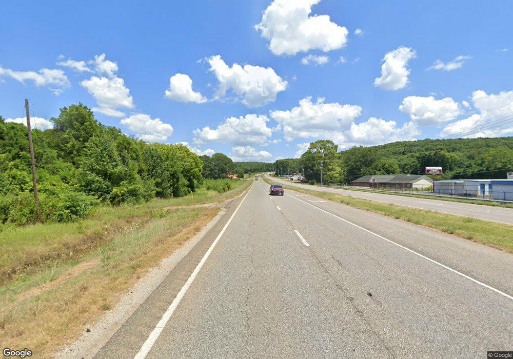
2827 Highway 72 E Unit 1&2 Huntsville, AL 35811
Ryland Neighborhood
--
Bed
1
Bath
15,370
Sq Ft
1.48
Acres
About This Home
This home is located at 2827 Highway 72 E Unit 1&2, Huntsville, AL 35811. 2827 Highway 72 E Unit 1&2 is a home located in Madison County with nearby schools including Central School and Madison County High School.
Ownership History
Date
Name
Owned For
Owner Type
Purchase Details
Closed on
Apr 3, 2024
Sold by
Reed Carl Donald and Reed Judy Parton
Bought by
Reed Judy Parton
Purchase Details
Closed on
Jan 6, 2009
Sold by
Harmening Susan
Bought by
H & H Contracting Llc
Purchase Details
Closed on
Feb 6, 2006
Sold by
Regions Bank
Bought by
Reed Carl D and Harmening Susan
Home Financials for this Owner
Home Financials are based on the most recent Mortgage that was taken out on this home.
Original Mortgage
$350,000
Interest Rate
6.21%
Mortgage Type
Credit Line Revolving
Create a Home Valuation Report for This Property
The Home Valuation Report is an in-depth analysis detailing your home's value as well as a comparison with similar homes in the area
Home Values in the Area
Average Home Value in this Area
Purchase History
| Date | Buyer | Sale Price | Title Company |
|---|---|---|---|
| Reed Judy Parton | -- | None Listed On Document | |
| H & H Contracting Llc | -- | -- | |
| Reed Carl D | $10,000 | -- |
Source: Public Records
Mortgage History
| Date | Status | Borrower | Loan Amount |
|---|---|---|---|
| Previous Owner | Reed Carl D | $350,000 |
Source: Public Records
Tax History Compared to Growth
Tax History
| Year | Tax Paid | Tax Assessment Tax Assessment Total Assessment is a certain percentage of the fair market value that is determined by local assessors to be the total taxable value of land and additions on the property. | Land | Improvement |
|---|---|---|---|---|
| 2024 | $3,771 | $103,880 | $6,800 | $97,080 |
| 2023 | $3,771 | $103,880 | $6,800 | $97,080 |
| 2022 | $3,781 | $104,160 | $6,800 | $97,360 |
| 2021 | $3,086 | $85,120 | $6,800 | $78,320 |
| 2020 | $3,057 | $84,320 | $6,800 | $77,520 |
| 2019 | $2,976 | $82,100 | $6,800 | $75,300 |
| 2018 | $2,657 | $73,340 | $0 | $0 |
| 2017 | $2,657 | $73,340 | $0 | $0 |
| 2016 | $2,657 | $73,340 | $0 | $0 |
| 2015 | $2,657 | $73,340 | $0 | $0 |
| 2014 | $2,534 | $69,980 | $0 | $0 |
Source: Public Records
Map
Nearby Homes
- 118 Season Ln
- 129 Season Ln
- 109 Dolf Leaf Ln
- 329 Wall Rd
- Johnson IV H Plan at Cedar Gap Estates
- Taft IV G Plan at Cedar Gap Estates
- Crosby III S Plan at Cedar Gap Estates
- Crosby III H Plan at Cedar Gap Estates
- Taplin III G Plan at Cedar Gap Estates
- Comstock III H Plan at Cedar Gap Estates
- Comstock III G Plan at Cedar Gap Estates
- Ionia III H Plan at Cedar Gap Estates
- Ionia III G Plan at Cedar Gap Estates
- Rodessa IV H Plan at Cedar Gap Estates
- Rodessa IV G Plan at Cedar Gap Estates
- 403 Ryland Pike
- 215 Teague Rd
- 103 Moms Cir
- 232 Pops Corner
- 105 Alice Janes Cir
- 0 Mastin Lake Rd
- 0 Mastin Lake Rd Unit 1772790
- 2818 Highway 72 E
- 198 Mastin Dr
- 190 Mastin Dr
- 220 Ryland Pike
- 115 Ryland Ridge Cir Unit 28
- 115 Ryland Ridge Cir Unit 23
- 115 Ryland Ridge Cir Unit 5
- 115 Ryland Ridge Cir Unit 7
- 115 Ryland Ridge Cir Unit 12
- 115 Ryland Ridge Cir Unit 2
- 115 Ryland Ridge Cir Unit 10
- 115 Ryland Ridge Cir Unit 4
- 115 Ryland Ridge Cir
- 115 Ryland Ridge Cir Unit 32
- 115 Ryland Ridge Cir Unit 29
- 115 Ryland Ridge Cir Unit 3
- 115 Ryland Ridge Cir Unit 8
- 115 Ryland Ridge Cir Unit 34
