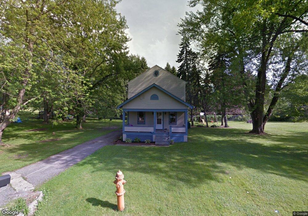
2829 Baker St Youngstown, OH 44505
McGuffey Heights NeighborhoodEstimated Value: $57,778 - $79,000
2
Beds
1
Bath
1,420
Sq Ft
$51/Sq Ft
Est. Value
About This Home
This home is located at 2829 Baker St, Youngstown, OH 44505 and is currently estimated at $72,195, approximately $50 per square foot. 2829 Baker St is a home located in Mahoning County with nearby schools including M.L. King Elementary School, Williamson Elementary School, and East High School.
Ownership History
Date
Name
Owned For
Owner Type
Purchase Details
Closed on
Jul 29, 2020
Sold by
F & C Property Rentals
Bought by
Ratliff Keith Gene
Current Estimated Value
Purchase Details
Closed on
Mar 8, 2019
Sold by
Saunders Fred E
Bought by
F & C Property Rentals
Purchase Details
Closed on
Jan 1, 1990
Bought by
Saunders Fred
Create a Home Valuation Report for This Property
The Home Valuation Report is an in-depth analysis detailing your home's value as well as a comparison with similar homes in the area
Home Values in the Area
Average Home Value in this Area
Purchase History
| Date | Buyer | Sale Price | Title Company |
|---|---|---|---|
| Ratliff Keith Gene | -- | None Available | |
| F & C Property Rentals | -- | None Available | |
| Saunders Fred | -- | -- |
Source: Public Records
Tax History
| Year | Tax Paid | Tax Assessment Tax Assessment Total Assessment is a certain percentage of the fair market value that is determined by local assessors to be the total taxable value of land and additions on the property. | Land | Improvement |
|---|---|---|---|---|
| 2025 | $295 | $6,800 | $770 | $6,030 |
| 2024 | $335 | $6,800 | $770 | $6,030 |
| 2023 | $332 | $6,800 | $770 | $6,030 |
| 2022 | $222 | $3,490 | $740 | $2,750 |
| 2021 | $222 | $3,490 | $740 | $2,750 |
| 2020 | $224 | $3,490 | $740 | $2,750 |
| 2019 | $227 | $3,230 | $680 | $2,550 |
| 2018 | $229 | $3,230 | $680 | $2,550 |
| 2017 | $226 | $3,230 | $680 | $2,550 |
| 2016 | $236 | $3,630 | $680 | $2,950 |
| 2015 | $243 | $3,630 | $680 | $2,950 |
| 2014 | $230 | $3,630 | $680 | $2,950 |
| 2013 | $227 | $3,630 | $680 | $2,950 |
Source: Public Records
Map
Nearby Homes
- 2849 McGuffey Rd
- 1214 Brighton St
- 1003 Liberty Rd
- 1251 Jacobs Rd
- 1720 Jacobs Rd
- 603 Liberty Rd
- 206 Beachwood Dr
- 2051 Blair Ave
- V/L Jacobs Rd
- 2915 Megan Cir
- 1538 Republic Ave
- 3240 Oak Street Extension
- 3786 Choice Ct
- 575 Woodside Ave
- 146 Greeley Ln
- 32 Maranatha Dr
- 36 Maranatha Dr
- 24 Maranatha Dr
- 111 Bassett Ln
- 2508 Applegate Rd
- 2833 Baker St
- 2830 McGuffey Rd
- 2826 Baker St
- 2810 McGuffey Rd
- 1200 Forest Glen Ave
- 2776 Baker St
- 3818 Baker St
- 2848 McGuffey Rd
- 2811 McGuffey Rd
- 2819 McGuffey Rd
- 2835 McGuffey Rd
- 2841 McGuffey Rd
- 2845 McGuffey Rd
- 521 Forest Glen Ave
- 2900 McGuffey Rd
- 1049 Bryn Mawr Ave
- 2747 McGuffey Rd
- 1041 Bryn Mawr Ave
- 2853 McGuffey Rd
- 1403 Hillcrest Ave
Your Personal Tour Guide
Ask me questions while you tour the home.