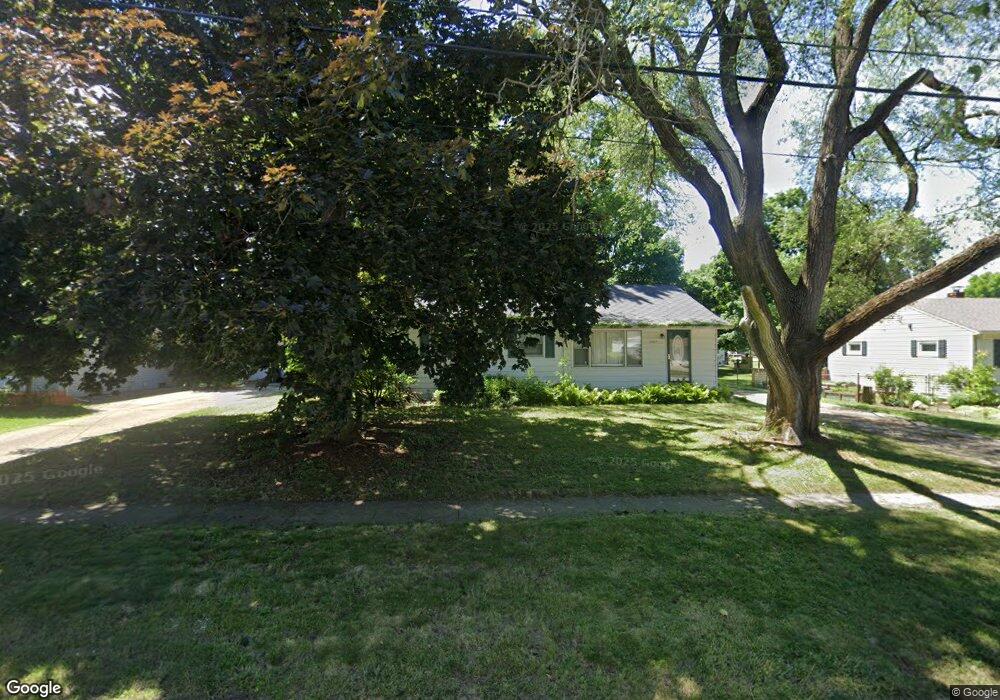
2829 Random Rd Kalamazoo, MI 49004
Burke Acres NeighborhoodEstimated Value: $176,612 - $201,000
3
Beds
1
Bath
1,056
Sq Ft
$177/Sq Ft
Est. Value
About This Home
This home is located at 2829 Random Rd, Kalamazoo, MI 49004 and is currently estimated at $187,153, approximately $177 per square foot. 2829 Random Rd is a home located in Kalamazoo County with nearby schools including Spring Valley Center for Exploration, Hillside Middle School, and Kalamazoo Central High School.
Ownership History
Date
Name
Owned For
Owner Type
Purchase Details
Closed on
Sep 13, 2011
Sold by
Mills Lynda A
Bought by
Green Michelle
Current Estimated Value
Purchase Details
Closed on
Oct 16, 2006
Sold by
Phares Margaret M
Bought by
City Of Kalamazoo
Purchase Details
Closed on
Oct 16, 2003
Sold by
Carlson Wade
Bought by
City Of Kalamazoo
Create a Home Valuation Report for This Property
The Home Valuation Report is an in-depth analysis detailing your home's value as well as a comparison with similar homes in the area
Home Values in the Area
Average Home Value in this Area
Purchase History
| Date | Buyer | Sale Price | Title Company |
|---|---|---|---|
| Green Michelle | $69,900 | Ppr Title Agency | |
| City Of Kalamazoo | -- | None Available | |
| City Of Kalamazoo | -- | -- |
Source: Public Records
Tax History
| Year | Tax Paid | Tax Assessment Tax Assessment Total Assessment is a certain percentage of the fair market value that is determined by local assessors to be the total taxable value of land and additions on the property. | Land | Improvement |
|---|---|---|---|---|
| 2025 | $1,254 | $82,200 | $0 | $0 |
| 2024 | $1,218 | $77,200 | $0 | $0 |
| 2023 | $1,160 | $68,900 | $0 | $0 |
| 2022 | $1,977 | $59,800 | $0 | $0 |
| 2021 | $1,912 | $54,900 | $0 | $0 |
| 2020 | $1,872 | $50,600 | $0 | $0 |
| 2019 | $1,785 | $44,500 | $0 | $0 |
| 2018 | $1,743 | $40,500 | $0 | $0 |
| 2017 | $1,875 | $39,200 | $0 | $0 |
| 2016 | $1,875 | $35,900 | $0 | $0 |
| 2015 | $1,875 | $34,100 | $0 | $0 |
| 2014 | $1,875 | $35,200 | $0 | $0 |
Source: Public Records
Map
Nearby Homes
- 3115 Michael Ave
- 3104 Courtlandt Ave
- 2842 Virginia Ave
- 2511 Monterey Dr
- 2428 Glendale Blvd
- 2516 Fairfield Ave
- 2407 Fairfield Ave
- 603 Park Ave
- 1223 Parchmount Ave
- 818 Parchmount Ave
- 2117 Lakewood Dr
- 2415 Parchmount Ave
- 2421 Parchmount Ave
- 332 Espanola Ave
- 2412 Sonora St
- 405 Park Ave
- 2716 Gull Rd
- 125 Haymac Dr
- 2910 Parchmount Ave
- 1042 E Mosel Ave
- 2823 Random Rd
- 2901 Random Rd
- 2912 Mount Olivet Rd
- 2913 Random Rd
- 2815 Random Rd
- 2904 Mount Olivet Rd
- 2902 Random Rd
- 2934 Mount Olivet Rd
- 2910 Random Rd
- 2818 Random Rd
- 2832 Random Rd
- 2809 Random Rd
- 2826 Random Rd
- 2814 Slater Dr
- 2854 Mount Olivet Rd
- 2803 Random Rd
- 2812 Random Rd
- 2846 Mount Olivet Rd
- 2916 Random Rd
- 2917 Mount Olivet Rd
Your Personal Tour Guide
Ask me questions while you tour the home.